Dublin Cycle Paths
Press
Radical New Plan
Car-Free Day
Cyclists try their luck
Minister
Launches Conference
Plans
DTO Cycle Network
The Law
The Acts & SIs
Links
Government
Interest/Lobby Groups
Reports
The Dundrum
Bypass
Dangerous Designs
|
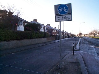
A fake cycle track: Malahide Road, Coolock: The official 'Malahide Road Quality Bus and Cycle Corridor starts off with a separate lane for cyclists and then, after 100 metres or so, 'dumps' cyclists on this narrow residential road with no special reservation for cyclists. This photo was taken on a quiet day. It's normally quite busy. On overtaking parked cars, cyclists have to ride into oncoming cars. This stretch of nearly a kilometre is included in the Corporation's misleadingly named statistics of 'Cycle Routes'. It is not, legally, a 'Cycle Facility'. |
26. (1) Traffic sign number RRM 022 shall— |
 |
Artane Roundabout - path blocked by parked car &
bus passengers. Note the poor quality of the surface markings.
|
| Malahide Road, Artane - Path blocked by truck. Note lack of safety gap between cars parked to the left of the bike lane. Regulations actually allow vehicles to block cycle lanes while making deliveries. It's a recurring feature of the regulations that cyclists take second place to vehicles. |  26. (1) Traffic sign number RRM 022 shall— (a) indicate the right hand edge of a cycle track where it forms part of a roadway, and (b) consist of a continuous white line approximately 100 millimetres or 150 millimetres wide. |
 |
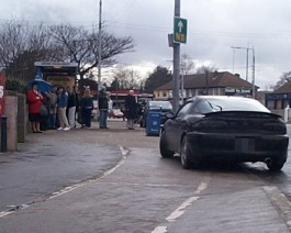
This taxi driver was driving with two wheels in the bike lane for no reason at all.....he was neither pulling in nor pulling out. There is no reason why he should be in the cycle lane.
|
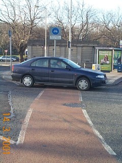
Malahide Road junction and Marino Mart -Lane blocked by single occupant queueing car. It's a legal requirement for cyclists to use these lanes but, according to the regulators, it's merely 'inconsiderate' for a motorist to block a lane. The lane, is in fact, a 'fake' as we'll see in the next picture.
|
|
|
|
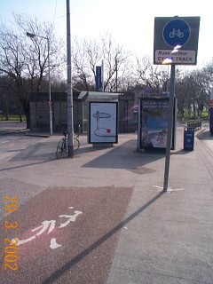
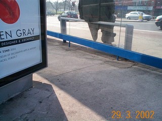
Cyclists and pedestrians now share a narrow corridor flanked by the plate glass of the bus shelters. The shelter on the left was added in March 2002.
Hopefully, the glass will not shatter if a pedestrian and cyclist collide in that narrow space, less than the width of a regular cycle lane. Note the total absence of legally required surface markings. |
|
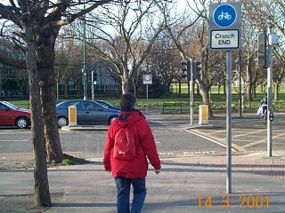
Some metres after the markings stop, there is an 'End' sign. Note the mixed use of this stretch although the sign indicated that it was 'cyclists only'. The sign marks the beginning of a route through the park. But.... the route has been closed due to work on a tunnel and no diversion signs have been posted. Unfortunate cyclists have been seen climbing over railings to get back to the road after they reach the tunnel works. The alternative route, as we'll see is in poor condition and does not conform with any standards for safe cycle paths. |
 |
 |
The crossing is frequently blocked by cars. The crossing itself cannot be legally be crossed by bicycle. Note the sign on the opposite side, obstructing the entrance to the cycle path through the park. |
| Collapsed roadworks sign lies accross the track at the Malahide Road/Howth Road junction.(NB: Personal Accident Solicitors are just accross the road!) | 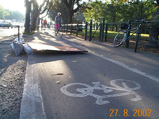 |
| Access to the cycle path is via an unmodified kerb. This is often submerged after normal rainfall & the lip is concealed. It is usually covered in wet leaves during the Autumn. Under the mud is a concrete lip...see the picture on the right. This surface is cleaned only once a year after all the leaves have fallen and composted themselves.(Just now in Feb 2002 & probably not again until next Feb 2003.) | 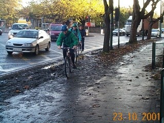 |
 |
|
|
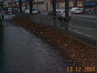
The cycle path is under those leaves somewhere... |
 |
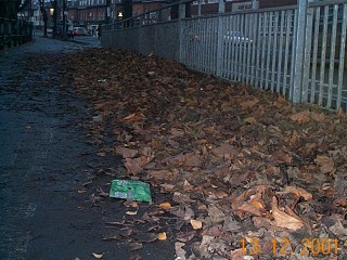 |
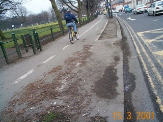
The path has was not swept for 4 months. |
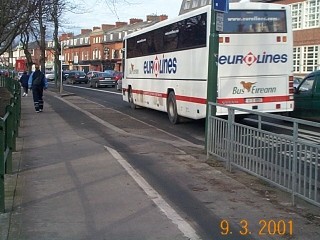
| This is what it looked like last March. Markings stop without warning where the lane has been removed to make way for car parking. |
 |
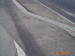 |
Detail of the lane, note how sharp kerb is not delineated by any markings, this would be very hazardous at night. |