![]()
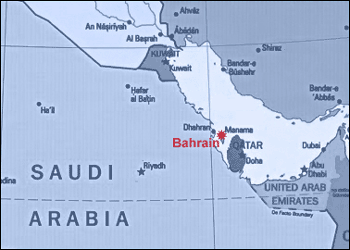
The State of Bahrain
is a group of islands group located off the central southern shores of the
Arabian Gulf between latitude 25° 32" and 26° 20" North and
longitude 050° 20" and 050° 50" East.
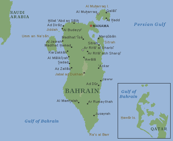
The state comprises some 36 islands, with a total land area of about 706 square
km.
The largest of these is Bahrain Island where the capital city, Manama, is
situated. Bahrain Island is 48 km long from north to south, and up to 16 km wide
at its maximum point east to west. Bahrain Island accounts for nearly 85% of the
total area of the State.
The next largest Islands are the southern archipelago called Hawar (50 square
km), not far from the coast of Qatar, followed by the desert island of Umm
Na'san (19 square km), the populous Muharraq Island (18 square km) connected by
causeways to Bahrain, and finally Sitra (10 square km), a mainly industrial
island also connected to Bahrain by causeways.
The remaining small islands, islets and coral reefs combine to make up the rest
of the land mass.