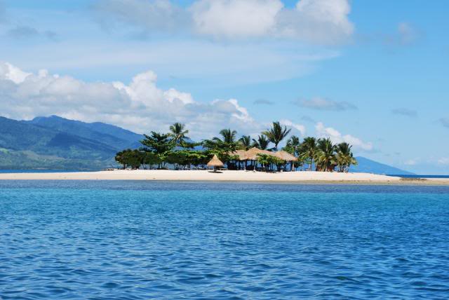
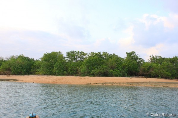
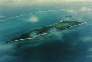
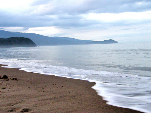
Pagbilao Grande
It is a group of island located at the Tayabas Bay area where there are white sand beaches and rich fishing grounds. This is also the site of Tulay Buhangin where sand dunes connect the islets of Padre Burgos during low tide. It is located in Tayabas Bay, near the coast of Pagbilao
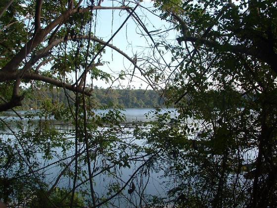
Tikub Lake
About two kilometers in diameter and 75 meters deep, Tikob Lake lies on the crater of an extinct volcano. Thick foliage surrounds the lake. It is located in Tiaong, Quezon.
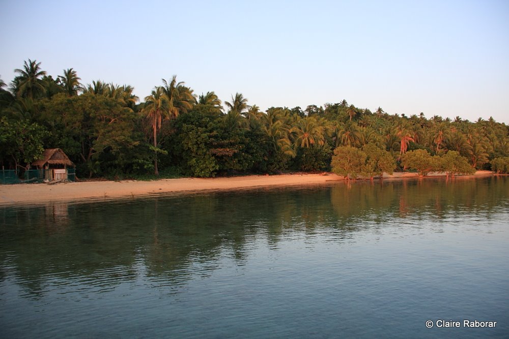
Puting Buhangin Beach
Located in the Pagbilao Grande area, this pure white sand beach, with crystal-clear and calm water, is a favorite place in Pagbilao during the summer months. The white sand beach is about 70 meters long and 10 meters wide. A small cave is found at one end of the beach. It is located at Pagbilao Grande, Pagbilao, Quezon.
 Kinabuhayan
This is the site where members of religious sects of Mt. Banahaw believe Christ spent His Calvary. Thousands of pilgrims, the number of which may reach to 30,000 come to this area to fulfill their vows or be healed of their afflictions. What can be found here are the rocks where Christ was believed to have been tied (Pinaggapusan). His footprints are embedded on a rock, and a cold and damp rock at the entrance of a cave is said to have curing power. Kinabuhayan is located in Barangay Kinabuhayan, Dolores, Quezon

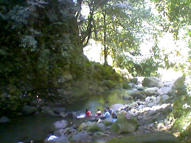
Cristalino Falls, Mt. Banahaw
It is a few meters south of Santos Collegio, where crystal clear water can soothe one�s thirst after climbing a few slopes up. The falls is located in Dolores, Quezon
 Durungawan, Mt. Banahaw
Having the strength of going up higher at Mt. Banahaw, one can see for himself the crowning glory of the holy mountain�s peak called �Durungawan� � a window place on the mountain�s top where one can gaze at the valleys, towns, and city surrounding the sacred mountain. It is from there that one can feel the ultimate satisfaction of having gone up the mountain. Durungawan is located in Dolores, Quezon
 Talabaan Islands
These are two islands located off the shore of Padre Burgos town. The bigger of the two, Malaking Talabaan, is a favorite jump-off point to the beaches of Padre Burgos and the neighboring town of Pagbilao. The smaller island, Maliit na Talabaan, is a rock formation jutting out of the sea. What makes the island unique is that the rocks seem to have been curiously arranged and piled.
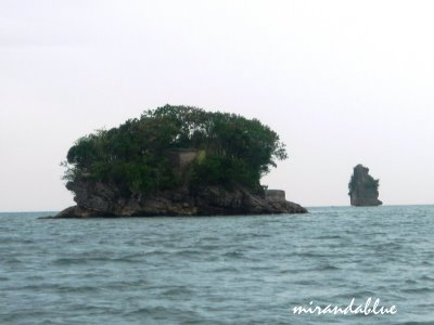
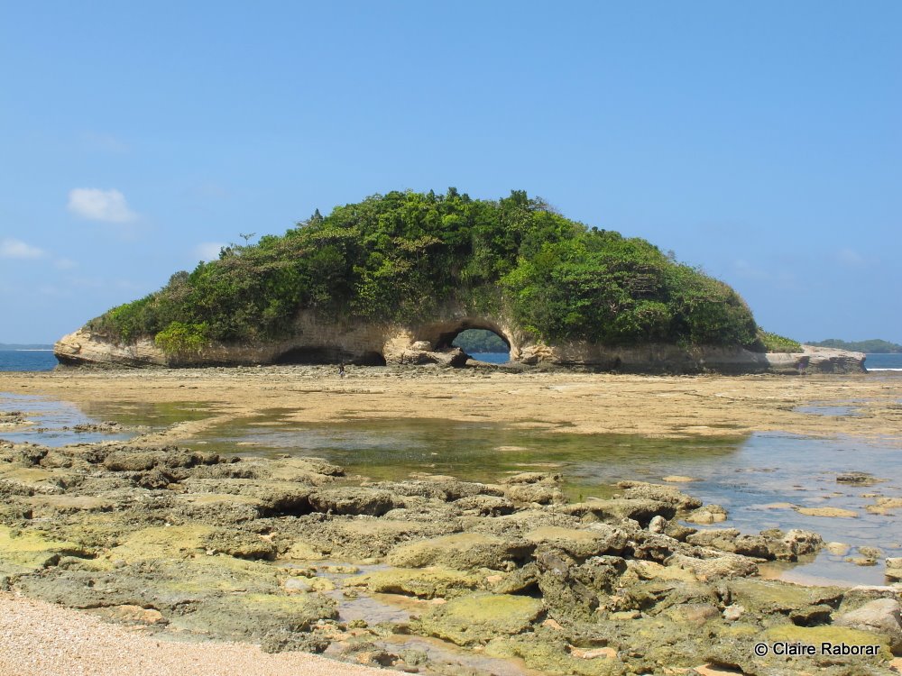
Mag-Asawang Bato
The Mag-asawang Bato are two pieces of big boulders jutting out of the sea. During low tide, the land where the stones stand are exposed so that people can walk over them. The boulders are located off the coast of Padre Burgos.
 Baluti Island
Located about three kilometers from the town port of Real, Baluti island covers an area of about 23 hectares. A wide river separates the island, which is a part of the mainland. Many parts of the island are covered with pine trees, instead of coconut trees. The beach areas are good for swimming. The water is relatively clear and the gray sand is fine. A slight drop-off is located just about 10 meters from the beachfront. It is located off the coast of Real.
Balabag Falls
It is the biggest of the three falls located in Barangay Mapalad in Real. It has about 100 feet of cascading water.
Bakaw-Bakaw Island
The island is about one hectare in size and filled with mangroves, talisay trees, and other shrubs. The beach is gently sloping and it has light brown sand and crushed shells. The deeper portion is dotted with isolated coral beds. It is located in Burdeos, Quezon
Ikulong Island
The island is about 15 hectares in size and filled with coconut trees. Like the other islands, it has white sand. It is located in Burdeos,Quezon

Anilon Island
The island is about 15 hectares in area and the white sand beach on one side of the island is about one kilometer long and 25 meters wide. During low tide, one end of the island reveals a long stretch of sand which looks like a sand bridge. It is located in Burdeos, Quezon
Anilon Cave
It is a small islet or a large rock, which also looks like a land bridge with a small cave where swimmers can pass through from one end to the other. It is located in Anilon, Burdeos, Quezon

Malaking Malaguinoan Island
The bigger one of the two Malaguinoan islands, it is about 40 hectares in area. Several white sand beaches are located along its coast. It is located in Burdeos, Quezon
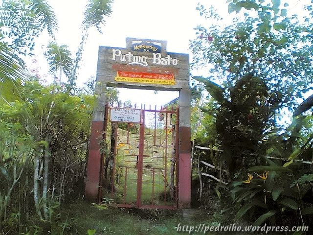 Puting Bato
The major attractions of Puting Bato are its cliff walls, which look like limestone cliffs of North Palawan. Aside from the walls, there are small caves. Small isolated beaches, which are good for swimming, can also be found. Rock formations, which look like umbrellas, abound in the area. It is located in Barangay Puting Bato, Burdeos, Quezon

Anawan Island
Although the beaches in Anawan are good, they are very far from the town pier. The distance is about 1.8 nautical miles. Its land area is about 18 hectares.
Katakian Island
The sand on the beach is brown, and gently sloping. The beach is about 500 meters long and 20 meters wide. A wide area of coral reef is located near the island. It is located in Patnanungan.

Maria Cristina Park
It is a promenade park with an area of 200 square meters, built along the Lamon Bay area in Atimonan. It is located along the Maharlika Highway, Atimonan, Quezon.
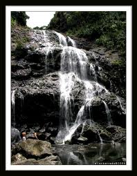
 Sta. Lucia Falls
Before going directly to the falls, an adventurous tourist can detour to a winding footpath leading to �Ina ng Awa,� a place of religious worship where many members of religious sects pray for guidance from the Virgin Mary. 267 steps going down to Sta. Lucia falls, one can hear the murmur of the cascading water as it quietly settles into a tranquil basin, truly nature as its best. The falls is located in Dolores, Quezon
 Patayan Island
Part of the Pagbilao Grande Islands, this is where the Tulay Buhangin (Sand Bridge) is located. People say that Patayan Island was named from the site where the young men of the town were killed by pirates during the olden times. This is the island to which one end of the Tulay Buhangin is connected. The island has a beach known for its smooth stones. The island is located in Pagbilao Grande, Pagbilao, Quezon
 Lamon Bay
It is a body of water connecting the northern part of Quezon to the Pacific Ociean. It bounds the coastal towns of Atimonan, Gumaca, Plaridel, Lopez, and Calauag, and the islands of Alabat. It is a rich fishing ground and the home of various living corals. Most parts of the bay consist of gray sand, some parts are filled with rocks, and other living corals. It is gradually sloping to the extend that, during low tide, the water level is low enough to allow one to walk as far as five hundred meters from the shore. Lamon Bay is located at the northern part of Quezon.

Tayabas Bay (Sariaya Area)
The area of Tayabas Bay in Sariaya is developed because of the presence of several large beach.

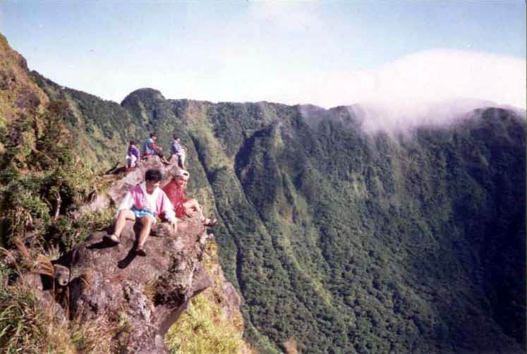
Mt. Banahaw
This 7,382-foot extinct volcano is famous for its mystical attributes. Unique religious rites are held during Holy Week by pilgrims who believe that Christ walked on this mountain. There are approximately 66 to 68 registered religious sects whose members hold rituals on Holy Week. The mountain is also a favorite site of amulet hunters. Mt. Banahaw is located at the western part of Quezon
esorts. The sand is gray and the water level is gradually sloping. It is located in Sariaya, Quezon.
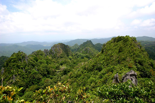 Quezon National Park
With an area of about 9,830,765 hectares, it has an intricate system of caves, waterfalls, springs, creeks, gorges, and ravines against a quaint backdrop of lush greenery. Local folks say that the park is full of flora and fauna from butterflies to birds and monkeys tugging along their young, while crossing the street. Trees are so tall and huge that the zigzag road is relatively dark. The park is also the site of Pinagbanderahan, a place where the Filipino Revolutionaries planted the Philippine flag in their fight against the Spanish colonizers. Quezon National Park encompasses the western municipalities of Atimonan, Pagbilao, and Padre Burgos. It can be reached by walking for about one hour from the road to the top of a ridge.
>> BACK TO TOP <<
|