 |
|
|
|
|
|
|
|
|
|
|
|
|
|
|
|
|
|
|
|
|
|
|
|
|
|
|
|
|
|
|
|
|
|
|
|
|
|
|
|
|
|
|
|
|
|
|
|
|
|
|
|
|
|
|
|
|
|
|
|
|
|
|
|
|
|
|
|
|
|
|
|
|
|
|
|
|
|
|
|
|
|
|
|
|
|
|
|
|
|
|
|
|
|
|
|
|
|
|
|
|
|
|
|
|
|
|
|
The Complete Blodgett Peak Website
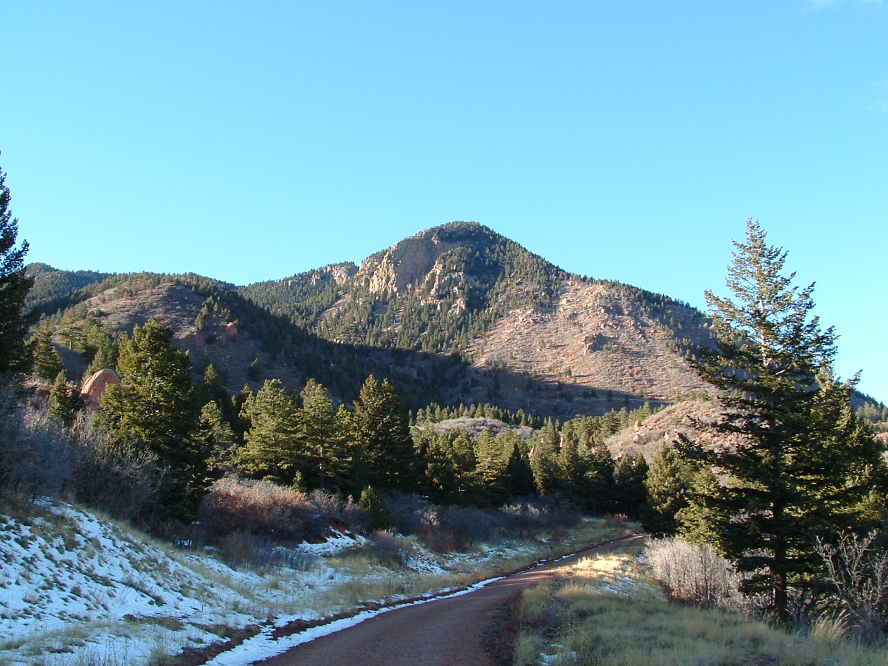
Colorado Springs, CO - 9,423 Ft. Above Sea Level |
|
|
|
 |
|
|
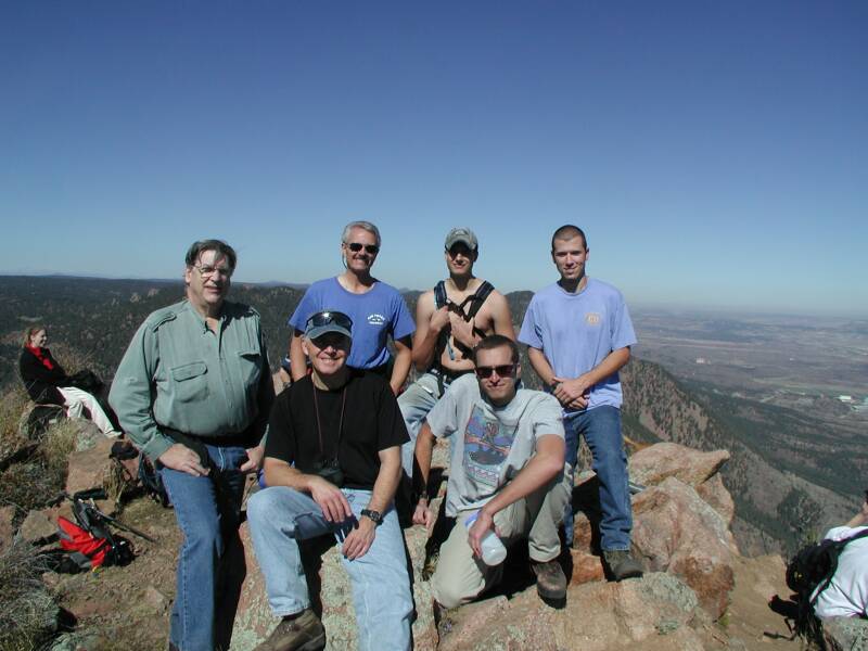
| On the summit of Blodgett Peak fall 2002: Far left; Bob Higgins; Back second from left- Bob Dorry; Back second from right- Shawn Dorry; Back right- Scott Elliott; Front left- Bill Young; Front right- Chris Dorry (Blodgett Peak homepage creator) [email protected] |
|
|
| Recent News: (3/11/08) Anyone interested in organizing a climb up Blodgett? Email me! Please email me with questions/comment/suggestions about the peak or surrounding area. |
|
|
|
Check out these other pages of mine: |
|
|
| If you want to find out a little bit about me please visit my Personal Information Page for some information on me, and my resume. |
|
|
|
The Old Palmer Trail planewreckage |
|
| Check out the Blodgett Peak PhotoPage . |
|
|
|
A lot more Blodgett Peak Photos |
|
|
|
|
|
|
http://www.wunderground.com/wximage/viewimages.html
In "search for" box type "WYCOWBZ" and search "handle" |
|
|
|
Other news I'm proud of: This page can be found or is linked through the Google search engine, Yahoo search engine, Peakware.com and Geocities! |
|
|
|
Please sign the guestbook below if you like, and be sure to follow the link (also below) to peakware's website so you can sign the Blodgett Peak log if you have ever reached the summit before! |
|
|
|
  |
|
|
|
If you have any questions or comments regarding Blodgett Peak, this website, or any of the others please do not hesitate to email at: [email protected] |
|
|
|
 |
|
|
| Location/Facts: |
|
|
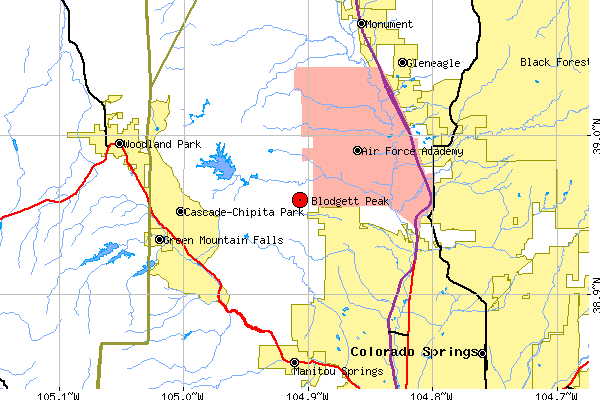
| Blodgett Peak is located in Pike National Forest, along the Rampart Range just to the northwest of Colorado Springs, Colorado, and southwest of the Air Force Academy. Standing at 9,423 feet, the peak offers breathtaking views of the surrounding area and offers a challenging, yet rewarding climb. The coordinates of the peak are 38 degrees, 57.32'N; 104 degrees, 55.42'W. |
|
|
|
 |
|
|
|
This map courtesy of the Mapping and Cartographic Resources at the U.S. Census Bureau. |
|
|
|
|
|
Who Was Blodgett Peak Named After? |
|
|
|
I think I've found some information that uncovers the mystery of who Blodgett Peak was named after. Please click here to read more. |
|
|
|
Who Can Climb Blodgett Peak?
Of course Blodgett Peak can be attempted by anyone, but this is not your normal hike. Blodgett Peak is not hard in the sense that it is very long, or very high in altitude, but has other challenging aspects. Probably the hardest part of Blodgett Peak is the lack of trail, and major sections of boulder hopping. The main routes I describe on this page all include loose dirt, rocks, and steep inclines. This climb should not be attempted if you are not physically in shape, your body is not adjusted to the altitude, or you dislike hikes that involve loose/steep trails. The other areas described on this website (waterfall, canyon, Ormes Peak, plane wreckage and others) could include falling rocks and loose terrain in general. In the winter months be prepared for snow cover, and in the summer be cautious of lightning. Now that you know the possible dangers, I recommend a good pair of hiking boots, even though I know people that have completed the climb in sneakers. Up and down Blodgett Peak is not a very long hike, my best estimate is about 2 or 2.5 miles one way (depending on route), and then back making for round trip climb of 4-5 miles. You will gain around 2,400 feet in elevation gain (if climbing from Peregrine), which equates to a steep climb, in a relatively short distance! |
|
|
|
 |
|
|
 |
|
|
|
|
|
|
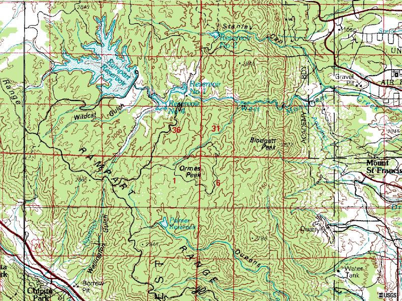
The topo map shows Blodgett Peak and the surrounding area. Blodgett Peak is about half way up the image, and closer to the right side of the image, near Mount St. Francis. With this topo map you can see just how steep Blodgett's east side is, along with the valley to the south that the main trail runs up. Click on the topo map for a better look. |
|
|
|
|
How Can I Get To Blodgett Peak? |
|
|
|
|
|
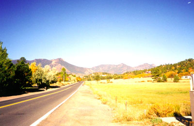
| There is more then one way to access Blodgett Peak. In my opionion the most common way is to take I-25 to the Woodmen Road exit (149), (below-left)... |
|
|
|
 |
|
|
 |
|
|
|
|
|
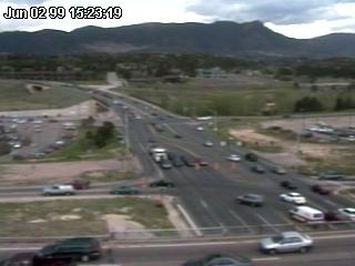
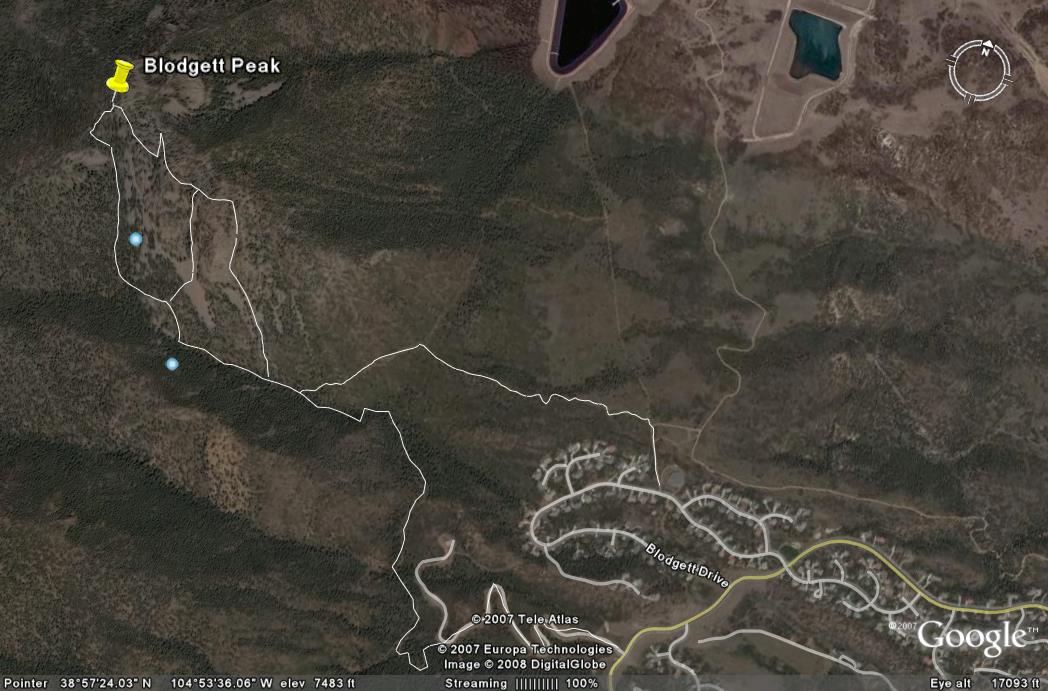
| ...and follow Woodmen Road west (above-right) through the Peregrine subdivision until you reach the highest point of the road (there is a park on corner). At this point you will make a right turn onto Blodgett Drive, and again follow this road until you reach the first Peregrine watertower on the right hand side of the road just past Richfield Drive. Blodgett Drive makes a loop, and comes out on Woodmen again, thus if you are coming from the south (via Centennial Blvd.) you can hang a left on the bottom end of the loop. You can follow the trail near the watertower which leads directly to the east facing slope of Blodgett which I would recommend as the starting point. |
|
|
| Another good starting point in Peregrine is a bit further down Woodmen Road at the Blodgett Peak Open Space. There is a small parking lot with a dirt road going up the valley to the other water tower in Peregrine. See trail route 2 for more info. on how to get to this location. |
|
|
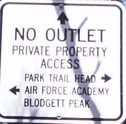
| Other starting points include Mountain Shadows, the Air Force Academy, or possibly to the west of the peak near Rampart Reservoir. If you are unfamiliar with the roads in Colorado Springs, or the NW part of the city, please click the button to the right for a street map of the area. See Below For More Info. On The Different Trails. |
|
|
 |
|
|
|
|
 |
|
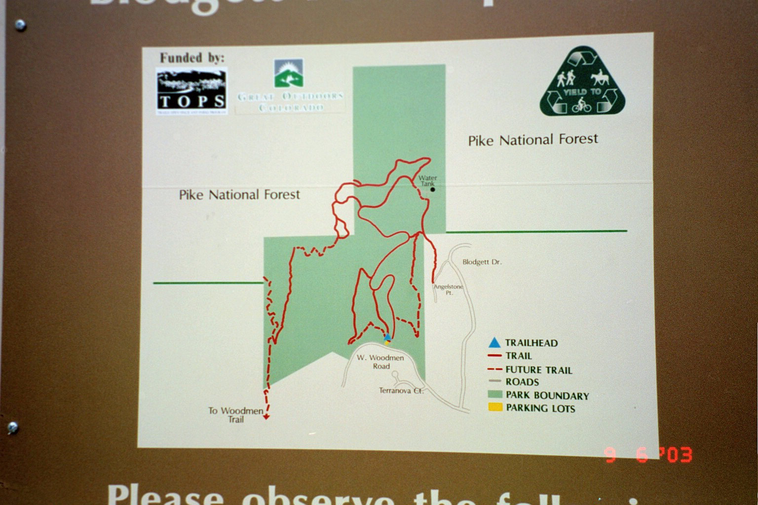
| The different trail routes: |
|
|
|
|
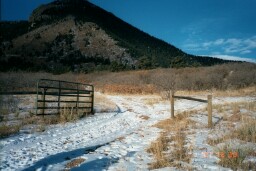
| 1. Blodgett Drive/Lower Water Tower Route -One of the easiest, and probably most well worn trails up Blodgett starts at the water tower in Peregrine off of Blodgett Drive. See photo to the right. |
|
|
|
|
|
|
This trail actually starts behind the water tower (west) and is behind a row of houses (picture right). Follow this trail through the gate (you are heading north) that takes you on to Air Force Academy grounds briefly. Once through the gate take your first left (now heading west)(picture of the left turn below). |
|
|
|
 |
|
|
|
|
|
 |
|
|
|
The trail at this point is a good two track trail and will become single track once you gain a little eleveation and reach the pine trees (picture below and left). |
|
|
|
Click the photos for larger view and more information |
|
|
|
|
|
|
|
|
|
Follow the single track through the pines and up the lower face of the mountain. Continually follow the main trail (see photo left) and do not take any turns onto smaller less traveled trails. At this point you are traveling directly west. At what has become known as the scar you can either take a right or a left. At this T junction you can travel no further west on the single track and are force to take a right or a left. If you take the right you will again head into the USAFA and down into their trail system. If you take the left (heading south) you will walk along the face of Blodgett and now have good views of Peregrine and the Rockrimmon area. Keep heading towards the valley that you are now quickly approaching. |
|
|
 |
|
|
|
|
|
| You will now enter into the main valley to the south of Blodgett. The valley is filled with pine trees and depending on the season and precipitation a little bit of flowing water. Use this valley for a good half mile or so. The trail is steep and very loose. This might be the hardest part of the whole climb. Once you've travled a 1/4-1/3 mile you will notice some considerable elevation gain and a look-out spot with a small rock out-cropping. |
|
|
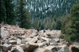
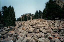
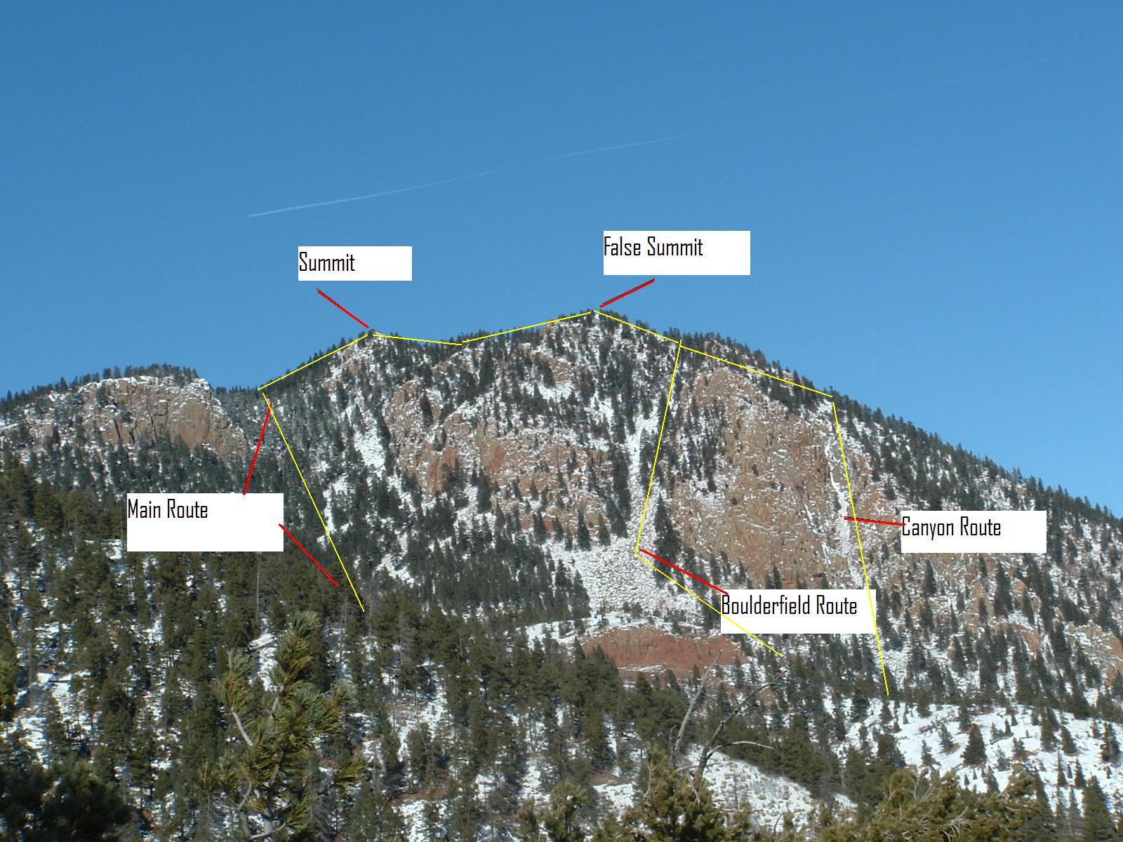
| At this point the men are seperated from the boys (just kidding!), you can either continue to follow the trail, or head off to the right a little more (north) and hit the infamous boulerfield (picture below)! Continue reading this paragraph if interested in the boulderfield. If boulders and rocks are not your style and you prefer a trail, then please continue to the seperate paragraph below. At the look-out you can just about see the lower reaches of the boulders. Continue to follow the trail to the west and find either a trail or pick your way to the boulders. Once onto the boulderfield you will be rock hopping your way up, and angle to the right (north). Most of the rocks are very solid and big enough to hop (or crawl if you are that tired) from one to another.As you get higher continue to the right of the large rock wall and the rocks will eventually become smaller and loose. The rocks being to become more seperated with more underbrush. You are still angeling to the right to the ridgeline. At the ridgeline you can now see down to the Air Force Academy and the Black Forest area. Head to your south (left) and only a couple of more inclines seperate you from the summit. Don't be fooled, you will summit the false summit first which is further to the north/east of the real summit. From the false summit (fairly broad and flat) look to you rsouth/west and you will see the only other high point around, this is the summit of Blodgett Peak. From the false summit follow the single track trails picking whichever way suites you best. You now only have one more mild hill and you have summited Blodgett Peak through the famous boulderfield route! |
|
|
|
 |
|
|
|
 |
|
|
|
|
|
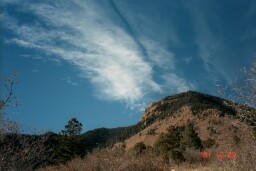
Non-boulders: From the look-out continue following the well worn trail directly to the west. This trail is well worn but steep in spots, and loose directly above the look-out area. The trail flattens out briefly but then climbs steadily until you are a ridgeline to the south of Blodgett. At this point you can see Pikes Peak and over to the west side of the Rampart Range. Take a right turn to the high point which is the summit of Blodgett Peak! |
|
|
|
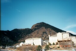
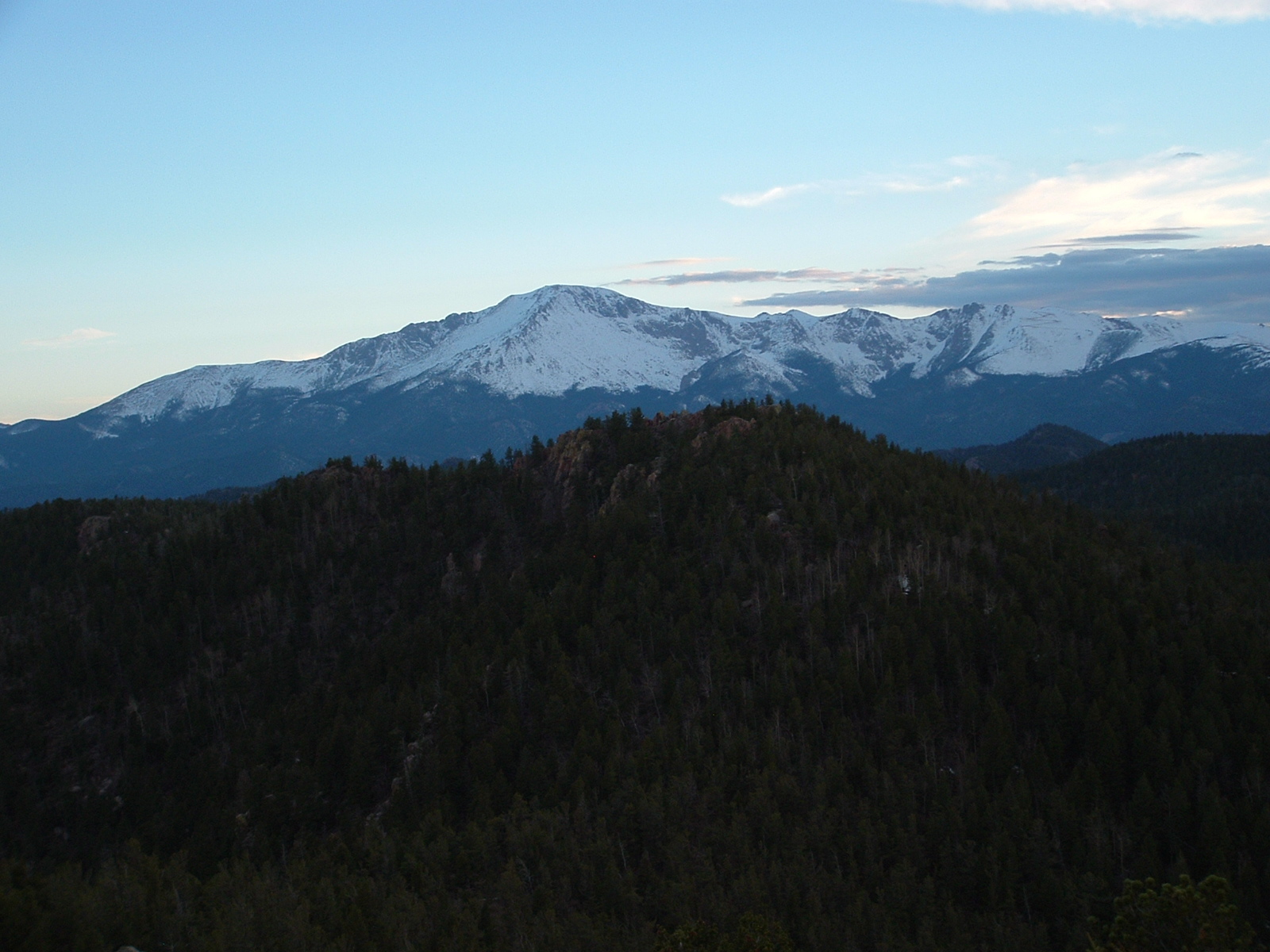
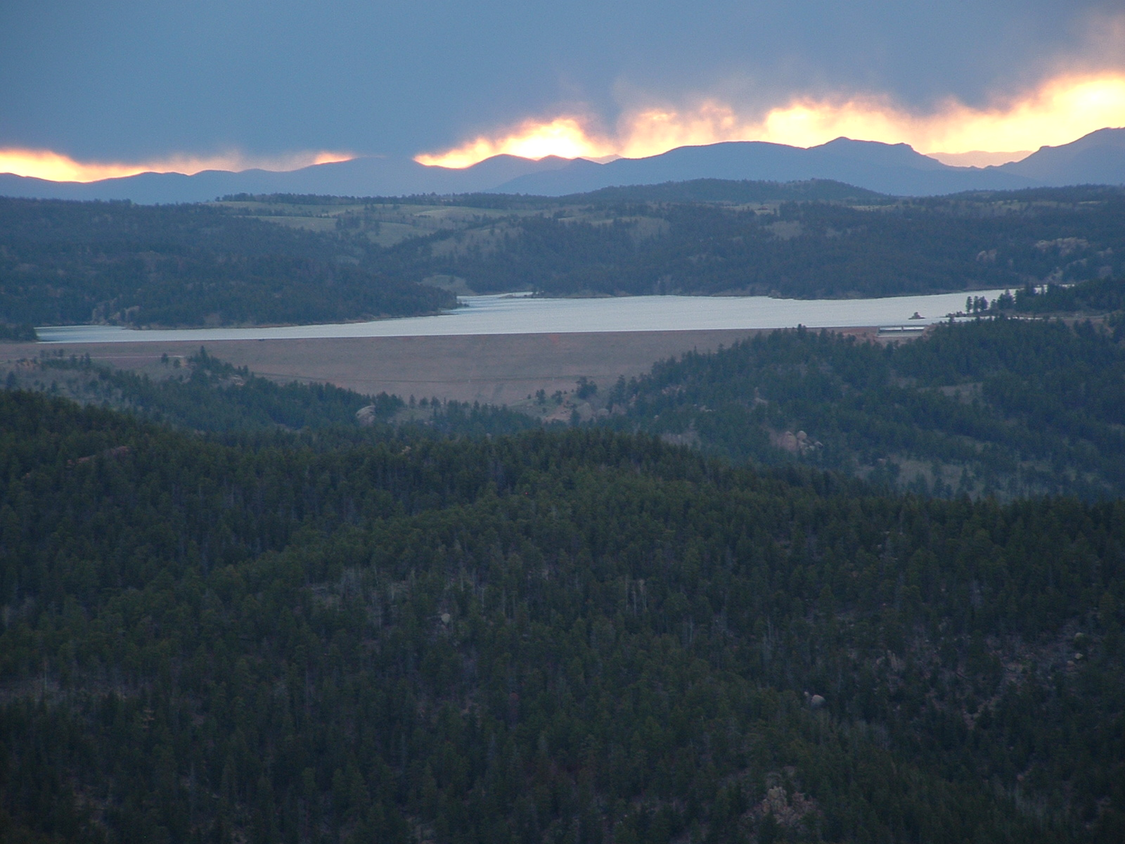
If you reach the summit during the summer months you will be inundated with bugs, especially lady bugs! If you reach during the winter odds are it will be breezy or very windy. Otherwise the view is incredible on most days. The surrounding mountains are Ormes Peak (to your west; look for info. on Ormes at peakware.com), Pikes Peak (west)(picture below-left), Cheyenne Mountain (south west), and the other Front Range peaks to the north. Some other landmarks in sight include Rampart Range Resv. (north west)(picture below-right), Briargate and Colorado Springs (southeast), and the town of Mounument and the Tri-Lakes region to the north. |
|
|
|
 |
|
|
|
 |
|
|
|
|
|
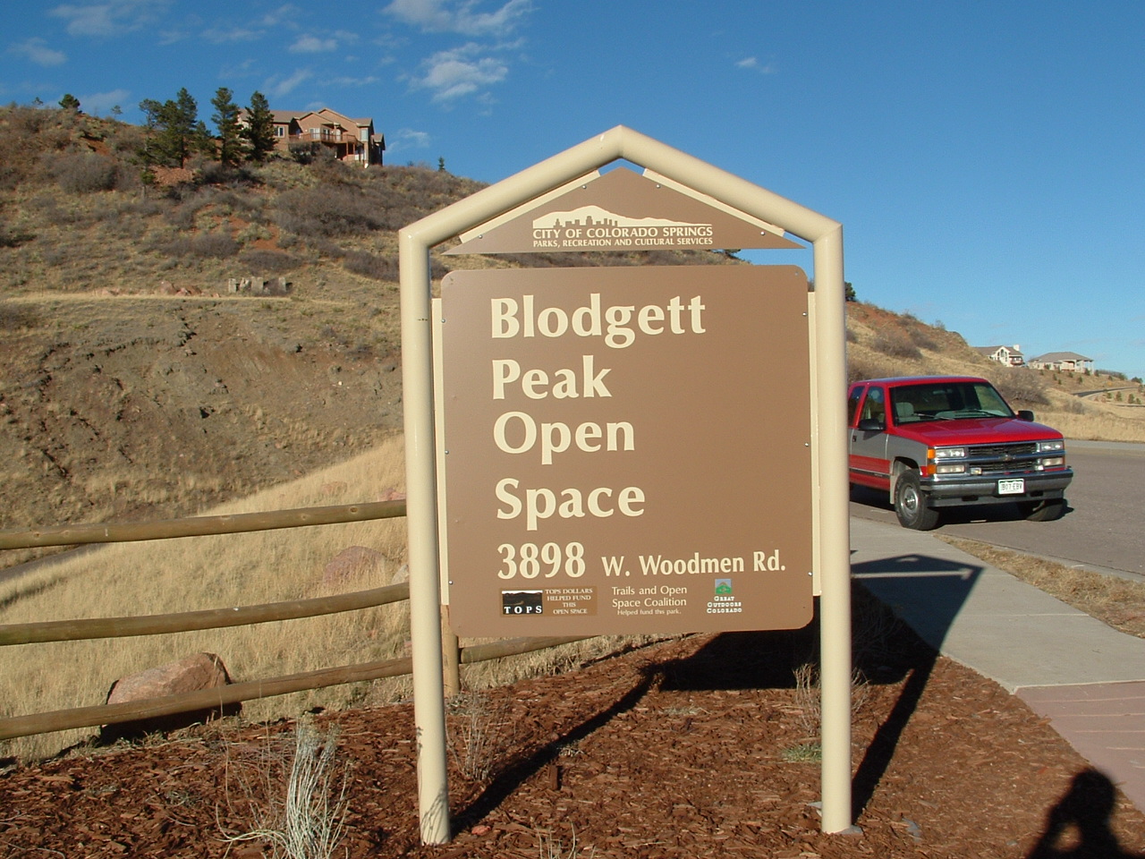
2. Blodgett Peak Open Space - The newly created Blodgett Peak Open space was obviously created as open space for city residents, but also for access to Pike National Forest to the west. The Open Space is also a great spot for starting for trips up Blodgett Peak. Follow Woodmen Road west from any direction in the city all the way into Peregrine and to almost the very top of Woodmen Road. If coming from the main Peregrine entrance follow Woodmen Road throughout the development until you pass Blodgett Drive three times and come down a hill with the parking lot on your right (west), you will see the sign and other cars parked in the lot. (photos right and below) |
|
|
|
 |
|
|
|
|
|
 |
|
|
|
 |
|
|
|
|
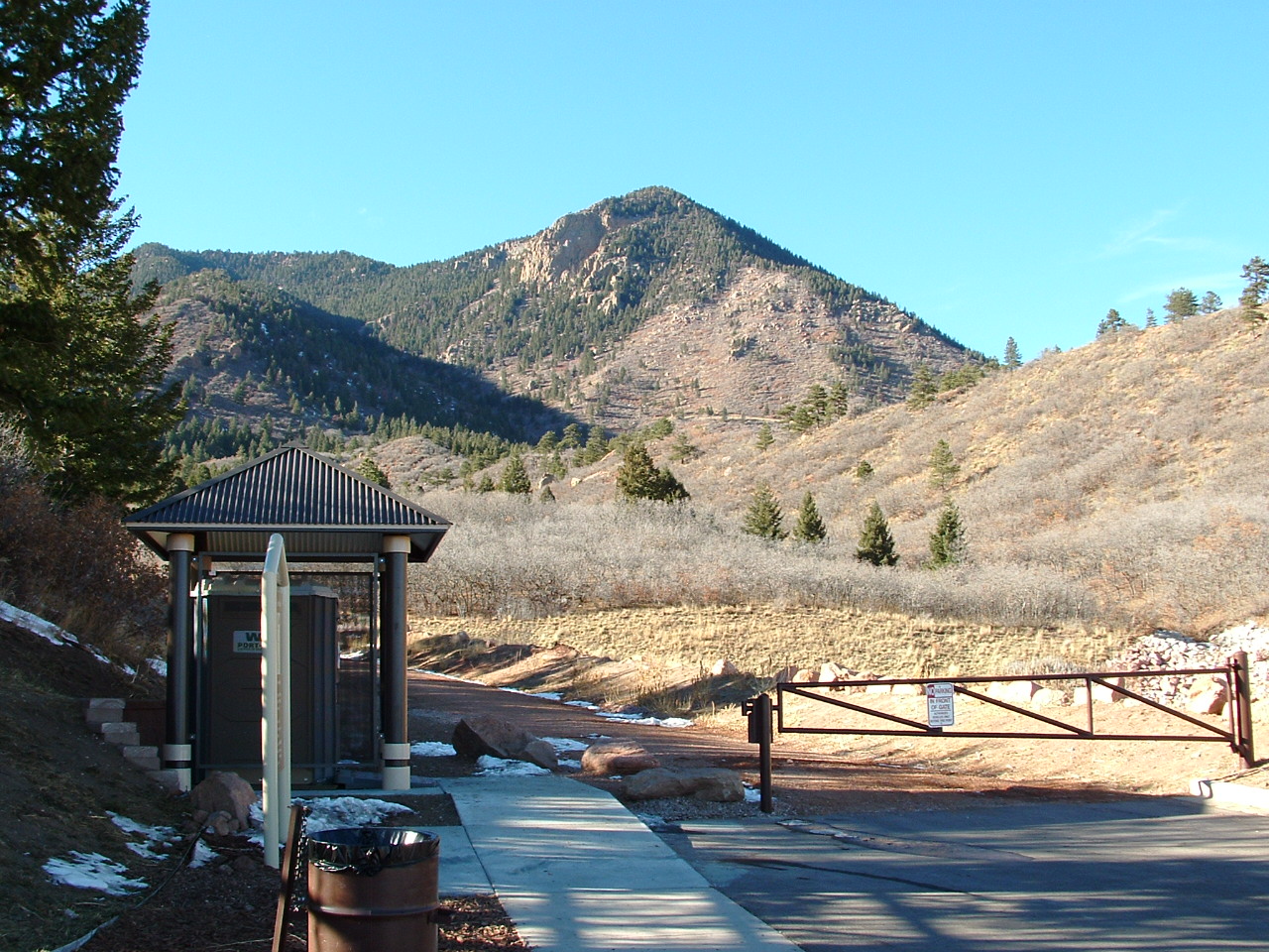
| Hike on up the dirt road (photo above right) leading from the B.P.O.S. parking lot for about three quarters of a mile, and don't miss the trail turn off to your left (highest point of road) going into the trees. If you keep going you'll see the second water tower and you've gone too far. Once on the two track trail follow the main trail and don't take any turns. Another good mile or so on this trail and you'll come to the end of the two track. The trail goes down to single track which might be hard to find, but is present going up the valley (west) past some of the woodmen's old water system. Keep following this steep trail up the valley (this is hardest, and steepest part of trail for me personally). From here you will be able to connect into the trail that was discussed in detail in trail route 1. The goal here is to continue your trek west through the valley on the main single track trail. Directions from this point can be seen above in trail route 1 starting on the paragraph that starts, You will now enter into the main valley... See the map below to get a better feeling of where you are going. |
|
|
|
 |
|
|
 |
|
|
|
|
|
|
3. Canyon Route - The Canyon Route has to be the hardest route to find, and the most challenging climb up to the summit. If you are in Mountain Shadows or near the quarry you can clearly see the canyon. The canyon looks extremely steep from the lower elevations, but it is feasible without any rock equipement.. |
|
|
|
Head up the valley mentioned in route description #1, or the trail that leads up the face.Before you reach the boulderfield you will have to make a turn out of the valley heading to your right (north), or if you're on the trail still just keep going straight up the face and angle to the noth. There is no exact turnoff but it is a ways up the valley; just start to angle your way over to the right, and you should see a huge rock wall, and the large rock outcropping. In the middle of this rock outcropping is a canyon going straight through the rock about 50 feet or more on each side. |
|
|
|
 |
|
|
|
The canyon starts out at of the width of about 4 cars side to side. It is full of loose skree and slowly narrows to the size of a single person. After entering the canyon it will eventually become very narrow and you will come upon a 8 foot high rock ledge (you're almost done now). There are a few hand or foot holds but you can probably manage to pull yourself up. After you clear this ledge you will shortly emerge from the canyon. Angle to the left (SW), but the main thing is you keep going up. You will eventually make your way over to the false summit and from here you can see the summit. This route is challenging and a bit dangerous but is by far the most enjoyable and interesting. One more suggestion I have is that I have never attempted to go down the canyon route, and I don't plan on it. This route description was written by Shawn Dorry, who also has many summits of Blodgett and hikes in the surrounding area. |
|
|
|
Extra Credit - 4. Waterfall - If you keep heading west up the above mentioned main valley you will come to a steep rock wall that runs almost the lenght of the valley. If you look hard enough and listen close enough you will see and hear a waterfall. I hope you aren't expecting Niagra Falls, because this waterfall is dependent on the current precipitation conditons. When running well it is very cool, and probably best in the winter when it is frozen over. Be sure to check it out! |
|
|
|
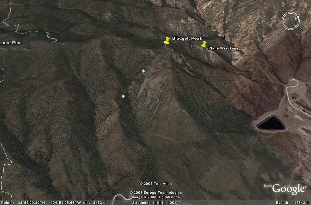
Extra Credit -5. Plane Wreckage - FOUND IT! Read more and see pictures of the Blodgett plane wreckage |
|
|
|
To sign your name on the Blodgett Peak log, view or sign my guesstbook, look at more Blodgett Peak pictures, or to view some other good sites, please checkout my links page. |
|
|
|
 |
|
|
 |
|
|
|
|
|
|
Please DO NOT use any of the contetnt/pictures/etc. on this, or any of my pages without first asking for permission |
|
|
|

|
|