
30.66 miles, 2:15, maximum speed 32, elevation gain estimate 500'.
Slept in – a little. Joanna’s for breakfast – big omelettes. Local farmers reading the Wall Street Journal and discussing subsidies. Left town at 8 AM. Clear crisp morning. Took East-west road and Hill road to see the sights and avoid traffic. On Hill road we saw an old wind-driven generator. The vane said Fairbanks-Morse (see our transcontinental diaries from ’89).
Great farming country – looks like Iowa with mountains. Come to think of it, Iowa probably doesn’t raise all that much horseradish. East-west road ends at the foot of the northward extension of Gillem’s bluff, which is called Sheepy ridge, a moderate climb. I believe it is on the great basin divide, or was before the canal linked Tule Lake to the Klamath watershed. As we came through the cut at the top of Sheepy ridge, we got a great expansive view across the valley to the Cascades, with Mts Shasta and Shastina presiding majestically over all.
Got to State line road, highway 161, with a wide truck patiently waiting behind us. We let him pass. He had a big cultivator with long sharp teeth. Waves. Glad he was civilized about it. State line road runs dead flat through the lower Klamath wildlife refuge. Much of it is dry lakebed that shows sporadic signs of alkali deposits. Presumably it drains to the Klamath river to the northwest.
There are many miles of marsh, occasional open water liberally interrupted and bounded by dense stands of tule reeds. Here’s where the birds are! As well as the kinds we saw yesterday at Tule Lake, we saw a lot of avocets today, and nearly rode through a big flock of low-flying Canada geese. But the highlight was the pelicans. Saw twenty or more, in groups of two to four. These are the white ones with black on their wings. On the water, they look a little like swans – in the air, they’re just wonderful, stately, graceful and elegant. They flew and soared and circled so close that we stopped twice to try for pictures. But a lone stationary human was not to be trusted, and they refused to get within camera range, much to my frustration.
A great route. Very little traffic and lots to enjoy.
Yellow air up Oregon way. I thought they were above that kind of thing. Joined highway 97 (the AlCan highway) after a brief climb out of the marsh. Lots of traffic on this road, lots of big trucks. Wide shoulders with rumble strip and room for us to its right. Noisy but safe. A steep climb and a slight descent into Dorris. Stopped to check B&B address. Turned off highway and explored small town streets for maybe five minutes till we found it.
It was about 11:00. Young lad answered the door. This was Mackay, pronounced McKAY. He didn’t know what to do with us, told us his mother worked at city hall. While we walked over there, Mackay (obviously) got on the phone.
Donna Burcher came out to meet us, gave us instructions. Back to the B&B, moved in, tied up the tandem in the back yard amidst half a dozen other bikes. Several kids in family, don’t know how many [two boys, 10 and 14, one girl, 12]. Mackay was the youngest.
We had a choice of two rooms. Very homey, family atmosphere. We share the bath with (at least) the kids. Donna provides a strong Irish theme in the decor and knick-knacks; no Irish accent, but she has at least been to Ireland. We went out to explore the town.
Town seems pleasant but a lot of the businesses are closed. Ended up buying lunch at a grocery store and eating on a bench at the drive-in next door. Watched the world go by. Eavesdropped on a conversation at the drive-in: someone who seemed to be a developer soliciting the president of the Sheepy Ridge hunt club.
Wandered past lumber company. Could see conveyor belts and hear saws through the open doors. No logs – sign says they make moldings. Lots of ordinary lumber in their yard.
Came past a tourist info kiosk, found the library. A couple of interesting books: Early Railways, by J B Snell. Worth getting – great anecdotes! Another book was about the secrets of Mt Shasta. Typewritten, really weird: Lemurians and Atlanteans living in cities inside the mountain, guardian angels from other planets who would save the earth… This particular copy was copy number 7 in the county library system.
Stopped back at a newly-opened Antique and Ice Cream shop and indulged in pie à la mode – decadent. Back to B&B for showers. Donna furnished beer and we sat on the back deck to chat. She used to be on the city council, but took over as city clerk when the old one resigned. Now she gets paid for what she was mostly doing anyway.
The two older kids are in Annie, get your gun, just finishing dress rehearsal in Klamath Falls. Home at 1 AM last night. Sounds at least as hard on parents as on the kids – they have to carpool the kids up there every night.
There’s a big water tower overlooking the house. Donna said it froze one winter, ruptured a number of joints, then suddenly thawed. Arcs of water spewed in all directions, flooding all the basements downhill from it. Now it’s empty, home only to a family of red-tailed hawks. As Donna finished telling the story, a hawk flew out from the tower.
Jeff showed up. He works for the Forest Service. Good ole boy, makes his own beer, says he did an excellent stout some time ago, drinks Miller. I guess he has to drink store-bought beer to obtain bottles for the homebrew.
Jeff said the house was built in the late 1800s as a rooming house. The government put pressure on the logging companies to have a hospital closer than Tennant, so the place became a hospital: hence its current name: HOSPITALity Inn.
The Burchers bought it, condemned and dilapidated, ten years ago, and have been fixing it up ever since. House shows lots of evidence of amateur carpentry. Not sloppy, just unskilled, things a pro wouldn’t do.
Jeff full of suggestions on off-road scenic detours we ought to make tomorrow. But it’s a long day, even as a straight shot, and the detours sound unpaved. We’ll probably skip most of them.
Ate at Malfunction Junction. The day’s special was sweet and sour chicken. We got a whole leg, sweet and sour sauce from a can, mandarin orange slices from a can, white rice with brown gravy, breaded fried zucchini, Texas toast. Waitress solicited our opinion – this was the first time the cook had tried s/s chicken, and wanted to know how it was. We had to admit it wasn’t bad – and it actually wasn’t, given the expectations we probably should have had going in. Whew! Good ole boy country, and no mistake!
Spent the evening reading in the anteroom. Found a bird book, confirmed that I had seen ibis at Tule Lake. The pelicans are pelecanus erythrorhynchos. The kids’ New Standard Encyclopedia is good browsing material.
A big moth flew in the open window. Couldn’t get it to leave. When we turned off the lights, it just headed for the lighted crack at the bottom of the door to the next room. We left it in peace. When we finally went to bed, we left the window open and all the doors closed – next morning, no sign of the moth.
56.23 miles, 4:20, max speed 41, elevation gain estimate 1500'.
Up at 5:30. The cat was drinking out of the toilet, then jumped up on a table and begged Jacky to let him drink out of the faucet. He seemed insatiable.
Jeff cooked breakfast at 6:00. That’s our kind of schedule! Bacon, eggs, waffles. Antique waffle iron over fire. Good stuff, and lots of it. Story about the kids’ dress rehearsal last night:
Annie’s gun didn’t work, so the other kid walks over and says, “Need some help, ma’am?” She picks up the ad lib: “Thanks, if you don’t mind.” A few minutes later, his gun didn’t work. Annie saunters over and runs the same ad lib in reverse!
Good people! Nice to have met them. We’ve noticed that B&B hosts tend to be the civic activists in these little towns, pushing, taking part, boosting, getting things done.
Early start on another cool, clear day. Excellent road surface with an eight-foot shoulder including at least four feet to the right of the rumble strip. In the hills, the surface is sometimes only good rather than excellent, but there is always either a wide shoulder or a passing lane. Enough truck traffic to justify it, too.
Wildlife: two jackrabbits, several soaring birds – at least one was a red-tailed hawk. By the way, we saw a deer crouching in the reeds yesterday.
The ride across Butte valley was dominated by Shasta and Shastina, which gradually grew in the field of view and revealed detail. Easy to see glaciers and lots of snow as you come in from the north. Beautiful! Sign calls it a National Grassland, but it’s mostly sage, not much grass.
Detoured at MacDoel to Mt Hebron. Old store advertised its quaint antiquity, but was actually just a dump. Only redeeming quality was free coffee – with a kitty.
The valley ends abruptly in a climb that alternates steeper and gentler grades. The forest begins at the bottom of the hill. Pretty and cool, a moderate level of effort. We spent about 50 minutes climbing (up and down, up and down) until we reached Hebron summit at 5200'. Even on the way down there were a few ups.
From the summit, there is a rolling downhill to a rest stop at Grass lake. Stopped for water and calories. A dry lake with cattle grazing on the meadow that used to be its bed. Saw a grass snake. Nice place.
It turns out that Grass lake was the site of a popular resort around the turn of the century. A dynamite blast caused the lake to sink into underground volcanic openings (!). The resort went out of business, but a marsh and wildlife habitat formed.
Three boys admired our 49ers water bottles more than our bike. They were also awed by the train that went by and bragged about seeing an even longer one earlier. Nice that kids still like trains!
More rollers, beginning with Grass lake summit, only a hundred feet lower than Hebron summit. Got to be hard work after a while. Fast downhills are a worry because the front wheel bearings seem to have worked loose and the bike feels unstable. Don’t have tools to adjust bearings, but there’s a bike shop in Mt Shasta.
Shasta valley visible to the right as we descended the grade. Chock full! of dozens of cinder cones! You want visible evidence of vulcanism! Lake Shastina is disappointingly small, as least as viewed from highway 97. The valley appears to be mostly dry sage with only a few green fields here and there.
Finally got to Weed about noon. Day was hot, we were getting tired, sore and cranky. Asked about motel where we had reservations. Turned out to be way the hell and gone out on the outskirts of this strip town. Found a vacancy closer in, at the Townhouse motel, phoned and canceled our original reservation.
Went out for food. Found an Ecotopian restaurant, Under the Apple Tree. And indeed, we sat under an apple tree to eat. Great lunch, and big. Greatly improved our mood. Town view is dominated by Black Butte.
Naps, showers, phoned Amtrak to find out whether we could short-circuit the long hot boring days in the Valley. Amtrak won’t take tandems.
Out again to explore. Wandered down Main street. Came to museum, headed in. It was about 3:40, sign said it closed at 4. In fact, Sam (?) was busy turning out the lights as we entered. But he grabbed us, assured us he would stay open, gave us a complete guided tour, told us about everything. He was retired, said he might as well be at the museum as go home. Sam used to work in the mill, the department where they printed (for example) Sunkist oranges on orange crates. Museum had some of the printing dies.
One of Sam’s friends also dropped in, with his wife. The friend was in one of the old photos, along with his logging truck. I had a question about how the log trailers worked, so Sam called the guy over and he explained it to me.
The town got its name from Abner Weed, who first started a lumber mill in Truckee, then came here to take advantage of the constant breeze, since lumber had to be air-dried, until the time they developed kilns. After a dozen years, Weed sold out to Long and –?. This was around 1910. The new owners added a finishing mill and expanded the whole operation. The picture we saw from 1931 (during the depression!) showed about 200 workers from the lumber mill, all white males, and 250 at the finishing mill, including about a dozen blacks and a dozen women. The museum displayed an old sign for the millworkers, trilingual: English, Italian, and believe it or not, Greek!
The Italian influence in Weed was and is strong. The Sons of Italy (has she no daughters?) donated all the public plaques and monuments; there are Italian days festivals, Italian restaurants, etc. Sam’s ancestry was Italian. He told us about his parents making wine. They distilled the dregs and marinated cherries in the distillate. The boy Sam was sometimes allowed to have one (but he would sneak another when he could… they got to be pretty potent after a while!).
The museum itself was the old city justice building. They had preserved jail cells as displays, country kitchens and parlors. There were notes on which rooms were courtroom, jury room, judge’s chambers, police chief’s office, etc.
Too many things in the museum to mention here. Just a few: an old arc-lamp movie projector. A wine-making arrangement. Factory whistles. The guide said Weed was a tough town, especially on Saturday nights. A teenager, annoyed at the mill, burned down a big section of the place.
There’s an arch over the main street entering Weed. This is the second one. The original arch was torn down not all that many years ago because of concerns about its safety. Turned out that under the deteriorating concrete it was reinforced with steel rails, and it took three months to tear down!
Shook hands all around as we left. A really interesting old guy. A museum exploration that really paid off. Wandered a little more, stopped for a beer at classic old Black Butte saloon. Lots of antiques inside, most of them inanimate. Grocery store and the remainder of our hoard provided a meal at the motel.
15.04 miles, 1:17, maximum 26. Hiked 17 miles. Total elevation gain estimate 2100'.
Rode to Mt Shasta before breakfast. A serious mistake – we neither one had any energy and felt bad as well as weak. I bonked and Jacky got a headache that lasted all day and upset her stomach on our hike later. Took College street to Old Stage road over a low divide from Klamath basin into Sacramento river basin, roughly 500'. Bike felt increasingly unstable today; kept the speed low.

Breakfast at Jerry’s, a local chain. Not because we expected it to be good or interesting, but because it was the first restaurant we saw. Figured quality would be adequate and service quick. We were right about the quality.
Left the bike at the restaurant while we did initial explorations. A nice little town with enough randomness in its street layout to create some interest. An insurance agent acts as the local AAA representative. Got a local street map, asked him where to find the bike shops (the yellow pages listed two). He wasn’t sure there were any, but told us where we might look.
Doctor Bicycle’s Cyclery was open early. Good guy, overloaded with service work, but said he’d look at the tandem. He tightened the wheel bearing, no charge, sold me a new altimeter computer. His wife, in bikie clothes, showed up to run the storefront while he did repair work. Nice folks. They know the PhD aeronautical engineer from Weed who has arranged for the human-powered vehicle contest in Montague (near Yreka) in August. Said the AAA rep was their insurance agent. They were indignant that he didn’t know they even existed. I hope they gave him a hard time!
Rode out to find Alpine lodge motel. Wheel was worse than ever. Motel was run by an east Indian, very friendly. We requested a kitchenette so we can do our own cooking. Unloaded the bike and went back to see Doctor Bicycle. He was apologetic, spent quite a bit of time on it, got it just exactly right this time. I bought a pair of cone wrenches in case it comes loose again. [Much later I discovered that the instability was caused by a bulge where the back tire was starting to fail. It never occurred to me that such an effect could originate at the rear wheel, therefore I didn’t even check the back.]
Mt Shasta is quite the nicest town we’ve been in. It’s not as touristy as Nevada City, hence not as expensive. In Weed, Mts Shasta and Shastina are gorgeous. But here there are also the Castle Crags and Lake Siskiyou. The houses, high school, etc, are distinctly middle America. The downtown is prosperous and lively. Rather than one long main street, there are several blocks of commercial development.
Stopped at forest service for topo maps. Decided to hike out Everitt Memorial highway as far as we could. Left on foot about 11 and walked up the road toward Shasta. The road goes up fourteen miles and then goes to trails and eventually technical climbing.
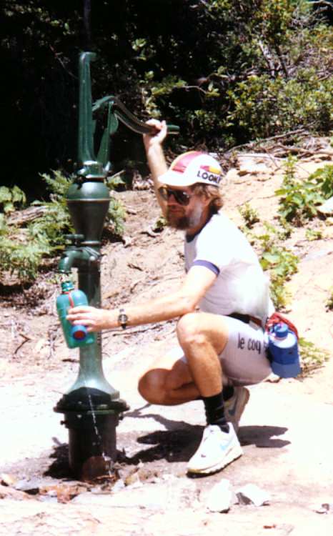
Drank as much as we could before starting off. Checked for water at McBride Springs campground – a mini-adventure in itself. Bees everywhere. Got them in water bottles, had to splash them out after bottle was full.
Walked on up, only to about 5700' point, where heat, distance, sore feet, and low blood sugar got to us. Spectacular views of Shasta, Black Butte, Castle Crags. Turned back. Lots of butterflies. One hawk, one bunny, one lizard, one crow. Very hot. On the way down, clouds occasionally covered the sun – and welcome.
We were in pretty bad shape by the time we made it down. Dragged into town, heading for motel to collapse. Happened past Willy’s Biergarten – cool, breezy, shaded deck. Couldn’t resist. Garlic bread, un pression allemand, and we revived remarkably quickly.
Stopped at a grocery store. Dates on the products put us off (cereal marked Use by April 1991), and there was no meat or produce. Checked the yellow pages, found a “supermarket.” Optimistic term; the dates on their products were not much better, but we got the rest of food we needed. Spent 5¢ on two cloves of garlic. Two onions. Stir-fry broccoli and beef stew meat – pretty good!
Due to a shortage of time and a surfeit of pain, we have been discussing ways to complete the journey more expeditiously. The official plan was to go through Redding, Red Bluff, Chico, Oroville, Marysville…, but the thought of a week of flat country and hundred-degree temperatures doesn’t appeal to either of us. Amtrak failed us. Jacky tried Greyhound, whose telephone interface clearly indicates that they are not interested in providing real service to real people. Last night, Jacky suggested we rent a car, drive to Grass Valley, pick up her car, and come back to Mt Shasta. So we did.
Up early for a standard Hood-style in-the-room breakfast, and laundry at the same time. Saw Doctor Bicycle riding to work on a recumbent. Eventually the car rental guy opened for business.
The only car available for hire in Mt Shasta was an antique 1980 Chrysler battleship. No, cancel that – a battleship needs to be seaworthy. It was an antique 1980 Chrysler barge. We mushed and wallowed through the sea of mountains as far as Redding. Long before we got there, we had run the numbers in our heads, including an estimate of gas mileage, and realized that renting another car in Redding made a lot of sense, as well as giving us an escape from the barge.
So we rented a nice little Geo Metro. Admittedly, I have never been an outspoken advocate of Geos when I’ve rented them on business trips, but after 60 miles of The Barge, in The Mountains…
Three cylinder engine, sounded like a Diesel locomotive on the highway. I speculate that this sound may be unique to (multiples of) three cylinders: locomotives probably have 12-cylinder engines. Anna agreed later, noting the unique sound of their 3-cylinder BMW motorcycle.
Took highway 99 down, 70 back. 70 was faster, but 99 was more picturesque, with orchards and fruit stands south of Chico. Peaches, plums, prunes, walnuts, almonds, apples, and kiwi!
Mike and Anna were away. Left a message on their answering machine and a note on their doorstep. Claimed the car and headed back.
Terrific view of Castle Crags. Definitely worth a visit someday. Lake Shasta itself is disappointing. The map suggests miles of water views, not true. And the water level is down a long way. Hard to get a perspective, but it could be hundreds of feet low! Mountains north of Redding are so rugged I get the feeling there is not even a network of trails, much less roads. It looks as if the road is the only recognizable route around and over the hills – that and the railroad, which goes through the hills as well as over them.
I expected to be able to watch Mt Shasta grow continuously in my field of view as I came north. But there was only a hazy outline from far away, and the mountains hid it until I got to Castella. Looked like more bad weather over Mt Lassen.
Ran a quick mental pro forma on car rental. Estimated we saved $42 by renting a second car – no mileage charge and much better gas mileage – even though we had to pay two days’ rent for the Geo. And we had a real car instead of a barge.
The guy in Mt Shasta was curious how we had gone to Grass Valley and put only 120 miles on his car, so I explained what we’d done. Wasn’t sure whether he’d be angry or what, but he just got a little apologetic about his price structure, wanted to know all about Redding rental prices.
A long day, but we now have the car.
Ate in motel room kitchen. Out for a short walk. Mt Shasta city is chock full of astrologers, shamanistic ritualists, faith healers, Mars missionaries, Lemurians, and Atlanteans, Sons of Suction, and what have you – at least if you believe the bulletin boards and kiosks around town. And indeed, there are stores selling crystals, a place called Radiant Footsteps (a shoe store, out of business). Good grief! This is worse than Santa Cruz! There was a whole program of full moon ceremonies scheduled for the weekend. Too bad the moon isn’t full until Tuesday, but the draw of the weekend crowd and the opportunity to charge $20 per event clearly outweighed the mere technicalities of astronomy.
Biked 41.07 miles, 2:42, maximum speed 34, elevation gain 2080'. Hiked 6 miles, 1000'.
Up early. Breakfast in our room. Jacky made cheese and peanut butter and jam sandwiches for later.
Drove to Siskiyou lake dam and left car. Hiked out to Færy Falls, which we had noticed on topo map. Beautiful day for a walk in the woods, dewdrops on the pine needles. Could hear the falls, but never saw them. Trail goes above and below; there are occasional views of creek boiling over rocks, but no view of the falls.
Checked out of motel, drove to McCloud. There’s a nine-hundred-foot hill between these points. Even when we’re driving, my eye notices things that matter for cycling.
Strolled around McCloud a while. Can’t see Mt Shasta because of clouds. Old company town, all the houses are the same. Not enough concentrated history here to be interesting. Sat on porch of museum (closed until later in the day) and ate sandwiches.
Unloaded the tandem. Car was angled slightly down to the right, and we unwittingly stepped forward a little as we lifted the bike off its mount. Chain caught on bottom bracket support and we weren’t strong enough to put the bike back and start over. Ended up inflicting a (small) scratch on roof of the car. Damn!
I headed out solo on the tandem, leaving Jacky to explore the town a little more. This part of highway 89 has a good surface but no shoulder. I was glad for Sunday – there were only a few trucks, and no logging trucks.
Grades not very steep. Some granny climbs before (and after) Dead Horse summit. Made pretty good time. Still feels like driving a truck, but it’s an empty truck. Jacky passed me about 13 miles out, stopped. We agreed to meet at McArthur-Burney Falls state park at 3. She went on into Burney to get us checked into a motel.
Jacky: After an hour I drove out. I chatted briefly with Dave at the 13 mile point. I went on into Burney (46 miles on highway 89, then three miles west on 299). Saw only a long strip of motels, shopping centers, etc. Green Gables motel quite nice with wood furniture, a new shower, heated pool. Expensive, too. Tried to get film processed, but there was a three to four day wait. Then she drove to McArthur-Burney Falls memorial state park, 11 miles back up the road.
Interesting names: Sheep Heaven, Bear Wallow! Passed under a pair of electrical transmission lines. Even on a clear, dry day, there was a lot of noise from corona discharge. I bet there are some real fireworks on foggy nights. Now that Mt Shasta is receding in our rear view mirrors, we are finally entering Shasta county. Didn’t this happen with Mt Lassen, too? (Yes, it did!)
About 2:20 I tied up the bike at the entrance to the state park. Found a picnic table in the shade and took a nap. Met Jacky at 3. This time we found the falls – very nice.
Took the self-guided nature hike downstream, across a bridge, and back past the falls again to another bridge above the falls. The river has eroded its way upstream over the years – its canyon wall is basalt chunks, a couple hundred feet deep, at about a 45° slope. The water eroded the softer material under the layer of lava, then the lava collapsed into the void, helped by freeze-thaw cycles and tree roots. Notice how the water actually emerges from inside the rock, where a porous surface layer of lava lies over impervious rock.

Sniffed a tree, got a strong vanilla smell. Sign identified the tree as a ponderosa. Now we’re confused: I thought the smell was unique to Jeffreys. One for further research. Amazing how many things we don’t know.
Jacky had never ridden the front seat before. She headed for Burney on the bike while I delayed a little in case there was a problem. Walked out to the shore of Lake Britton. Beyond the lava flow, the canyon wall is limestone and what I thought was chalk. It’s perfectly white, and has easily been carved by graffiti artists. Read later that it isn’t chalk, it’s diatomaceous earth. Lots of toothpaste you could make from that! Too bad I don’t have a microscope – there would surely be some interesting views!
We were told we’d have trouble finding a place in Burney because there was a pipeline going through. Saw its right of way along 299, a wide strip of bare earth. There’s room for an access road alongside the pipe, and plenty of extra space as well. There was a big pipe yard just east of Burney. Pipe is green, looks to be about four and a half feet in diameter – comes halfway up the window of pickup truck parked next to pipe. Water?
Passed Jacky just outside town. She got to the motel just after I did. Lots of vacancies, no trouble finding a room, at least when it’s not a weekend. Town nothing special, five miles long and five blocks wide. We were a mile east of the main part, but getting tired and didn’t explore it.
After nap and showers, went to Jerry’s for potato skins and their interpretation of Mexican food, because it was next door and the yellow pages didn’t inspire a wider search. Mountain View road has a great view of Burney mountain.
In all the store windows, posters by the Burney chamber of commerce welcome the pipeline workers. They may or may not like the people, but business is business and money is money. One window had a notice of a house to let at Cassel, ideal for pipeline worker and family, $150 per week.
View Guestbook
Jacky’s home
Dave’s home
View old guestbook
Email: ![]()