Waypoint Navigation
We are fortunate today to have available reliable GPS electronic navigation systems at affordable prices, making
navigating around the featureless sea relatively easy. By inserting waypoints into the appropriate "page" of the
GPS System we are able to navigate accurately. Not only do we know where we are but also our speed over the sea bed,
our side track error; that is knowing if we are going off to one side or the other, and when we can expect to arrive
at our destination, (ETA).
Probably the most difficult part of all this is putting into the GPS the various waypoints along our route.
Though waypoint positions can be found in Nautical Almanacs it is always better to ascertain and put in your own.
This requires absolute care as an incorrect position could spell disaster.
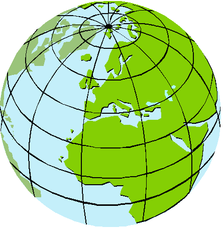
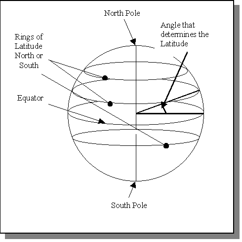
Every spot on earth be it on a mountain or the sea has a definable location by way of latitude and longitude.
Latitudes and Longitudes are imaginary lines superimposed on the Earth surface.
Lines (or rings) of Latitude divide
the surface around the globe, the Equator is one with a value of Zero� we then move north/southwards until we eventually
reach the poles which are 90� north or 90� south. Latitude has values in degrees, minutes, fraction of minutes (or seconds)
and will be north or south. One minute of Latitude equals one sea mile (Nautical mile) and
one degree therefore equals 60 miles. See diagram for explanation.
Lines of Longitude pass from the North Pole through the equator to the South Pole around the globe. Longitude values are either east or west depending on the position relative to the prime meridian (Longitude) of zero degrees; this is also known as the Greenwich meridian and passes through Greenwich, London. Longitude also has values in degrees, minutes, fraction of minutes (or seconds) Note that one degree of longitude does not equal any definable distance as this varies both Northwards and Southwards of the Equator. See diagram below
.

To determine the position of a point which is required as a waypoint, first measure with divders the distance on
the chart from your waypoint to the nearest horizontal line of latitude. Transfer the "gap" between the points
of the dividers to the Latitude scale on the nearest chart edge to determine the latitude of the waypoint
(up and down) and record the measurement ie latitude
in degrees, minutes and decimals of min. Repeat for the longitude using the scale across the top or bottom
edge of the chart. Check by comparing the course and distance of the waypoint on the chart with the GPS readings.
` Take care not to confuse degrees with minutes on the latitude scale of the chart!
| Navigation | Weather | Tides | Top of Page | Safety | Buoys and Buoyage | Home Page |
�keith matthews2001