|
|
|
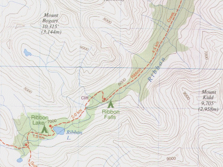
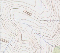
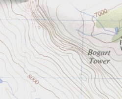
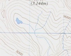
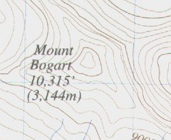
Reading Maps Maps come in many different sizes, scales and types. Some maps (like road maps) are easy to read. Other, such as topographical maps, are difficult for beginners to read. However learning how to read topographical maps is easy, and once you know how its a snap. What is a topographical map? A topographical (topo) map is a map that depicts topography (shape) of the land. Many publishers of contour maps stick to various rules. Here are the ones most commonly used in Canada: contour lines show the elevation above sea level in feet. They are usually colored gray or black. Forested areas are colored green and glaciers/snow fields are purple. Lakes and rivers are light blue. Roads are thick black lines, hiking trails dotted red lines, undeveloped routs are dotted black lines. This standard isn't used by all map publishers, but all maps will have a legend on them some where. This legend will provide all the information you need to read the map. Most importantly there will be the color/line style of trails and roads, symbols for camp grounds and ranger stations, scale (how many centimeters to the kilometer and/or inches to the mile) and declination (discussed under compass). Sample map: Ribbon Creek Trail (Gem Trek Publishing, 1996)
You may be a little intimidated by the map shown above. If you are don't
worry, it's really simple. The red line is a hiking trail, the blue wavy
lines are rivers, the blue blots are lakes, the green shading is forest and
those curvy brownish gray lines are the topo lines. When you cross the
distance between two topo lines you move up or down 60m (200 feet). Below
are some samples, these will give you more of an idea what exactly the
contour lines represent. All maps adapted from Gem Trek Publishing, 1996.
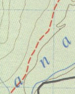
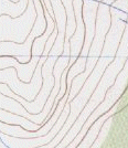
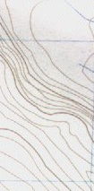
Nearly flat area - Contour lines far apart
Steep slope - Contour lines close together
Cliffs - Contour lines very close together or touching
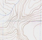
Gully/Valley (couloir) -Lines form a 'U' or 'V' shape with the 'point" of the 'V' pointing uphill
Ridge - A region on the map where two cliffs join, forming a 'V' shape on the map. The point of the 'V' points uphill.
Saddle Pass - A low point on a ridge with a hour-glass shape.
Cirque (bowl) - Contour lines for a semi-circle, which may or may not contain a lake/glacier.
Putting it together: The only way to learn to associate what you see on the map with the actual landscape is to practice. Pick a location that is easy to find on your map (trail heads are good), orientate the map to true north, and compare what you see on the map with the surroundings. In minutes you'll be able to find more noticeable feature such as peaks. With more practice you should be able to identify almost everything that you can find. Remember: practice makes perfect!
|
This Page Copyright (2004), Knights of Dionysus
Authored by: Bryan Heit