|
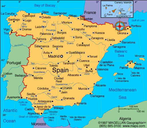
Spain occupies 85% of the Iberian Peninsula, in southwest Europe. Africa is less than 10 miles south at the Strait of Gibraltar. A broad central plateau slopes to the south and east, crossed by a series of mountain ranges and river valleys. Principal rivers are the Ebro in the northeast, the Tajo in the central region, and the Guadalquivir in the south. Off Spain's East coast in the Mediterranean are the Balearic Islands, the largest of which is Majorca. Sixty miles west of Africa are the Canary Islands. Mainland Spain is dominated by high plateaus and mountain ranges such as the Pyrenees or the Sierra Nevada. Alluvial plains are found along the coast, the largest of which is that of the Guadalquivir in Andalusia, in the east there are alluvial plains with medium rivers like Segura, Júcar and Turia. Spain is bound to the south and east by Mediterranean Sea, to the north by the Cantabrian Sea and to its west by the Atlantic Ocean, where the Canary Islands off the African coast are found. Spain shares borders with Andorra, France, Gibraltar , Portugal and Morocco. Due to Spain's own geographical situation which allows only its northern part to be in the way of the Jet Stream's typical path and due to its own orographic conditions, its climate is extremely diverse.
|