
Day Two - Staigue Fort
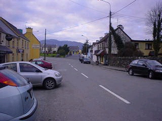
From the gap, we drove onward to what would become my favorite town of Day Two: Sneem. For some reason, I loved it here. Thierry really liked saying the word “Sneem” whenever it would pop up in our planning, and that may have had something to do with it's charm. I was preconditioned to think it was an adorable place. And really, it was. One of my guidebooks had given it the thumbs-down for being “usually crowded and touristy”. But at this time of year, it was quiet and quaint. We had some really delicious apple pie (served warm with cream) and coffee in a little shop, and I found it to be quite a relaxing break in the day, and a really good memory. Everything at that point was so vivid, so new. Just so happy to be in Ireland!
 |
|
The charming village of Sneem.
|
 |
 |
|
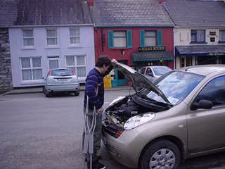
Nothing wrong — just looking at the engine.
|
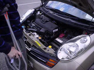
Really, a marvel of micro-mechanics.
|
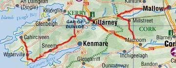
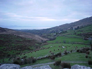
We left Sneem and headed out on the “Ring of Kerry” We drove clockwise, against the advice of our first-night B&B host and several guidebooks. Supposedly the recommended direction of counter-clockwise is to put you in the flow of traffic, rather than having to pull over continuously to let tour buses pass. Needless to say, in February, it doesn't matter which way you drive. We saw no tour bus on this peninsula (although we did see a few on the trip, just none here). The Ring of Kerry is a very (justifiably) famous drive that takes one around the perimeter of the Iveragh peninsula. Now's probably a good time for our Day Two Map:
 |
|
Day Two: Mallow to Macroom to Killarney, down through the Gap of Dunloe, to Sneem, Waterville and Cahirciveen. The Staigue Fort is just past Sneem. (Click to see bigger map again.)
|
 |
 |
|
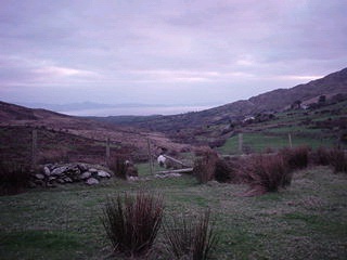
Random view of the land from the Ring of Kerry.
|
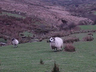
Sheep were everywhere.
|
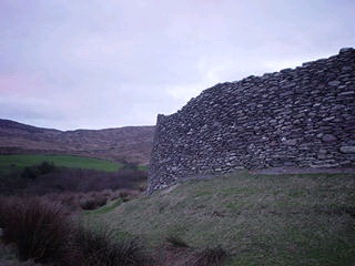
Just a little past Sneem, we arrived at the Staigue Fort, which I'd heard was fantastic. And it was. It's a 2,000 year old ring fort that was built without mortar or cement. Just stones stacked on top of stones. And you wouldn't believe how cool it is, how preserved it is, how magnificent. There was a huge parking lot, so it's obviously quite crowded during the season. (If I haven't said it enough, let me restate it now: Winter is a good time to go to Ireland!) There were no cars, no people, no one but us. There was a house nearby where we assumed the people live who own the land — there is no admission to the site, but there is an “honesty box” by the gate where you are asked to leave €1 for the landowners. And you are expected to close the gate behind you.
 |
 |
|
|
The perfectly smooth exterior of Staigue.
It looks this perfect up close, too. |
Gorgeous view from atop Staigue wall. The water in the distance is the Kenmare River. It's very wide because it's very close at this point to the mouth. The land you can see across it is the Beara Peninsula.
|
 |
 |
|
The stone stairs inside the fort fascinated me. Presumably, these provided a way to access the top of the wall, for defense. They were built in so cleverly, they almost disappeared into the wall, but they were quite easy to walk up, just like a staircase.
|
Another thing that fascinates me is that this fort has stood intact in the face of wind, weather, war, catastrophe… and tourism.
There are signs asking people “not to take the stones”. (!) |
 |
 |
|
The entrance to the Fort. We guessed that the newer stone stacks on either side keep the sheep from wandering in!
|
Thierry on Top.
|