Day Three - The Ring of Kerry
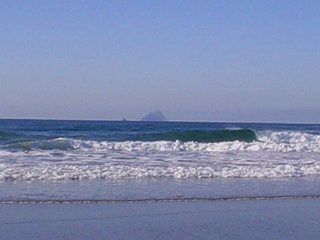
We left Ballinskellig and headed over a short mountain pass (with spectacular views of St. Finan's Bay and the Skellig Islands. We emerged from the pass to a beautiful, sandy beach with views of, you guessed it, the Skelligs (has everybody got that we were a little obsessed with the Skelligs?) This was a really awesome spot. Gorgeous views, mountains all around, beautiful beach. There was a tiny little cottage on the side of one hill, and the guy who lived there was sitting out on his back porch, just watching the ocean. This was his back yard. We were really taken by this spot and we lingered here a while. There were three guys preparing to surf when we arrived, and we got to see them do that for a little while. Other than the surfers, the guy on the hill and us, there was no one around. I couldn't believe there weren't throngs of people here, on a sunny, fairly warm, February day.
 |
 |
|
View of the Skelligs. Skellig Michael is the big island, where the monastic settlement was. There's no access in the winter. Little Skellig is the tiny bump to the left of Michael. It's a bird sanctuary and people can't go there at any time. If you see pictures of it, it looks white. That's because it's covered in guano. Heh!
|
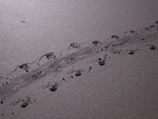
Thierry guessed that a turtle made these tracks. Pretty cool. They were about a foot wide, perhaps a bit less.
|
 |
 |
|
We supposed the next people to come along would take pictures of Thierry's tracks. “What sort of creature do you think this was?!”
|
This was a mountain stream, flowing into the ocean in a wide, shallow swath. It was beautiful. The rocks you see were covered in mussels. They made Thierry hungry.
|
 |
 |
|
More stream. I love this shot. My friend Annie's digital camera. Thanks Annie!
|
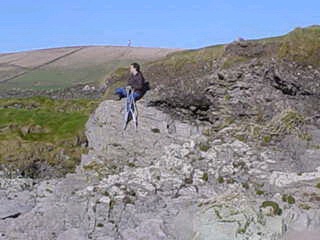
Thierry, sitting atop rock, again.
|
 |
|
Climbing to join Thierry. We sat up on this ledge and took in the view for a while. A nice morning.
|
When we were able to drag ourselves away from the beach, we headed up and over another mountain pass, towards the town of Portmagee.
 |
 |
|
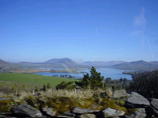
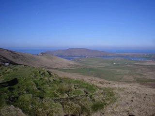
The town of Portmagee and Valentia Island from
the top of the pass. |
All the roads looked like this. Only much narrower.
|
 |
 |
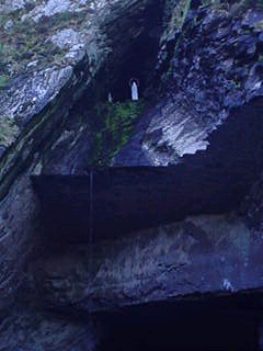
We crossed the bridge in Portmagee over to Valentia Island. There is only one bridge to the island, and we'd planned to drive the length of it and catch the ferry, at the eastern tip, to the mainland. But we discovered the ferry doesn't run in the winter, so we had to backtrack. While we were there, we saw a rock quarry which had, for reasons I read on the sign, but can't now recall, become a holy shrine of some sort. I believe it all stems back to a sighting of the Virgin Mary.
|
|