Day 2: The Run Up The Coast Distance Covered: 285 Miles
The group got started early enough but the light drizzle put a damper on our riding. We ended up hanging out at the local Starbucks coffee house for an hour of bullshitting and laughing at the dazed locals coming to get coffee.
We hit the road after we got bored and as I lead the group towards Highway 1, at the corner of my eye, I saw several riders standing by a gas station waving profusely as if to get our attention. At first I thought, �just motorcyclists�. But later I thought maybe they were members of Sport-Touring.net who recognized us and wanted to hook up? Nah.
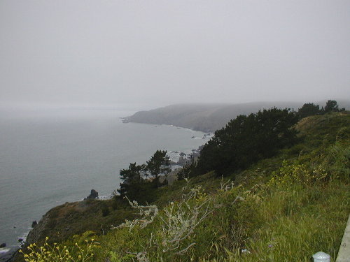
Highway 1 coming out of Mill Valley was damp and bumpy. In addition, it twisted and turned, climbed and descended like an angry snake. The turns where mostly very tight and many of them were blind as the road climbed up from sea level as it skirted the edge of Mount Tamilpias and the Golden Gate National Recreation Area. D207RR�s plus wet surfaces plus hairpin turns don�t make a great combination. Yikes! So I kept our speed VERY low. Last thing I wanted to do was crash just when I was about to cover one of THE roads I�ve been wanting to ride on for years. The surrounding area was lush green and filled with thick juniper trees, ferns, and other greenery that thrives in constant moisture and shadows.
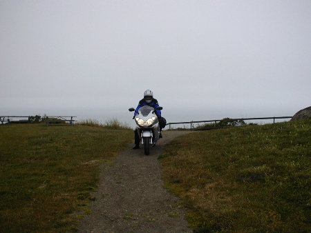
We stopped at Muir Beach Overlook. During the early days of WW2, US Army lookouts had a bunker right on that spot to watch over the Pacific Ocean for invading Japanese ships. At specific points along the beach, there were giant artillery pieces which the lookouts could direct fire to targets out at sea. The bunker was still there, but the big guns had long since been hauled away. The Japanese never invaded, nor had any plans to do so during that time. But during the dark days immediately following the attack on Pearl Harbor, everyone took the threat very, very seriously. |