| Back to Rogue's Home |
| Back to Rogue's Home |
| Highway 1 passed by the Point Reyes National Seashore, along the Point Reyes peninsula. This peninsula juts out from the Marin County seashore and is home to many migrating birds and other species of animals and plants. It is a preserve and no development is allowed along this 100 mile long peninsula. In addition to being a preserve, the peninsula is rich with history. During the 1500's, Spanish Galleons rich with spices, porcelains, & silk from Asia and their colony in the Philippines sailed across the Pacific to Mexico to trade and stop over before the long voyage down Cape Horn and on towards Europe. Some of these ships anchored along the treacherous shores of this peninsula to gather needed supplies. Some of them simply crashed into the rugged coastline during a storm. In the late 1500's, when Britain was at war with Spain, the British sent Sir Francis Drake and his ship, the Golden Hinde, to circumnavigate the globe, and intercept Spanish ships loaded with treasures as a prize for her crew as well as the British Crown. Drake landed on the peninsula to make repairs to his ship after an altercation with a Spanish vessel. The spot is now called Drake�s Beach. According to history, the Golden Hinde was loaded with Spanish treasures when she returned to England in 1580. There, Queen Elizabeth took 50% of her plunder as well as help the Royal Treasury become debt-free in 1581!
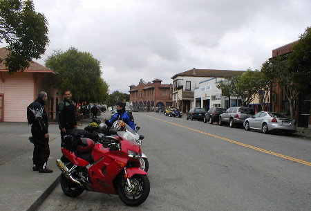
Due to the treacherous nature of the Point Reyes Peninsula, the U.S. Lighthouse Service built a lighthouse in the south end of the peninsula in 1870 to minimize the shipwrecks that occurred along the very rugged coastline that is frequently shrouded with fog. Today, the lighthouse is open to the public for viewing. I stopped the group in the town of Point Reyes, adjacent to the peninsula. It has several restaurants, bed and breakfast inns, as well as tourist shops. Of course! This tiny town was originally home to the inhabitants of the Point Reyes Light house as well as a supply depot for the operation of the lighthouse itself. |
 |
| North of Point Reyes, Highway 1 brought us passed Tomales Bay and into the open coastline as it hugged the rugged shores. The twisting and turning and the constant elevation changes got tight in some places requiring 2nd gear work. But on the straightaways it was hard to resist and I used them to pass a few cars at high speed. I was so busy riding a smooth but quick pace I completely missed a local Sherif sitting by side of the road. Luckily, I wasn�t near triple digit speeds when I went by him! |
| Above: Rest stop at the town of Point Reyes. |
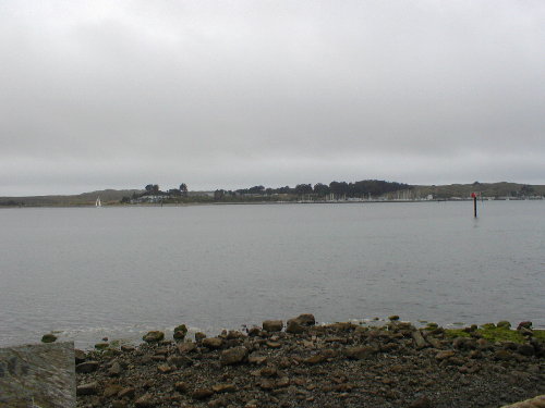
| We stopped by what I think was Bodega Bay, where there was a Texaco gas station for me to fuel up.
After Bodega Bay, nobody wanted to lead the group (hmmmm....I wonder why) so I was voted in to continue my handy work of leading the troop up Highway 1. The road was so intoxicating. It was always smooth, well marked, with tight twisties opening up to long straights. It was everything I expected it to be and then some. Dave was right behind me as we both swept passed turn after turn, straight after straight. On one long straightaway, my mind wondered at the beautiful scenery for a moment and I completely disregarded a very tight uphill left hander that was fast approaching. Whoa VFR! I was hard on the binders when I realized the turn was a decreasing radius....one of the turns I can remember that was unmarked. |
 |
| Soon after that, we suddenly found ourselves stuck behind the largest procession of cars and SUV�s we�ve encountered so far. It was nearly stopped as it negotiated a very tight and steep portion of the highway. Something was definitely holding this pack back. At first I thought it was construction ahead. After we negotiated the very tight section, the �thing� holding everyone back were two very large motorhomes attempting to climb and negotiate the hairpins. The motorhomes where heading to Fort Ross State Historic park. |
Left: Bodega Bay under the cover of the typical California morning clouds. All along the northern coastline are small bays that contain little coastal towns. In the past, these towns made their living with fishing. Today, they are mostly tourist attractions with fishing as a minor business.. |