DAY 11
DAY 13
FINISH:
miles
Raton, NM
7430.7
Gateway to the Grand Canyon.
Williams is about 30 miles west of
Flagstaff and about 60 miles south of
the Grand Canyon. I began Day 12 by
driving north on Route 64, which
brought me to Route 180. Once on
Route 180, I saw a sign which
mentioned that the entrance fee to the
Grand Canyon is $20.00. I suppose
this sign was placed there to warn
people who were expecting the fee to be
less and give them a chance to turn
back before driving another 25 miles to
the park entrance. The $20 fee is
actually per carload (not per person)
and is good for 7 days. As I
approached the entrance gate to pay the
fee, the park ranger took one look at
my attire (T-shirt and shorts) and said
"I hope you brought along something
warmer to wear - it looks like you just
came from Phoenix!" Coming from
New York, I figured shorts would be
safe to wear in Arizona in October, but
the weather in N. Arizona in the fall can
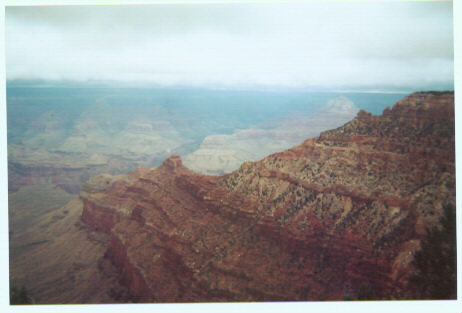
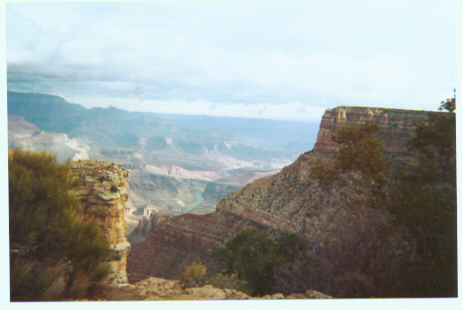
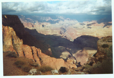

would not be doing this natural wonder justice if I tried to describe its beauty and
grandeur, so I won't even try. There are plenty of parking areas available while driving
through Grand Canyon National Park to stop and admire the canyon. Just before
leaving the park is the "Watchtower," located at Desert View. The first floor of the
Watchtower houses a gift shop, which specializes in Native American goods, and by
putting a quarter into a turnstyle, you can climb the stairs to the top of the Watchtower
Canyon. After leaving the Grand
Canyon, I made my way through towns
like Cameron, Tuba City and Kayenta.
As I was approaching Kayenta, I looked
in my rear-view mirror to see a
policeman driving behind me. A few
informed me that I was driving 69 mph in a 65 mph zone. In New York, no one would
ever get pulled over for exceeding the speed limit by only 4 mph. I wonder if the fact
that my car had New York license plates on it had anything to do with the policeman's
actions. I was fortunate enough to only get a warning, but there was paperwork written
up on it, a copy of which I got to keep. By the way, if you're ever in the Kayneta area
and you should happen to run into Officer S. Garnenez, please take a moment to thank
him for keeping Arizona's highways safe. My next destination after Kayenta was the
traditional route of Route 160, I decided
to head north on Route 163 so that I
could log some miles in Utah. At the
Utah/Arizona border, I finally had my
opportunity to get a picture of the
"Welcome To Arizona" sign, an
oppotunity which sadly did not exist a
This picture was taken at the UT/AZ border.
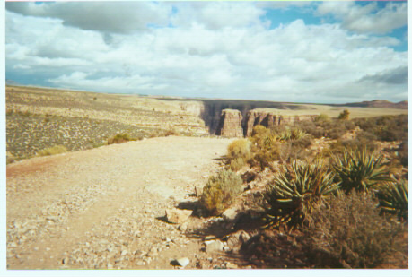
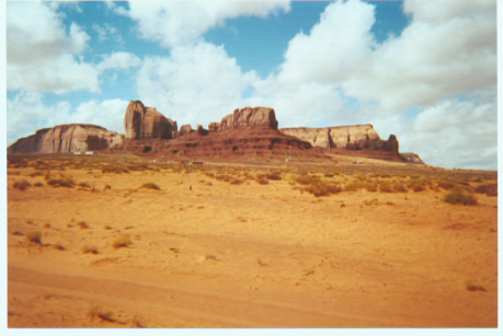
known as Monument Valley, and the scenery in the above picture is typical of the
scenery in Monument Valley. I drove through a 70-mile stretch of Utah and 15 miles in
Colorado to get to the Four Corners, the only point in the United States common to 4
states: Utah, Colorado, Arizona and New Mexico. The entrance to Four Corners is
actually in New Mexico, where Route 160 passes through New Mexico for just over a
mile between Colorado and Arizona. I was surprised by two things about Four
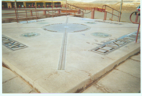
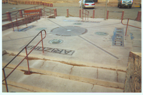
per person) and 2) it's only open from
8AM to 5PM. I was expecting it to be free
and open 24 hours. Once I left the Four
Corners, I headed back onto Route 160
into Colorado and passed through Cortez,
Durango and Pagosa Springs, and then
Utah, Colorado, Arizona, New Mexico
my destination of Raton, but it would actually take me 4 more hours to get there. It
didn't look like too far of a distance in the road atlas, but when Rand McNally squeezes
the fifth-largest state onto one page, whereas my state (New York) needs 4 pages, I
realized that I needed to be more careful in calculating distances, and that the scale of
miles is radically different. From what I could see, this 200-mile stretch of Route 64
would have probably been very scenic, but I drove the entire stretch in total darkness. I
made my way over the mountains on Route 64, sometimes having to slow down as slow
as 15 mph as I negotiated the many turns and thick fog. I drove through towns like
Tierra Amarilla, Tres Piedras and Taos before finally reaching Raton, marking the end
of Day 12 of my journey.