DAY 10
DAY 12
FINISH:
miles
Williams, AZ
6720.6
the San Diego-Los Angeles area. Being that Day 11 was Columbus Day, rush hour was
not bad at all. I took I-15 north through cities such as Escondido, Temecula and
Corona, bypassing Los Angeles in the process. Around the point where I-215 meets I-
15 (near San Bernardino), the scenery rather suddenly changes to all desert as I-15
makes its way across the Mojave Desert. The scenery changed very little for the next
few hours. Billboards constantly remind you to visit Denny's in Baker, or how great
the shopping is in Jean, Nevada ("in-JEAN-ious"). One structure did stand out as I
thermometer. The black ovals which
work their way up the thermometer are
separated at 10-degree intervals.
Current temperature reading at the time
of this photograph: 86 degrees.
(Shortly thereafter, it was mentioned
on the radio that the temp was 91
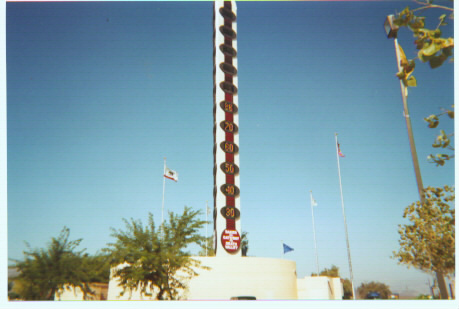
Baker, California
Valley," since visitors approaching Death Valley from the south typically exit at Baker
to take Route 127. Baker was also the town in which I saw the highest gas prices in
my 16-day journey - regular unleaded at the Gulf station in Baker was going for $2.15
a gallon. I did not gas up there, though! About 40 minutes after leaving Baker, I saw
what appeared to be a colorful mixture of buildings in the middle of the desert. I
thought at first that perhaps it was just a mirage, but as I got closer and closer, I
noticed that these colorful buildings really did exist. The town of Primm, Nevada rests
right along on the California border, and is home to casinos and amusement park rides.
This colorfulness lasts for only a few tenths of a mile, and then it's back to desert
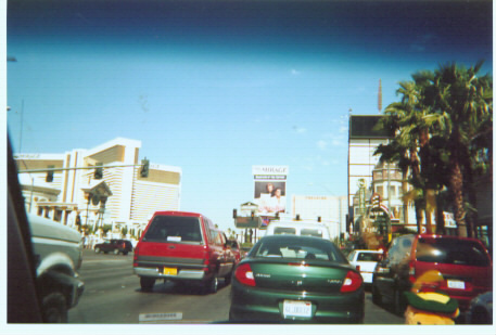
Driving down Las Vegas Blvd (better
known as "The Strip") was everything
I expected it to be, with dozens of
grand and glorious casinos lining both
sides of the highway. As I headed
further north on the Strip, I noticed a
bunch of wedding chapels which Las
Vegas is known for, including a few
drive-thru wedding chapels. That's
right, you can get married without
even getting out of your car! As I left
Las Vegas, I headed onto I-515 for a
short while, and then onto Route 95.
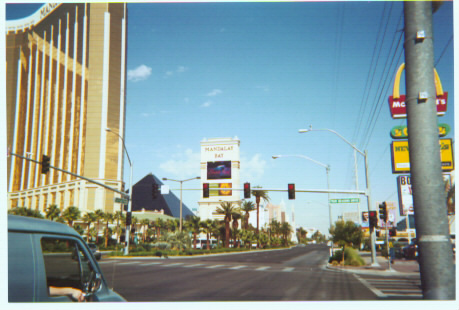
Above: Intersection of Four Seasons Drive. Mandalay Bay is on the left
Below: The Mirage is straight ahead, featuring Siegfried and Roy.
20 miles in Nevada. Just before crossing the Colorado River to bring me into Arizona
was yet another casino. It seems like the people of Nevada take every opportunity to
welcome visitors to their state with a casino! My first goal in Arizona (as with every
other state I visited) was to take a picture of the state welcome sign to add to my
collection. There was no sign as I crossed the bridge into Arizona, and just after the
bridge, I had the opportunity of going left, right, or straight ahead. I tried each of the 3
directions, hoping there would be a sign in at least one of the directions. There wasn't.
I drove Route 68 over Union Pass to Kingman, and hopped onto Interstate 40. I chose
to exit the interstate at Seligman to drive a portion of old Route 66 (the "Mother
Road"). Route 66 has a very colorful history which I have researched in some detail.
It would have been a sin for me to drive cross-country and not drive even a small
portion of Route 66. I plan on driving the entire 8-state length of Route 66 someday. I
ended the day in the Route 66 town of Williams.