 |
|
|
|
|
|
|
|
|
|
|
|
|
|
|
|
|
|
|
|
|
|
Trail 266
The Roosevelt Trail |
|
|
|
 |
|
|
|
The trailhead for Trail 266 lies just a stones throw north of the entrance to the Stagger Inn Campground (refer to my writeup on Trail 301, the Granite Falls Trail, for driving directions to the Campground).
Trail 266 provides the primary access route to three other trails: 1) Trail 265 which leads to Little Grass Mountain, 2) Trail 293 which leads to Boulder Mountain, and 3) Trail 256, the Zero Creek Trail. These trails offer panoramic views of the surrounding area. |
|
|
|
Trail 266 runs from US Forest Service Road 302 to Road 1014. The trail proceeds from Road 302 to a stand of old-growth cedars. Total length of the trail is approximately 4.5 miles. The elevation on the trail ranges from 3280 feet at Road 302 to 5160 feet at its highest point (i.e., intersection with Trail 293).
Note: Elevation based on USGS Quadrangle for Helmer Mountain, 7.5 Minute Series (Topographic), 1996 |
|
 |
|
|
|
|
 |
|
|
|
|
|
|
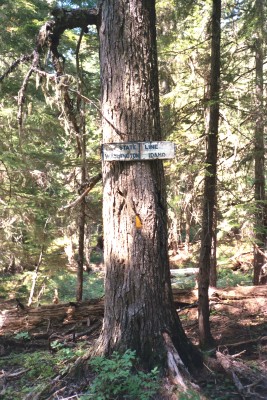
Trail 266 crosses the Washington-Idaho State Line - marked by the sign on the tree in the photo |
|
|
|
|
|
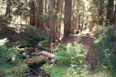
In the photo above, you can see where Trail 266 crosses the headwaters of Huff Lake |
|
|
|
 |
|
|
|
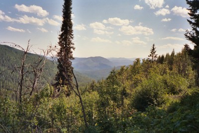
View from the Roosevelt Trail near its intersection with the Zero Creek Trail |
|