| Full Cascades Tour | Virtual Climbs | Live Cameras | Climb the Web | Top Pics | Climb Smart |
 |
 |
 |
 |
 |
Mt. McLoughlin |
|
|
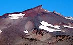
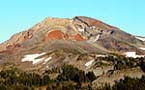
The traditional route starts from a parking area trail head located off Highway 140 approximately 35 miles west of Medford, or from an alternate trail head located off Four Mile Lake Road. Either way the route takes an approach to the east ridge of the mountain which climbs above the large bowl strewn with huge boulders located on McLoughlin's northeastern slopes. The views of McLoughlin climbing past the 6000 foot level reveals that the mountain is far from a perfect cone. Spectacular hardened volcanic lava tubes jut up from ridges where erosion has stripped away the surrounding softer sediments to reveal the remnants of past eruptions. The 3900' climb covers almost 5 miles distance, and if easier summer climbing isn't enough of a challenge for you, excellent winter access and parking is available with a Snow Park Pass at the Highway 140 trail head. Winter conditions on McLoughlin as with all the northwest Cascade summits, can change and deteriorate very quickly. Full mountaineering gear should be carried. Winter and spring climbs will require either snow shoes or back country skis and the skills to use them in the wilds. |
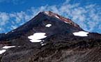
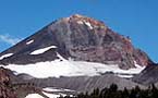
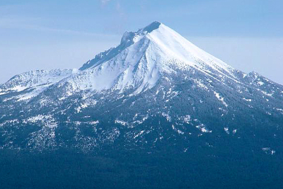 The
southern most volcanic summit in the Oregon Cascades rises to 9,495
feet. From it's heights the towering presence of Mt. Shasta lies just
across the border to the south in northern California. The mountain's
conical shape appears symmetrical except for a large collapsed cirque
on the northeast side.
The
southern most volcanic summit in the Oregon Cascades rises to 9,495
feet. From it's heights the towering presence of Mt. Shasta lies just
across the border to the south in northern California. The mountain's
conical shape appears symmetrical except for a large collapsed cirque
on the northeast side.