Looking south from the Riverton Check Station
Road #313 is paved all the way into the Check Station. It starts on County Highway J46 (west of Riverton) and connects with County Highway L68 (north of Riverton) where the DNR Headquarters is located. #313 is also paved all of the way into the Overlook coming from the DNR Headquarters/L68. This area is very busy during the deer and duck seasons, all of the rectangles on the map below are duck blinds that are rented in advance.

The following species were harvested during the fall of 1999 in the Riverton Wildlife Area.
A. Geese
1. Canada goose (Branta canadensis)
2. Snow goose (Chen caerulescens)
B. Ducks
1. American wigeon (Anas americana)
2. Blue-winged teal (Anas discors)
3. Gadwall (Anas strepera)
4. Green-winged teal (Anas crecca)
5. Hooded merganser (Lophodytes cucullatus)
6. Lesser scaup (Aythya affinis)
7. Mallard (Anas platyrhynchos)
8. Northern shoveler (Anas clypeata)
9. Pintail (Anas acuta)
10. Redhead (Aythya americana)
11. Ring-necked duck (Aythya collaris)
12. Wood duck (Aix sponsa)
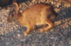
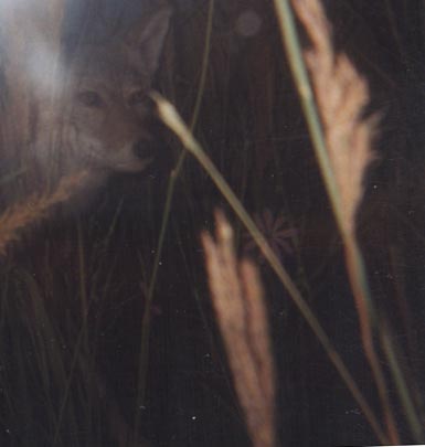
Rabbits and coyotes are also found within the Riverton Wildlife Area.
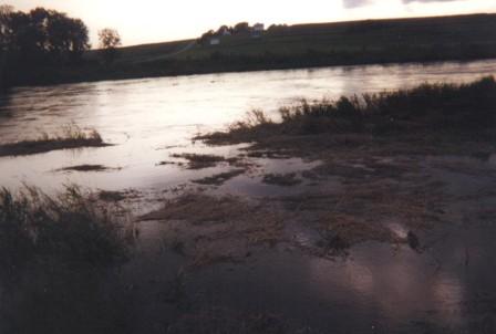
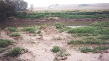
These are during and after pictures of the West Nishnabotna River, looking west from the Pump House. A major flash flood occurred in the Omaha area late Saturday evening August 6th into the early morning hours of Saturday August 7th of 1999. Rainfall estimates exceeded 8 inches in Dodge, Washington and Douglas counties in eastern Nebraska (including the north side of Omaha) and into Harrison and Pottawattamie counties in far western Iowa (including the city of Council Bluffs, Iowa). Omaha's Eppley Airfield recorded the peak rainfall of 10.48 inches during the 24-hour period ending at 4 a.m. Saturday. The old Omaha 24-hour precipitation record was 7.03 inches and was set back on August 26-27, 1903. The new Omaha record of 10.48 inches of rain is still short of the state record for a 24-hour rainfall of 13.15 inches set in York, on July 9, 1950. The Riverton Area didn't receive any rainfall from this storm, but the Silver and Slocum Creeks, etc., drain the Council Bluffs area and flow into the West Nishnabotna River before it passes through the Riverton area. Water was pumped from the West Nishnabotna river into the the Riverton Management Area during this time.
Home Page
1) 1999 PLANT LIST FOR WAUBONSIE STATE PARK
2) Prairie Plant List
3) 1940 Plant List for Waubonsie State Park
5) The Lakota and footbridge
6) SIU Home Page
7) Wildlife Species Information