![]()
| OS Map Ref SD 801 125 |
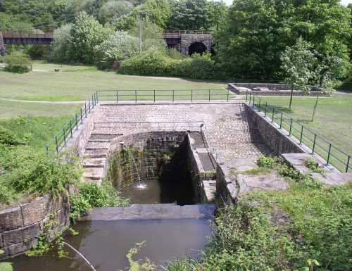
Standing at the viewing area and looking down into the waterwheel pit really gives an impression of its size. |
|
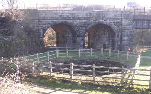
Higher Woodhill Mill had its own gasometer for coal gas produced on the site and this circular pit lined with stone is the remains of its base. |
|
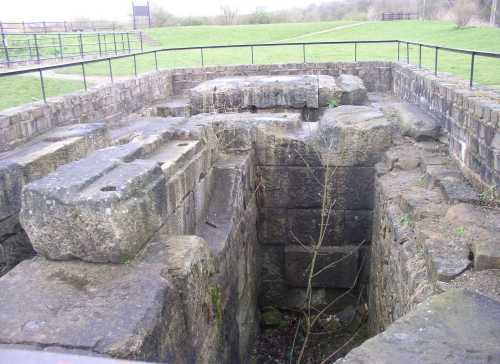
This is where the steam engine was located. Mounting holes are visible on some of the stone blocks, and near the centre is a semicircular recess for the flywheel crank. |
|
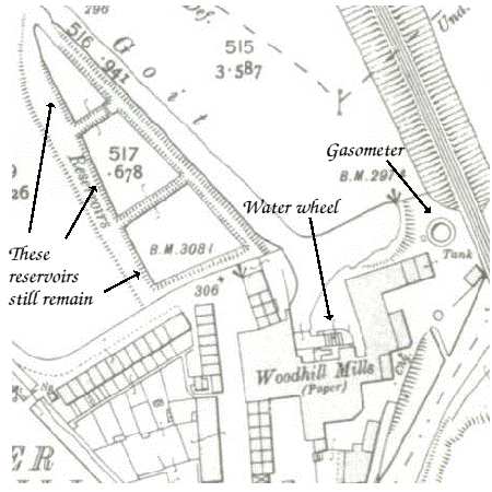
This extract from a 1908 map shows the outline of Higher Woodhill Mill. The row of terraced millworkers' houses just to the west of the mill are still occupied. |
|
|