Friday August 5, 2005
Hurricane Irene may be on the way. Depending on what develops this should be the next name. Harvey is to the north of us and is only affecting Bermuda.
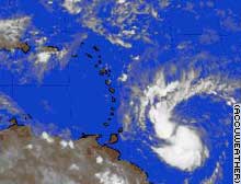
Emily became the second major hurricane of the 2005 Atlantic season, reaching Category 4 status early Friday after its maximum sustained winds reached 131 mph. A Category 4 hurricane is capable of causing extensive structural damage and inundating coastal areas with up to 18 feet of storm surge.
The storm's current location is away from land, but a hurricane watch has been issued for Jamaica and the Cayman Islands, meaning hurricane conditions, including winds of more than 73 mph, are expected within 36 hours.
At 2 a.m. ET, the storm's center was about 350 miles south-southeast of Santo Domingo in the Dominican Republic and about 635 miles east-southeast of Kingston, Jamaica. It was moving west-northwest at near 20 mph. Tropical storm warnings have been Thursday, July 14
Emily is officially upgraded to hurricane. The good news is that she heads west and is moving toward the Yucatan. Looks like she will bypass the DR and Jamaica.
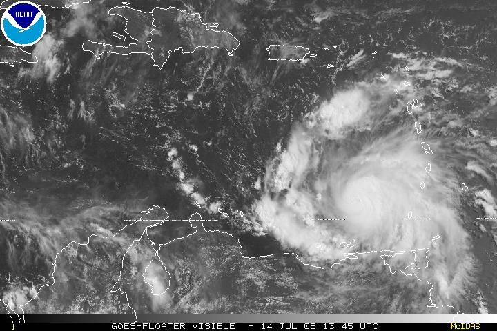
5 PM AST THU JUL 14 2005
...EMILY BECOMES A DANGEROUS CATEGORY THREE HURRICANE...
AT 5 PM AST...2100Z...THE GOVERNMENT OF JAMAICA HAS ISSUED A HURRICANE WATCH FOR JAMAICA. A HURRICANE WATCH MEANS THAT HURRICANE CONDITIONS ARE POSSIBLE WITHIN THE WATCH AREA...GENERALLY WITHIN 36 HOURS.
AT 5 PM AST...THE GOVERNMENT OF THE DOMINICAN REPUBLIC HAS ISSUED A TROPICAL STORM WARNING FROM PUNTA SALINAS WESTWARD TO THE DOMINICAN REPUBLIC/HAITI BORDER. THE GOVERNMENT OF HAITI HAS ISSUED A TROPICAL STORM WARNING FROM THE DOMINICAN REPUBLIC/HAITI BORDER TO PORT-AU-PRINCE.
Wednesday, July 13
With Tropical Storm Emily picking up steam in the Atlantic, hurricane warnings were issued across the Windward Islands, with forecasters saying the storm could rake the islands late Wednesday and enter the Caribbean.
The latest projection of Emily's path from the National Hurricane Center puts the storm on a trajectory that has it heading toward Mexico's Yucatan peninsula by the end of the weekend. However, such long-range forecasts often change because of the unpredictable nature of hurricane movement.
With maximum sustained winds near 60 mph, Emily was getting better organized and has the potential to become a hurricane before it reaches the islands, according to the National Hurricane Center. To reach hurricane status, maximum sustained winds would have to reach 74 mph.
At 11 p.m. EDT, the storm was located about 370 miles east-southeast of Barbados, moving west at about 20 mph.
Hurricane warnings have been issued for Barbados, Grenada, St. Vincent and the Grenadines, St. Lucia and Tobago, which means hurricane conditions are expected within 24 hours. A tropical storm warning and hurricane watch were issued for Trinidad and a tropical storm watch for Martinique.
The Windward Islands are a string of small islands arrayed in a north-south line marking the eastern edge of the Caribbean.
Once Emily passes over the islands, the hurricane center's five-day forecast track shows the storm moving on a path similar, though further to the south, of the one taken last week by Hurricane Dennis -- northwest across the Caribbean, where it could affect Hispanola, Jamaica and Cuba. On that trajectory, the storm would approach the Yucatan late Sunday, with entry into the Gulf of Mexico still a possibility.
Release of New Book: Gratefulness
Scheduled for August release, Dale has written a book about the lives of several women who exhibit lives of gratitude. These people have been important influences on both local and international levels.
Release the Hero Within is averaging about 11 books a day at www.lulu.com/barhanna Books Relating to the Language of Jesus
Mailing Address: Snail Mail
Mailing address
(via the kindness of our friend):
Dale and Marta Johnson%
Leticia Minaya
Roman de Pina pob 35
Mao, Velverde, Republica Dominicana

August5
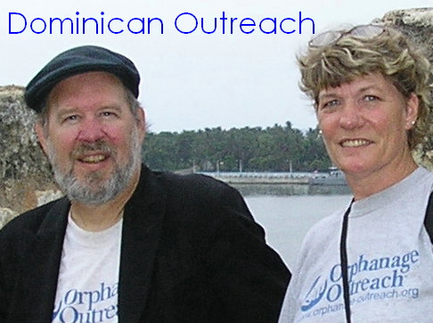
Field report from Good Samaritan Orphanage, Dominican Republic
Hurricane Bog begins Again>
Hurricane Franklin missed us and Harvey too. Gert was way to the West. Hurricane Dennis dumped a lot of rain on us last week. Now Emily is on her way. We will watch her closely for the next couple of days and report every 12 hours until she approaches closer. Like last year we reported every hour during hurricane Jeanne.
Hall of Heroes
Click the photo button at the bottom to see all the orphans we presently serve at El Buen Samaritano. Each child is identified by name with a short note about his special talent or circumstance.
Dale and Marta Johnson,
Send contributions to Orphanage Outreach,
atten. Dale and Marta
6111 Robert E. Lee Street,
Glendale, AZ 85308 or pay by major credit card through Pay Pal. Click below