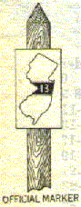
Let's Take the tour of NJ Route
8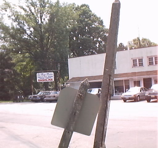
What it looks like today
Stage One begins as we turn right onto "Pompton Ave", and this is
the beginning of State Highway Route 8, now the beginning of State Highway
23 (North) in Cedar Grove. This
section will take us through Little Falls (the Singac Section) and ends
just after the Bridge over the Passaic River into Wayne.
Stage
Two finds us in Wayne merging onto US Highway 46 (East). This, the famed
"Spaghetti Bowl" is now the merge of NJ 23, US 46 and I-80. Although we
follow the signs for "Route 23 North", we can see the name for this
interchange. We find ourselves back on Route 23 North, but to stay
accurate, we need to exit at the "Service Road" that will take us onto
Holy Cross way which becomes "Mountain View Boulevard" and our next
stage.
Stage Three takes us
through the village of Mountain View. There is the Church of the Holy
Cross (built 1925?), then, off to the right is Parish Drive with a bridge over the
"Totowa Spur", what was once the Delaware, Lackawanna and Western Railroad.
A station used to sit along this line. Now it used sporadically by the
remnants of Conrail. Here is a bridge on this road over the tracks. Also,
the Morris Canal crossed near this spot. Back on the Boulevard, we
can't legally take the true path as this stretch has been closed only to
emergency traffic. Here is a good artist
rendition of this area. This takes us through Wayne and onto the
Bridge over the Pompton River, into Pequannock.
Stage Four
find us in Pequannock. This is the main street through town. Here we will
pass over the Erie RR (Greenwood Lake Division), next to the non-existant Pequannock
station, and just off the road is the Pequannock School, built in 1923.
Continuing on, we pass Jacksonville Road, which will take the traveler to the
hills and into Jacksonville (now parts of Kinnelon and Lincoln Park) and
into the Towaco section of Montville. Moving along, we pass through the
village of Pompton Plains, with numerous landmarks. One of them is the
First Reformed Church of Pompton Plains, built in 1736, rebuilt after a
fire around 1937. Across the Street is a plaque, designating the
site of the First and second "Pompton Plains School" buildings.
Both are no longer there. The Post office occupies that location. Passing that, we pass by Jackson Ave on our right,
This corner, once known as "Gilland's Corner" for the building
owned by that family, housed an old building that was many things. Among
them a post
office, a general store, even a gas station back in the 1920's, bought by the Jones Family in the
1927s and is
still owned by them today as a hardware store. Down this street is the
Pompton Plains Railroad Station (Erie Railroad), and this road continues
over the Pompton River, into Wayne, leading the traveler to the Paterson
Hamburg Turnpike. Continuing on our journey, we travel to Pompton
(Riverdale), the Riverdale school not built until after 1925 after the
borough seceded from Pequannock Township, an historical sign explaining the
Pompton Mutiny and this stage ends at Paterson
Hamburg Turnpike, across from Slater's Mill, circa 1770's.
Stage
Five starts at the intersection of Paterson Hamburg Turnpike in
the Village of Pompton (now Riverdale). This stage will take us through
three towns. We head west, crossing the New York, Susquehanna &
Western Railroad tracks, sitting aside the Pequannock River. We then cross
this river into Bloomingdale, home of the Bloomingdale
Cornet Band, which was founded in 1884 and still in existence. We pass
the site of one of the first Iron Forges in the area, although nothing
marks it's existence now except a small sign. The road continues, connecting with Main Street,
Butler (by crossing the Pequannock River, again) which formed it's own
borough as of 1901, with a station on the NYS&W railroad line and with it's
dominating structure being the Rubber Mill. Hamburg Turnpike continues,
again passing the other end of Main Street (Butler) again by crossing the
Pequannock River. Our road continues north now, into the rural areas. We
will pass over the NYS&W tracks and the Pequannock River (twice) into
Butler and back to Bloomingdale, one time cross one of three remaining
bridges from the 1924/1925 era. At it's modern endpoint, we have entered
West Milford, returning to modern state Highway 23, into the next stage.
Stage
Six will take us through West Milford, Jefferson, and ending just after we cross over the Sussex County line in
Hardyston. This section of Road was modified in the early 1930's so
finding the original route is tricky. One problem we face is that the
southbound lanes (we are on a divided highway) did not exist in the 1920's
so only traversing northbound in this stage can we be sure we are on the
original 1920's era road. In any event, we pass by sections labeled
"Old Route 23" and take them through the country road like
atmosphere of West Milford, crossing streams and the NYS&W tracks,
paralleling the Pequannock River to where it has been damned by the City
of Newark for water Supply (in between the highway) and also the
Charlottesburg Reservoir (Also used by the City of Newark). This stage ends as the highway no longer divides, at the
termination of County Route 515 in Hardyston.
Stage Seven has
us on a roadway single lane in each direction. We will pass through the
village of Stockholm and into the town of Franklin, home of the Franklin
Town Band, started in 1881, not existing continuously, but,
none-the-less, still active today. Continuing, we pass into the Borough of
Hamburg. incorporated in 1920, crossing an abandoned Railroad line and then
crossing with today's Route 94, ending this stage, also the historical end
of the Paterson Hamburg Turnpike.
Stage Eight takes us out
of Hamburg, back into Hardyston, then quickly into Wantage Township.
Through this section we pass over streams and past the old Wantage Church
(built 1780's?) and the cemetery across the street. We continue on, with
our stage ending in the borough of Sussex, meeting up with Unionville
Road.
Stage Nine is our final stage. Now called NJ
Route 284, this road was also called State 84 before Interstate 84 was built
nearby across lower New York state. I have never been on this road myself,
so when I do, I can complete this part of the tour.
Let's Take The Tour
SECTION I
Verona
Cedar
Grove
Little
Falls
Wayne
Pequannock
Riverdale
SECTION II
Bloomingdale
Butler
West
Milford
Kinnelon
(future)
Rockaway
(future)
Jefferson
(future)
Hardyston
(future)
Franklin
(future)
Hamburg
(future)
Wantage
(future)
Sussex
Information on this page came from various sources including various history books and other road sites
I hope you learn something about State Route 8 history, Please email me if you have some historical information about old New Jersey State Route 8.
