 Contents Casio Digital Diaries Capt. James Cook Henderson Island Information about Denmark Life on Mars? Lockheed P-38
Contents Casio Digital Diaries Capt. James Cook Henderson Island Information about Denmark Life on Mars? Lockheed P-38


 Recent archaeological research has proven that Henderson had been colonised by Polynesians, however when it was discovered by Pedro Fernandez de Quiros in 1606 he states that the island is uninhabited. Had Polynesians been living on Henderson in 1606, they most certainly would have made themselves known to Quiros. Three crew members landed on Henderson with a small boat and came back with an unripe pine fruit (probably a fruit of Pandanus tectonius, screw pine, which grows on the island). Quiros wrote: it is only inhabited by birds; it was named San Juan Bautista; and not having a harbour to look for water and wood, we continued our travels towards WNW.
Mangareva, Pitcairn, and Henderson Islands are remote from other Polynesian areas. By the time Polynesian settlers reached this southeastern outpost, sometime between A.D. 800 and 1000, most of the rest of Polynesia, except perhaps New Zealand, had already been discovered and settled.
Of those three habitable islands, the one most abundantly endowed with natural resources important to humans, and capable of supporting the largest human population, was Mangareva, although it's most significant drawback was its lack of high-quality stone for making adzes and other tools. Fortunately, that deficiency could be remedied on Pitcairn Island. Pitcairn's Down Rope Quarry, is southeast Polynesia's sole usable lode of volcanic glass, whose flakes are used as sharp tools for fine cutting tasks, while Pitcairn's Tautama lode of fine-grained basalt is southeast Polynesia's biggest quarry for making adzes.
Pitcairn is too small and steep to afford much land suitable for agriculture. Pitcairn's coastline also lacks a reef, and the surrounding sea bottom falls off steeply making fishing and searching for shellfish difficult These factors indicate that the total population of Pitcairn in Polynesian times could not have been much greater than a hundred people.
The remaining habitable island of southeast Polynesia, Henderson, is the largest. Unlike Mangareva or Pitcairn, Henderson is not volcanic--it's a coral reef that geologic processes thrust up 100 feet above sea level and is therefore devoid of basalt or other volcanic rocks suitable for toolmaking. That's an awful limitation for a society of makers of stone tools. To make matters worse, because the island consists of porous limestone, Henderson has no streams or reliable freshwater. Henderson's tallest trees are only about 40 feet high, not big enough to fashion into canoe hulls.
Offsetting these fearsome disadvantages, Henderson does have attractions. In the reef and shallow waters nearby live lobsters, crabs, octopuses, and a limited variety of fish and shellfish, unfortunately not including the black-lipped pearl oyster. Each year, green turtles come ashore to lay eggs on the beaches. Henderson used to support at least 17 species of breeding seabirds, including petrel colonies possibly as large as millions of birds, whose adults and chicks would have been easy to catch on the nest. There were enough birds for a hundred people to eat one apiece, every day of the year, without endangering the colonies' survival. The island was also home to nine species of resident land birds, several of them flightless or weak fliers, including three species of pigeons that must have been especially delectable.
Henderson, did support a permanent tiny population of perhaps a few dozen people. A huge buried kitchen-midden--an accumulation of shells and of bird and fish bones and other garbage left behind from generations of people feasting--runs 300 yards along the beach. Every cave and rock shelter near the coast with a flat floor and accessible opening--even small recesses only two by three yards wide, barely large enough for two people to sit there protected from the sun--contained human debris testifying to former habitation. Charcoal, piles of stones, and relict stands of crop plants showed that the northeast part of the island had been burned and laboriously converted to garden patches where crops could be planted in pockets of soil. Among the crops and useful plants that the settlers must have introduced intentionally were coconuts and bananas, several species of timber trees, candlenut trees whose nut husks are burned for illumination, hibiscus trees yielding fiber for making rope, and the ti shrub. The latter's sugary roots serve only as an emergency food supply elsewhere in Polynesia but were evidently a staple vegetable food on Henderson. Ti leaves could be used to make clothing, house thatching, and food wrappings.
Thus, southeast Polynesia presented colonists with only a few potentially habitable islands, each with more or less serious drawbacks. There is extensive evidence that trade among all three islands that utilized each island's surpluses to fill the other islands' deficiencies. Trade began by A.D. 1000, probably simultaneously with the first settlement by humans, and continued for many centuries.
All analyzed pieces of volcanic glass found on Henderson originated at the Down Rope quarry on Pitcairn. Most of Henderson's basalt adzes also originated on Pitcairn, but some came from Mangareva. On Mangareva itself, although far fewer searches have been made for stone artifacts there than on Henderson, some adzes were also evidently made from Pitcairn's high-quality basalt. Conversely, of the vesicular basalt stones excavated on Henderson, most came from Mangareva, but a minority were from Pitcairn.
As for what products Henderson exported to Pitcairn and Mangareva in return, we can only guess. They must have been perishable items unlikely to survive in Pitcairn and Mangareva archeological sites, since Henderson lacks stones or shells worth exporting. One plausible candidate is live sea turtles, which today breed in southeast Polynesia only on Henderson, and which throughout Polynesia were prized as a prestigious luxury food consumed mainly by chiefs. A second candidate is red feathers from Henderson's parrot, fruit dove, and red- tailed tropic bird, red feathers being another luxury item used for ornaments and feather cloaks in Polynesia.
Trade within southeast Polynesia continued from about A.D. 1000 to 1450, as gauged by dates assigned to artifacts on Henderson. But by A.D. 1500 the trade had stopped. Later archeological layers on Henderson contain no more imported pearl shell, volcanic glass, fine-grained basalt for cutting tools, or basalt oven stones. Apparently the canoes were no longer arriving from either Mangareva or Pitcairn. Because trees on Henderson itself are too small to make canoes, Henderson's tiny population was now trapped on one of the most remote, most daunting islands in the world. Henderson Islanders confronted a problem that seems to us insoluble: how to survive on a raised limestone reef without any metal, without stones other than limestone, and without imports of any type.
They survived in ways that are ingenious, desperate, and pathetic. For the raw material of adzes, in place of stone, they turned to shells of giant clams. For awls, they fell back on bird bones. For oven stones, they turned to limestone or coral or giant clamshell, all of which are far inferior to basalt because they retain heat for less time, tend to crack after heating, and cannot be reused as often. They now made their fishhooks out of purse shells, which are much smaller than black-lipped pearl shells, yielding only one hook per shell and restricting the types of hooks that can be fashioned.
Radiocarbon dates suggest that, struggling on in this way, Henderson's population of originally a few dozen people survived for several generations, possibly a century or more, after all contact with Mangareva and Pitcairn was cut.
Why did Henderson's contact with the outside world come to a halt? Because of environmental changes on Mangareva and Pitcairn. All over Polynesia, when people settled on islands that had developed for millions of years in the absence of humans, habitat damage and mass extinctions of plants and animals inevitably followed. Mangareva was no exception. With too many people and too little food, hunger on Mangareva became chronic.
Henderson itself also suffered environmental damage that reduced its human carrying capacity. Half its species of land birds, and colonies of four of its species of breeding seabirds, were exterminated. Those extinctions probably resulted from a combination of hunting for food, habitat destruction for gardens, and depredations of rats that arrived as stowaways in Polynesian canoes. Today those rats continue to prey on the remaining seabirds, which evolved in the absence of rats and so are unable to defend themselves.
Thus, environmental damage, leading to social and political chaos and to loss of timber for canoes, ended southeast Polynesia's interisland trade, cutting Mangarevans off from Pitcairn's sources of high-quality stone for making tools. For the inhabitants of Pitcairn and Henderson, the results were even worse: eventually no one was left alive on those islands.
Henderson Island was sighted by Pedro Fernandez de Quiros, a Portuguese navigator sailing for the Spanish King, on January 29, 1606. He named it "San Juan Bautista".
Some scholars once thought that Henderson Island was first re-discovered in 1791 by Captain Edwards of the Pandora (searching for the Bounty mutineers), who named it Lord Hood's Island. This claim can be easily disproved, for Captain Edwards described his discovery as lying in latitude 21 deg. 31 seconds S. and longitude 135 deg. 30 seconds W. and being a low lagoon island covered with wood; it was almost certainly one of the Tuamotu Islands.
January 17, 1819 Henderson Island was re-discovered by Captain James Henderson of the British East India merchant ship Hercules. The Herculescalled at Pitcairn on January 18, 1819, and had sighted Henderson the previous day.The Hercules was engaged on trading voyages between India and South America and was instrumental in commencing the long association of the Society for Promoting Christian Knowledge (at first through their Calcutta committee) and the Pitcairn Islanders.
March 2, 1819 Henderson Island is sighted by Captain Henry King of the ship "Elizabeth." He is unaware of Capt. Henderson's discovery in January. He lands on the island: " The British colours were displayed on the island and greeted with three cheers, and a bumper of grog was drunk to the health of His Majesty. The ship returned the compliment, by hoisting her colours and performing the same ceremony. While these ceremonies were performing, a proper person was employed in carving the ship's name and other particulars upon a tree, near the spot where we landed." For some years both the names "Elizabeth" and "Henderson" are applied to the island.
Aaron Mitchel and Company's whale ship Oeno of Nantucket, 328 tons, Captain George B. Worth in command discovers Oeno Island on Jan 26th 1824. Oeno is a low atoll which is 3.5 km in diameter and 120 km NW of Pitcairn The remaining uninhabited island in the Pitcairn group is Ducie Island which was discovered by Quiros in 1606 and named "Encarcnacion", (another source says he named it "Luna puesta") and rediscoverd by the infamous Captain Edwards of the HMS Pandora in 1791. Ducie is a low islet 300 east of Henderson Island. Captain Edwards and his ship the Pandora were sent to capture the Bounty mutineers - they were on Pitcairn, which he couldn't find. Many shipwrecks have occurred on Oeno and Ducie Islands.
In 1825 H.M. Sloop Blossom is sent to determine whether Ducie and Elizabeth (Henderson) Islands are the same island. H.M. Sloop Blossom visits Pitcairn and both islands, and also Oeno, where a sailor is drowned when a boat is smashed on the reef.
H. E. Maude writes that the true story of the ill-fated American whaling ship Essex of Nantucket, sunk by a 40- foot sperm whale in the vicinity of the Marquesas in 1819, provid(ed) material for Herman Melville's immortal story, Moby Dick. The survivors landed on Henderson, after sailing in an open boat from the distant site of their shipwreck. Most of the party departed on December 20 1820. Two of the boats sail 4.300 miles towards South America before being rescued. The third boat becomes separated from the others and is found by a passing ship earlier. The three crew members that remained on Henderson Island were picked up by the English ship Surrey, dispatched from Valpariso, on April 18 1821 after spending 107 days on the island.
Owen Chase, one of the survivors of the Essex boat crew voyage to South America states that while on Henderson we had observed the name of a ship, 'the Elizabeth,' cut out in the bark of a tree, which rendered it indubitable that one of that name had once touched here. There was, however, no date to it, or anything else, by which any further particulars could be made out.
Six human skeletons were discovered in a cave by the Essex crew. There is, however, another report, written by Thomas Chapple, one of the Essex survivors, from the Religious Tract Society in 1830, that eight skeletons (as versus six) were found by the Essex crew. There is also believed to be a report of a finding of skeletons even before the Essex survivors arrived at Henderson.
A total of six skeletons were again found on Henderson Island on Saturday, March 29, 1958 in a cave on the northeastern coast.
Were these the same skeletons found by the Essex crew in 1820-21?
Were they Polynesians or shipwrecked Europeans?
 More information about the skeletons found on Henderson Island!
A ship named the Allen Gowie was wrecked on Henderson in 1877 --the survivors were picked up by a passing vessel while trying to reach Pitcairn.
The three-masted iron screw schooner Acadia was shipwrecked on Ducie on June 13, 1881. The crew made sail for Pitcairn Island, stopping for a day at Henderson Island. Acadia crewman Phillip Coffin, a sail maker from Nantucket, Massachusetts USA, found a bride and settled down on Pitcairn.
Lincoln Clark, another Acadia crewman, settled on Pitcairn many years later. His son, Roy Clark, married Philip Coffin's daughter.
As one would expect from its suggestive formation, guano-phosphate has loomed large in Henderson' brief and uneventful his- tory. The island was first prospected in 1881 by the Melbourne firm of Grice, Summer & Co., then lessees of Malden. They were able to discover only about 200 tons of guano, however, and abandoned their application for a license.
In 1903, Captain J. Rasmussen applied to the British Consul in Tahiti for a permit to explore Henderson for guano in behalf of Grice, Summer & Co., but he was, in fact, acting on his own initiative and evidently in ignorance that the firm had already completed a survey. Permission was granted, but Rasmussen never went to Henderson and in 1907 his permit was considered to have lapsed.
The Pacific Phosphate Co. next came on the scene and in 1907 Messrs. George C. Ellis and J. D. Arundel, two directors of the firm, visited Henderson on the Tryian; again without knowledge of the work done by their business rivals. Little trace of phosphate was found but their stay ashore--only a few hours--was really insufficient to constitute a serious survey. Arundel's initials can be seen carved on a tree to this day.
Interest in Henderson's phosphate possibilities was again raised by the discovery of high-grade deposits on Makatea, another island of similar type, and a concession was granted in 1908 to Messrs. Banks and James Watt. As far as is known, however, they never visited the island, though it is believed that they were instrumental in forming a company, known as Henderson Island Ltd., to exploit its resources. A license was granted to the company in 1912 and lapsed in 1915.
Henderson Island, Oeno Island and Ducie Island were annexed to the British Crown in 1902, when Mr. R. T. Simons,the British consul in Tahiti, sent the Seventh-day Adventist mission cutter Pitcairn, in charge of Captain G. F. Jones, to visit them. Consul Simons, in all probability, was unaware that this had already been done by Captain King of the Elizabeth. Among Pitcairn Islanders present may be mentioned Fred Christian, a Chief Magistrate and a noted church leader.
Captain Jones placed a board on each island inscribed with the words: This island is a dependency of Pitcairn and is the property of the British Government.
In 1937 the three islands were visited by the cruiser H.M.S. Leander, and new signboards were erected to reaffirm British sovereignty The Henderson signboard read: This island belongs to H.B.M. King George VI. It was visited by H.M.S. Leander on 6th of August 1937. Signed J.W. Rivers-Carnac, Capt. R.N. In connection with the Leander's visits, Flight Lieutenant R.A.R. Rae from a Walrus aircraft took aerial photographs of each island. Flagpoles, with the Union Jack flying, were also erected and charted on each island. In December of 1940 the Royal Navy discovered that the Union Jack had been replaced by a Nazi Swastika. The landing part sent ashore also discovered this notice: With apologies to King George VI, this island is now the property of the Greater German Reich.
H. E. Maude searched between 1941-45 for uninhabited islands suitable for colonization by the Gilbert Islanders, due to the poor subsistence possibilities on their own islands. Henderson was examined for its settlement possibilities and he considered that, despite its barrenness, it could maintain a permanent population of from 200-200 natives. After spending a winter on Pitcairn himself, however, he realised that the climatic conditions on Henderson, only 100 miles away, would be severe for equatorial islanders and nothing further was done to colonise it.
Since a post office was opened on Pitcairn in 1940, the island's stamps (it's main source of income) have borne the words 'Pitcairn Islands' to cover it's three dependencies. In October 1947, the Western Pacific High Commission ship Awahou made a special trip from Suva for the Fiji Government to install a lighthouse (beacon) on Henderson Island, at that time the flagpole erected by H.M.S. Leander was still in place.
In the early 1980's, the American millionaire Arthur M. "Smiley" Ratliff attempted to first buy and then to lease Henderson Island. Ratliff proposed to bulldoze the vegetation to make a cattle ranch, build a mansion and a small settlement, and build an airstrip. Ratliff visited Pitcairn April 1981, and the Pitcairn Island Council approved of his plans. Through the lobbying efforts of the Royal Society of England and the American Smithsonian Institution, his request was turned down by the British Foreign and Commonwealth Office.This decision to protect the natural environment of the island was later strengthened by the signing, by these authorities, of the Convention for the Protection of the Natural Resources and Environment of the South Pacific Region on 16 June 1988. This was an important decision, insuring the preservation of the island in it's natural state. It would have been a complete disaster for the island's ecology if Ratliff, or anyone else, had been allowed to settle on the island.
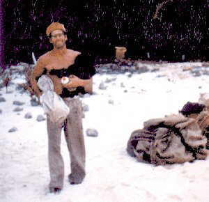
Read the true story of Robert Tomarchin and his chimpanzee left on Henderson Island by a Canadian yacht in 1957!

The two most important early expeditions to Henderson Island were the Whitney South Sea Expedition in 1922 and the Mangarevan Expedition of 1934. The island was visited by Operation Raleigh in spring 1987 and by an expedition from the Smithsonian Institution in the same year, and by the Sir Peter Scott Commemorative Expedition in 1991-1992.
The successful 1987 Smithsonian and 1991-1992 Sir Peter Scott Commemorative Expeditions produced a wealth of information on all aspects on Henderson, from marine life to archaeology. The information accumulated on Henderson Island is copious for an island of it's size.
Note: much of the material on this page concerning Henderson Island's pre-history is adapted from the article Paradises Lost by Jared Diamond. This article is based upon archaeological research done on Henderson Island by Dr Marshall Weisler.

Pitcairn Island's flag is a Blue Ensign with the island's Coat of Arms in the centre. The design was suggested by the Pitcairn Island Council in December 1980 and approved by HM The Queen in April 1984. The flag was flown on Pitcairn for the first time in May 1984, during a visit by the Governor the late Sir Richard Stratton. The flag measures 6' x 3'.
The description of Pitcairn's Coat of Arms, which was granted by Royal Warrant dated 4th November 1969: Azure on a Pile in base Vert fimbriated Or a representation of the Bounty Bible proper and in base of the Anchor of H.M.S. Bounty Or. And for the Crest on a Wreath Or and Vert on a Mount Vert a representation of the Pitcairn Island Wheelbarrow in front of a Slip of Miro leaved and fructed proper.

 Henderson's History Henderson's History
| Henderson's Geography
| Henderson's Flora and Fauna
|
| Why am I interested?
| First hand accounts.
| Links and Books.
|
| Map of the Island.
| Pictures of the Island.
| The Monkey Story
|

New information about the skeletons found on Henderson Island in 1958!

The Monkey Story: Read the true story of Robert Tomarchin and his chimpanzee left on Henderson Island by a Canadian yacht in 1957! New information has also come to light and is now presented here.

