|
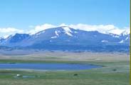
About 85 percent of the land is lifted more than 1000 (3280 ft) meters above sea level. The average altitude of the country is about 1600 (5250 ft) meters, making it one of the highest countries in the world.
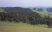
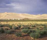
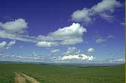
Based on its distribution of annual precipitation and landscape type, distribution of soil type, and floral and faunal characteristics, Mongolia is divided into six main ecological regions: the high mountain, the taiga, the mountain forest, the steppe, the desert steppe or semi-desert, and the Gobi-desert.
Vegetation is relatively abundant in grassland steppe and mountainous areas, but less in arid semi-desert and desert areas. Forest resources of Mongolia are relatively limited. It is extended about 11 percentage of the total area of the country. Some Saxsaul Haloxylon ammodendron forests occur in the semi-desert and desert areas.
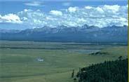
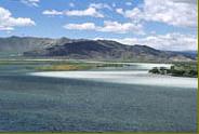
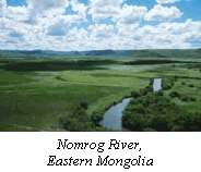
The river system is extensive in the northern and less in the southern part of the country. Several major rivers of Asia have their origin in Mongolia; however, there is no river directly drainage to the ocean. The major rivers are the Kherlen, the Selenge, the Orkhon, the Khovd, the Tuul, the Zavkhan, and the Tamir. The major lakes are the Khuvsgul, the Uvs, the Khar Us, the Khar, the Dorgon, the Khyargas, the Buir, and the Terkhin-Tsagaan lakes.
The geographical position that is located far from seas or oceans and the main mountains' locations cause the extreme continental climate in this country, with long dry cold winters, relatively short summers, and relatively low precipitation. The average temperatures in winter vary from -20oC to -35 oC (-4 to -31F). In contrast, in summer temperatures in the Gobi desert sometimes rise up to +40oC (104F). Average amount of rainfall varies in different regions, from 600 mm in the mountainous areas to less than 100 mm in the desert regions. In some parts of the desert region, no precipitation may fall in subsequent years.
|
|