Go Back to
Last TOUR Site
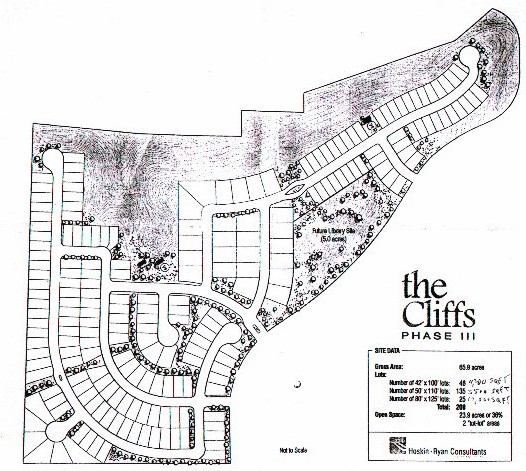
Commission approached Mr. Simonton, developer as to
the availability of a donation of land for the library. He
offered to donate a parcel to the Library if the Town
were to approve some alterations to his project plot
plan. The alterations were approved by Town Council
and the property was deeded to the Town.
Shortly thereafter the Library Commission was
approached by the Town Manager and the Mayor as to
their interests in placing the Library in the Downtown
City Hall Campus as it would be a magnet for tourists and would help drive the economic engine of downtown Camp Verde. The Commission weighed the various aspects using a set of criteria from a library consultant and concluded that Downtown was a better location for the library and chose not to put the Library at The Cliff's site.
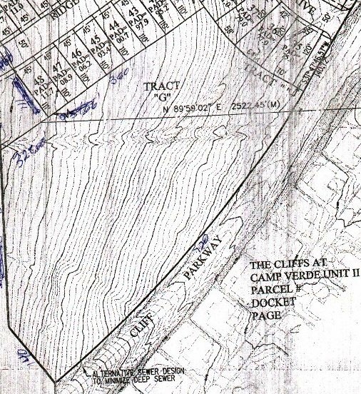
There are roughly 5 acres of land at The Cliff's with
an average slope of 1:4, 15% grade, meaning one foot up in elevation for every four feet forward when walking uphill.
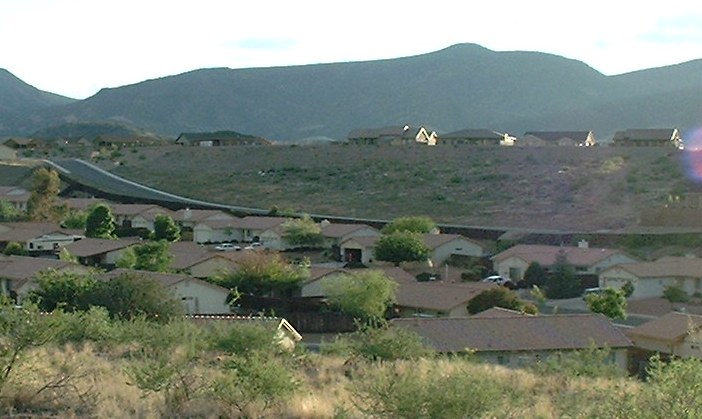
The property is bordered by back fences of the
various lots of the Cliff's and along Cliff's Parkway at
the lower elevation. The Cliff's Parkway has a slope to it increasing stopping distance for vehicles traveling downhill and it has a curve with some areas of limited visibility making for some safety concerns for traffic entering and exiting the site.
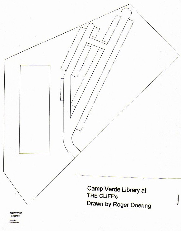
There are some places on the lot where one can get a
partial view of the redrocks of Sedona. The layout which I drew of the site was drawn for the best view from the site and also to reduce cost of grading the land by using a rectangular building of 100 x 300 feet than a square shape to achieve a 30,000 square foot pad. Using this plan requires roughly 20,000 cubic yards of earth to be relocated on the site. If one were to use a square shaped building 30,000 cubic yards of earth would need to be moved. The design calls for an equal amount of cut and as fill dirt to not have to move any dirt to or from the site. (Dirt at the upper half of each pad would be dug out and placed along the lower elevations of each pad for the building, parking, and a driveway in such a way that no dirt is needed to be brought in or carried away.)
Even with this frugal design, it will be some expense
to grade the site and to design and build a sure footed foundation that would resist sliding down the hill in wet weather compared to building on a level lot.
The property was to be sold and proceeds to go
toward the Library. Using the site for the library will
remove the income from its sale and the Library will
incur the construction costs at the site. There is sewer
and water within tapping distance of the site.
Look at all the sites. Which site(s) do you think provide the best accessability for the library?
Scroll Down.