The proposed Leading Creek Water Trail was the subject of a recent story in The Daily Sentinel.
Click here to view the story.
c/o Meigs Soil and Water Conservation District
33101 Hiland Road
Pomeroy OH 45769
Phone: 740.992.4282
Fax: 740.992.4248
E-mail: [email protected]
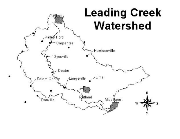
The Leading Creek Watershed drains just over 150 square miles in the hills of southeastern Ohio. It lies mostly in Meigs County with portions in Athens and Gallia counties. Today the watershed is affected by three main causes of pollution: sedimentation, acid mine drainage, and nutrients/pathogens via runoff from household sewage treatment systems and agricultural operations. Unreclaimed areas of historical surface mining cause high rates of erosion and excessive sedimentation in many of the streams. Historical deep mines and surface mines also produce toxic acid mine drainage in many areas that turns water a characteristic orange color.
The Leading Creek Watershed Group (LCWG), the Meigs SWCD, the Leading Creek Improvement Committee, and many partners are working to restore the entire watershed to warm-water habitat. The LCWG is a partnership of residents, officials and agencies united by common interest in restoring the Leading Creek Watershed to add to the quality of life for the residents of the watershed and surrounding communities. Membership in the LCWG is free and open to anyone, although donations are always accepted and go directly toward watershed activities.
We've been thrilled to see so many watershed residents show stewardship for the area and participate in our activities. One highlight of 2008 was the 8th Annual Leading Creek Stream Sweep. It was held on April 19th at Jim Vennari Park in Rutland, and this year's was arguably the largest ever in the history of the event. Over 100 volunteers showed up to clean up locations in Rutland and Salisbury townships and in the village of Middleport. Concerned individuals, students and youth groups included 4-H, Girl Scouts and Boy Scouts were among the participants.
New horizons continue to be explored in the Leading Creek Watershed. In addition to our ever-expanding outreach programs, we have continued to plan and monitor for reclamation projects and seek funding sources. Plans are being finalized to reclaim the number one site of acid mine drainage (AMD) in the Leading Ceek Watershed, the Unnamed Tributary of Thomas Fork (which is also shown in the photo gallery on this website). A feasibility study and preliminary design has been completed for the reclamation known as the Thomas Fork Doser Project. This project will be completed in partnership with ODNR-Division of Mineral Resource Management, U.S. Fish and Wildlife Service and the Leading Creek Improvement Committee. Contracts and funding agreements are now being drafted to begin construction at this site in 2009.
Contracts and funding agreements are now being drafted to complete reclamation at three other top AMD sites in the Leading Creek Watershed including Casto's Seep, Hysell Run and Bailey Run.
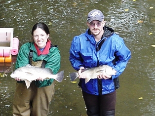
Proposals have been approved for funding by USFWS to reintroduce two animals into the Leading Creek Watershed. A partnership is being formed with the Columbus Zoo and Aquarium/Ohio State University to establish freshwater mussells and fish, including Brindled Madtoms, into Leading Creek. The goal is to augment these populations that were eradicated by devastating coal mine pumping in 1993.
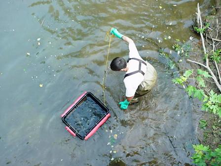
The Little Leading Creek Sediment Study being conducted by Ohio University is now in the final draft stages and is expected to be completed very soon.
We thank our many partner agencies that help to make these exciting things possible.
--- Raina Fulks, Leading Creek Watershed Coordinator
Meigs Soil and Water Conservation District
ODNR Division of Soil and Water Conservation
ODNR Division of Mineral Resource Management
Natural Resource Conservation Service - Ohio
U.S. Fish and Wildlife Service - Ohio Ecological Services
Ohio EPA Division of Surface Water
A Comprehensive Watershed Management Plan for the Leading Creek Watershed Management Plan - Jan. 2005
Ohio EPA Leading Creek Fact Sheet - Jan. 2008
Ohio EPA Fish & Macroinvertebrate Study of Leading Creek - Jan. 2005
Total Maximum Daily Load Report - Jan. 2008
Acid Mine Drainage Treatment and Abatement (AMDAT) Plan for the Leading Creek Watershed - May 2006
Sediment Study of Little Leading Creek (in progress)
US Fish and Wildlife Service Draft Natural Resource Restoration Plan & Environmental Assessment for Leading Creek Stream System - June 2006
Appendix A & Section 7
