[Company Logo Image] 

 sangermanpr.cjb.net


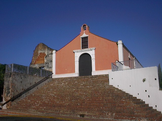
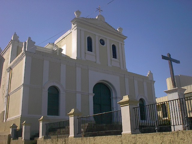
Welcome to San Germán, one of the oldest cities in the New World, and the second oldest city under the United States flag  (San Juan is the oldest).  

In this pages you will find facts about our city, old archive pictures as well as recent views of our "Ciudad Fundadora de Pueblos" (The City Founder of Towns).

Please feel free to browse through our history, culture, and traditions.  Make sure to visit this historic town within your lifetime!

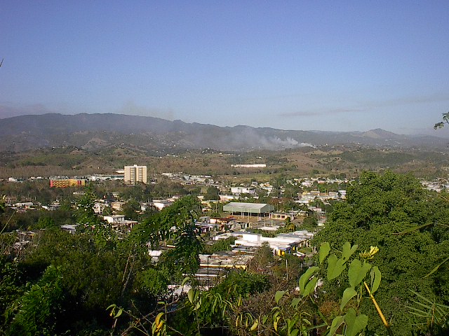
View of the San Germán Skyline, with the towering Central Range in the   background.

Fast Facts about San Germán:

We are called: Sangermeños  


The City is calledLa Ciudad de las Lomas
(City of the Hills), La Ciudad de las Golondrinas (City of the Swallow Bird), La Ciudad Fundadora de Pueblos (City Founder of Towns), la Ciudad Cuna del Baloncesto Puertorriqueño (Cradle of the Puerto Rican basketball) and La Ciudad Peregrina (The Pilgrim City)


Patron SaintSan Germán de Auxerre  (Saint Germain of Auxerre, origin of the city's name) 

Parrish: Parroquia San Germán de Auxerre

             Mons. Humberto López Bonilla, Parson

             P.O. Box 305 

             San Germán, P.R. 00683  

             Tel. (787) 892-1027 


Distinguished Sangermeños: Francisco Mariano Quiñones - Abolitionist leader, politician and writer; Samuel R. Quiñones - Participant in the Liberal Party and one of the founders of the Partido Popular (Popular Party); Lola Rodríguez de Tió - Poet and patriot, wrote the Liberation Anthem of Puerto Rico; Manuel F. Rossy - Lawyer, news writer, orator and leader of the statehood movement;  Aurelio Tió - Historian. 


Location: Southwest Puerto Rico, 2 hour drive from San Juan. Neighboring municipalities are Mayagüez and Maricao on the North; Lajas on South,  Hormigueros and Cabo Rojo on West, and Sabana Grande East. 


Surface: 140.4 km² / 54 sq. miles      Comparison: Walt Disney World Resort  is 45 sq. miles.

 
Elevation: Around 200 ft over sea level, Highest Peak "Las Tetas de Cerro Gordo" , 2,600 feet over Sea Level.


Topographic Description: Belongs to the Coastal Plains of the West del Oeste. On the Northeast is located the Central Range (Cordillera Central) where the municipalitie's highest peaks are located: Las Tetas de Cerro Gordo with 883 meters and  Alto del Descanso with 768 meters over sea level. (Both over 2,000 ft) 


Population: 38,988 souls (1990 Census)


Population Density: 268.5 people per km² / 698.2 people per miles² 

Topographic map of the Municipality of San Germán, with it's 18 boroughs (barrios):

Contact Information:

If you have any comments on this page, wish to contribute pictures of additional information, please contact me via e-mail.

Postal address
Bo. Duey Bajo Sec. Nazario
San German, PR 00683
Electronic mail
General Information: [email protected]
Webmaster: [email protected]
 

History ] Views of San German ] Our Mayors ] Website Map ]

Send mail to [email protected] with questions or comments about this web site.
Unless otherwise stated, information in this page comes from the Municipality of San Germán, Tourism Department; Owner's Interpretation;  Some information and photos property of the website "1898, La Villa de San Germán" and it's owners, from which I am eternally grateful for being my inspiration; Pictures of San Germán in this website, unless otherwise stated are property of Michael González.  The author of the pictures retains it's rights.  Pictures can be used without permission for educational purposes, or non-lucrative purposes only.  Please link the pictures to this website and give proper credit if using.  Pictures will NOT be used for lucrative purposes.

Copyright © 2003-2004 Michael González
Last modified: January 14, 2003
Hosted by www.Geocities.ws

1