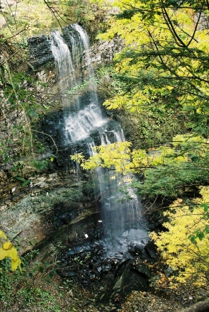
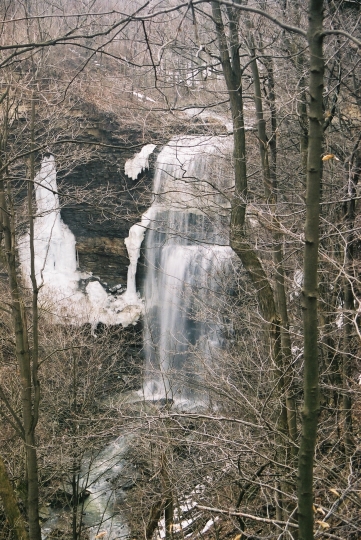
Direction Take the QEW to (Hwy 20) exit here, take highway 20 until you climb up the escarpment and come to Mud St turn right and drive on Mud St until you reach Paramount Dr turn right on Paramount drive. Drive on Paramount until your reach Ackland St turn right and Drive on Ackland until you come to Felker's falls conservation area you can follow the trail into the forest and see felker's falls on your right if you back track and follow the Bruce Trail along the side of the park it will cross a bridge and head north again which will take you to the east rim.
Public Transportation*.
Take any of the following routes.
22 Upper Ottawa
23 Upper Gage
24 Upper Sherman
25 Upper Wentworth
26 Upper Wellington
27 Upper James
Once on the bus take this to Stone Church Rd once to Stone Church get on the east Bound Stone church route 43 bus. Take this bus until your on Stoney Creek on Paramount Dr till you come to Ackland dr, get off here and walk to the park where Felker's Falls is located
*See Public Transportation Notes
Waterfall Index