0S
300E
Rudiakel
0S
240E
Month
Adir
Bora
Coan
Deti
Edal
Flo
Geor
Heliba
Idanon
Jowani
Kireal
Larno
Medior
Neturima
Ozulikan
Pasurabi
Rudiakel
Safundo
Tiunor
Ulasja
Vadeun
Wakumi
Xetual
Zungo


forest


0N
300E
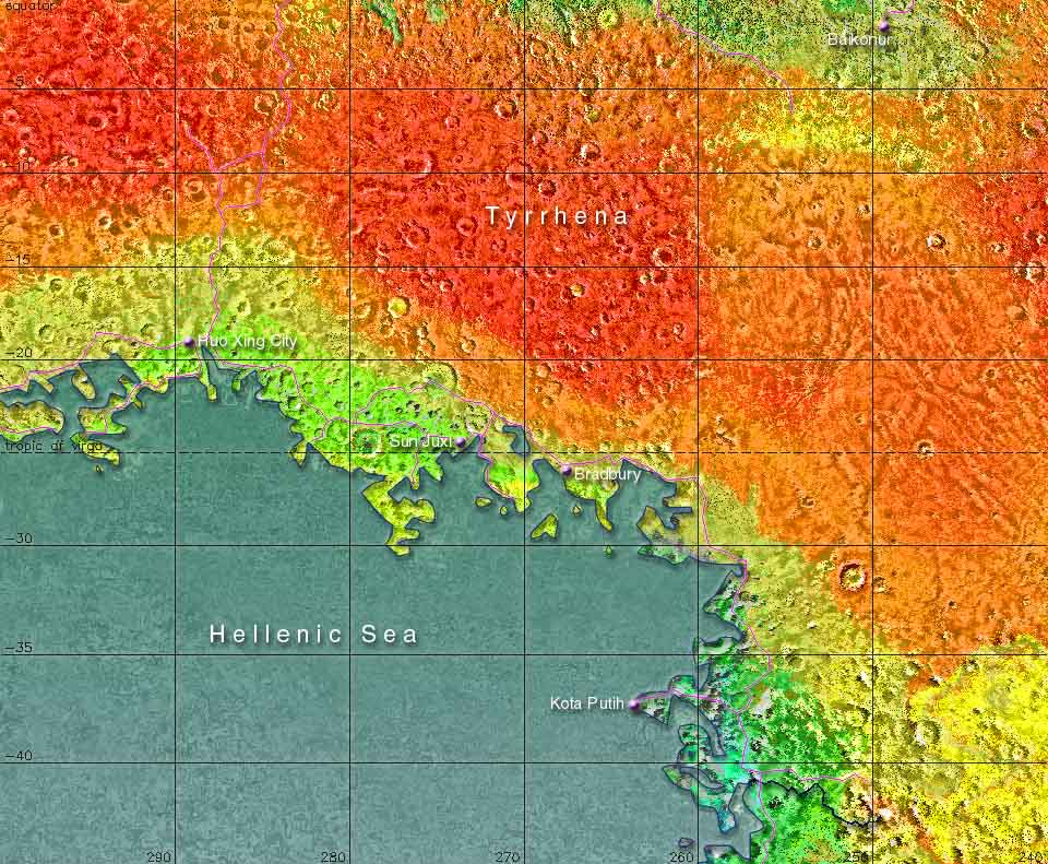
The area shown on this map is about 5.9 million square kilometers, which is roughly the same size as the USA minus Alaska or Europe without Russia
0N
240E
The
Martian Time Website
The Mars
Society
The Astrobiology
Web
The Terraforming Information
Pages
The Red, Green & Blue MarsSite
The Hellenic Sea, of which almost half is visible on this map, is bigger than any sea on earth; it has almost the size of Australia. All around the basin is a relatively small zone of mainly broadleaf and pine forests, with grass plains, mountains and deserts following at a short distance. The shores in this north eastern corner even have a slightly mediterranean touch about them, although like anywhere on the southern hemisphere winters can be cold. Kota Putih is one of the prettiest places of Mars; the city is completely white and is marvelously located on a mountain at the end of a peninsula.
The Darian Calendar created by Tom Gangale Month and weekday names, maps and page layout by Frans Blok