0S
180W
Medior
0S
120W
Month
Adir
Bora
Coan
Deti
Edal
Flo
Geor
Heliba
Idanon
Jowani
Kireal
Larno
Medior
Neturima
Ozulikan
Pasurabi
Rudiakel
Safundo
Tiunor
Ulasja
Vadeun
Wakumi
Xetual
Zungo


forest


-44S
180W
The area shown on this map is about 5.9 million square kilometers, which is roughly the same size as the USA minus Alaska or Europe without Russia
-44S
120W
The
Martian Time Website
The Mars
Society
The Astrobiology
Web
The Terraforming Information
Pages
The Red, Green & Blue MarsSite
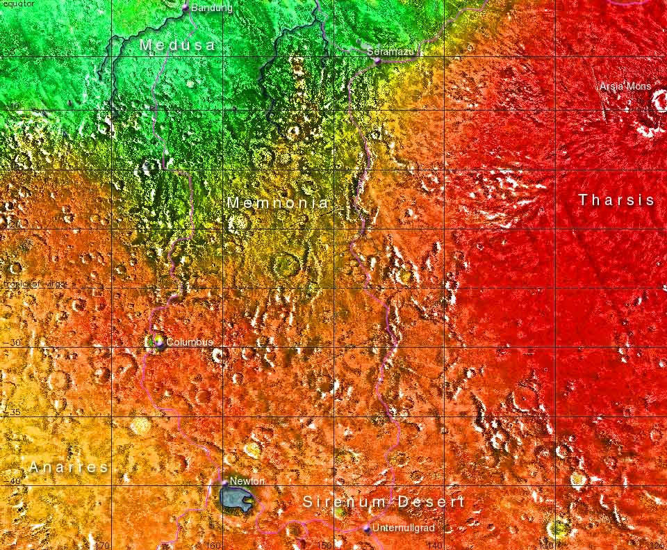
On this map it's clearly visible how the greened part of Mars makes a brave
but futile effort to conquer the southern hemisphere. Medusa is quite a lush
area but Memnonia is already a transition zone towards the steppe of
Anarres and the desert of Sirenum. Some isolated craters, the biggest of
them being Columbus and Newton ,have oases within their walls. The name of
the city of Unternullgrad indicates that winters on the southern hemisphere
are much colder than in the north, due to Mars' asymetrical orbit (during
the southern winter the planet is much further away from the sun). In Summer
however the temperatures rise far above zero...
In the east is the Tharsis bulge, the roof of the world at some nine kilometers
above sea level; this area is not accessible without breathing gear, but
it's a must for anybody who wants to get a glimpse of the prehuman Mars.
The Darian Calendar created by Tom Gangale Month and weekday names, maps and page layout by Frans Blok