+44N
360E
Jowani
+44N
300E
Month
Adir
Bora
Coan
Deti
Edal
Flo
Geor
Heliba
Idanon
Jowani
Kireal
Larno
Medior
Neturima
Ozulikan
Pasurabi
Rudiakel
Safundo
Tiunor
Ulasja
Vadeun
Wakumi
Xetual
Zungo


forest


0N
360E
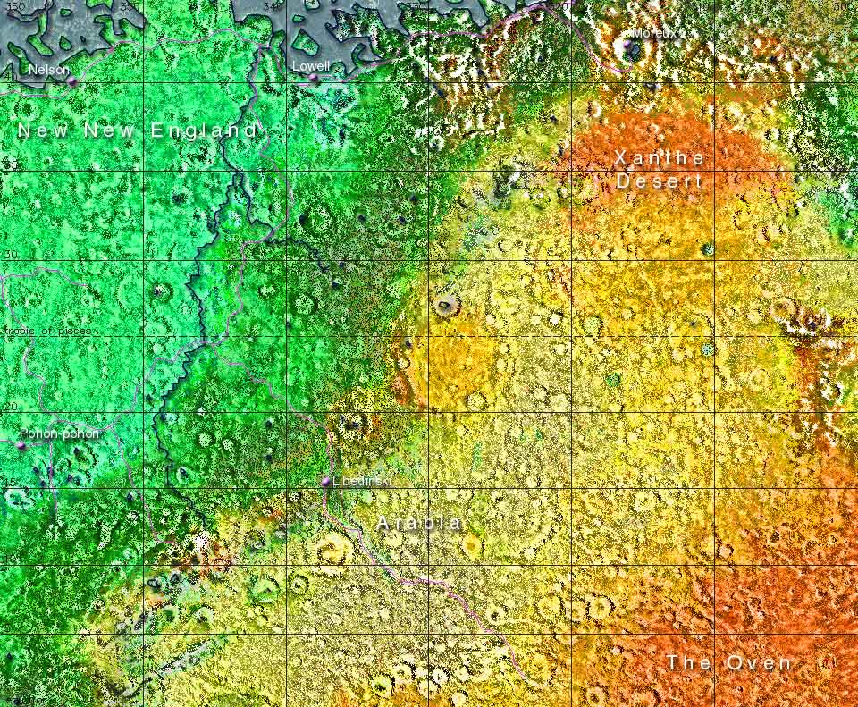
The area shown on this map is about 5.9 million square kilometers, which is roughly the same size as the USA minus Alaska or Europe without Russia
0N
300E
The
Martian Time Website
The Mars
Society
The Astrobiology
Web
The Terraforming Information
Pages
The Red, Green & Blue MarsSite
There's a large variety of landscapes in this part of Mars. Dense forests cover the northwestern area, where the proximity of Viking Bay and the Icecold Ocean can be felt. Here we also find the longest river on Mars, the Alvin (rivers on Mars are named after the first children born in the early settlements) Further east the forests gradually change into the grass plains of Arabia. The Deuteronilus Mountains in the north seperate Xanthe Desert from the Ocean. In the south The Oven is the hottest place on the planet, making it hard to believe Mars is so much further from the sun than Earth!
The Darian Calendar created by Tom Gangale Month and weekday names, maps and page layout by Frans Blok