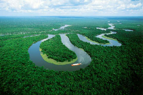
Brazil is the fifth largest country in the world. It borders all South American countries except Chile and Ecuador. From the Amazon basin in the north and west to the Brazilian Highlands in the southeast, Brazil's topography is very diverse. The Amazon River system carries more water to the ocean than any other river system in the world. It is navigable for its entire 2000 mile trip within Brazil. The basin is home to the most rapidly depleting rain forest in the world, losing about 52,000 square miles annually. The basin, occupying more than sixty percent of the entire country, receives more than eighty inches (about 200 cm) of rain a year in some areas. Almost all of Brazil is humid and also has either a tropical or subtropical climate. Brazil's rainy season occurs during the summer months. The Brazilian Highlands and plateaus generally average less than 4000 feet but the highest point in Brazil is Pico de Neblina at 9888 feet. Extensive uplands lie in the southeast and drop off quickly at the Atlantic Coast. Much of the coast is composed of the Great Escarpment which looks like a wall from the ocean.
Amazon river (6,516) kilometers |
|---|