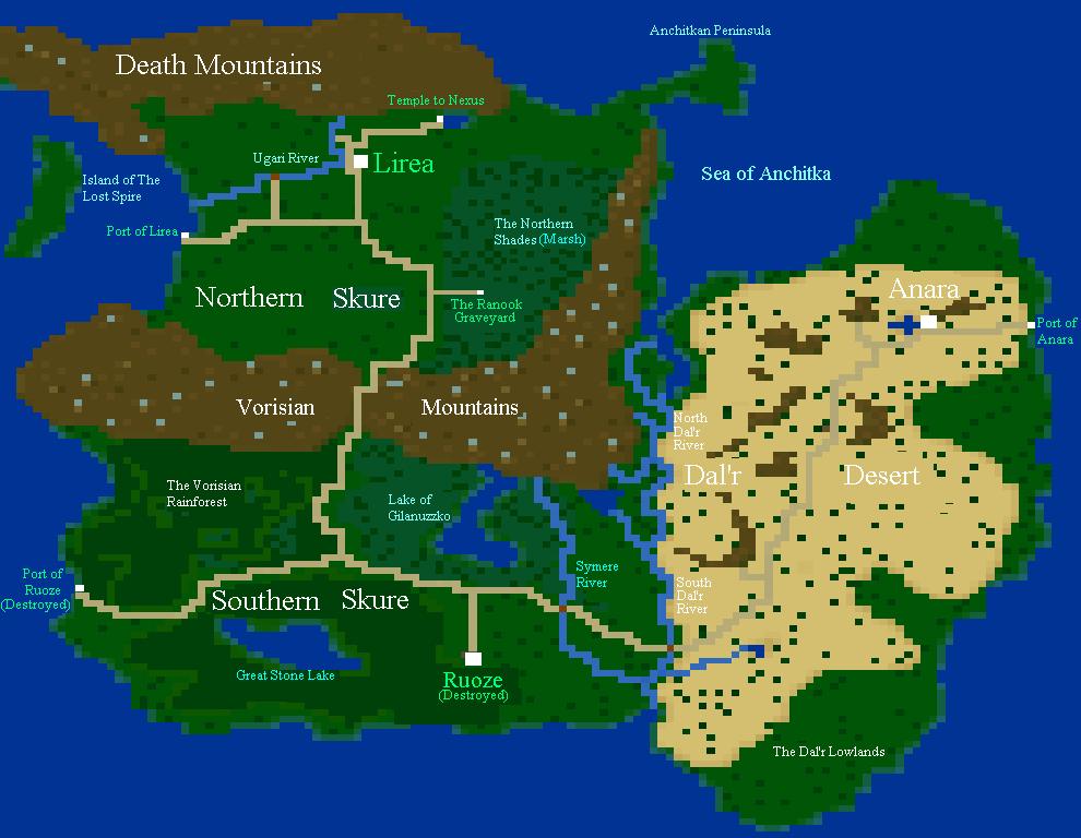
When the Lireans fled from Ruoze to the contemporary city of Lirea in this map hundreds of years prior, they travelled the rough paththrough the Vorisian Mountain pass into Northern Skure at a distance of travel around 2400 km (1, 491 miles). It took them 90 days to reach their destination. With the road more built up, travel from Ruoze to Lirea could take as little as a month and a half at a steady pace.
Skure only represents about 1/6 of the total area of Darlow, and some important areas cannot be seen on this map. If one goes northwest through the Death Mountains, they will end up in North Kreland, which was the continent where Dainan resided. If one leaves the former port of Ruoze to go straight south, they would end up (after a very long trip) at the polar South, where Hassen resided. For this game, however, Skure is the central area and so is the only one shown here.