
A Rough History of Titirangi and its Environs
"We have by abiding miracle retained something of urban or suburban New Zealand as it might have been - had it not been for the lack of imagination, fire and bulldozer. We live in and with the contours of New Zealand pristine. That I hope will never be lost; will never be for sale."
- Maurice Shadbolt (Titirangi Primary School Centennial celebrations Journal)
SOME PLACE NAMES:
Man and nature may hide the legacy of times gone but the poetry of Maori place names ensures that the stories live on.
Titirangi is generally taken to mean to close to, or fringe of heaven (rangi -sky.) There are other descriptions too, such as long streaks of cloud in the sky or even 'titi' being the call of migratory seabirds that sing from the sky.
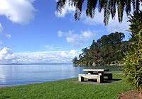
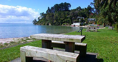
Titirangi Beach was
formerly known as Paturoa a place of extended killing, which speaks of the
three-day clash where in
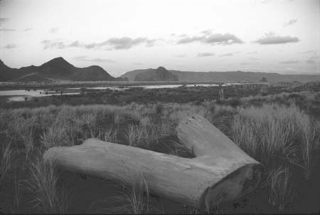 1760 the creeks ran red with blood and the Waiohua of
the Tamaki Isthmus were decisively defeated by the Ngati Whatua.
1760 the creeks ran red with blood and the Waiohua of
the Tamaki Isthmus were decisively defeated by the Ngati Whatua.
The drubbing cost the Waiohua all their Chiefs including their leader Kiwi Tamaki, on a day marked as Te Rangi Hinga nga Taki, the day when all fell together.
It's hard to comprehend the intensity of a battle that forever changed the geo politics of the Isthmus of Tamaki Makarau in this otherwise serene bay secluded by giant stands of native forest.
PAKEHA COME TO THE HILLS
The tentacles of
colonisation spread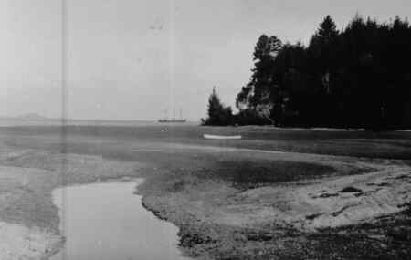 towards the ranges in the second quarter of the 1800's. Te Kawerau a
Maki -though decimated in number by an epidemic in 1790 and then by a
raid on their land by musket wielding Nga Puhi- still inhabited the
hills and the bulk of coastal settlements. Ngati Whatua and Waikato
tribes shared the seasonal resources of the Manukau about Titirangi.
towards the ranges in the second quarter of the 1800's. Te Kawerau a
Maki -though decimated in number by an epidemic in 1790 and then by a
raid on their land by musket wielding Nga Puhi- still inhabited the
hills and the bulk of coastal settlements. Ngati Whatua and Waikato
tribes shared the seasonal resources of the Manukau about Titirangi.
It was a Ngati Whatua chief Te Kawau, who built and occupied the Karangahape Pa on Puponga Point at present day Cornwallis. He sold the land to a Sydney trader Thomas Mitchell. But due to the poor damp quality of the tobacco Mitchell proffered as part of the deal the land was resold again to the Crown as part a deed that included most of the Tamaki Isthmus.
Named for the fifth
Earl of Cornwallis, the tiny coastal community formerly known as Karangahape was
in 1840 earmarked as a town to rival that of Auckland. But the disputed land
deed turned sour before the barque Brilliant landed after it's grueling
301day journey from Glasgow.
coastal community formerly known as Karangahape was
in 1840 earmarked as a town to rival that of Auckland. But the disputed land
deed turned sour before the barque Brilliant landed after it's grueling
301day journey from Glasgow.
The exhausted cargo of Scottish immigrants arrived to the sight of uncut bush instead of a promised grid of streets. And the town of Cornwallis was doomed before the first settler stepped ashore
Significant accelerated changes to the area occurred at the hands of European settlers keen to harvest the wealth of native timbers. For the best part of a century the hills yielded timber for the ship yards of Sydney and the homes of inner Auckland with some lumber travelling as far as gold rush San Francisco.
Due to their close
proximity to the harbour, Parau, Laingholm and Cornwallis were the first to be
cleared. Major milling operations at Huia and Whatipu cranked on for half a
century. The latter was a hive of forestry activity. A wharf tucked behind
Paratutai rock was linked by 14kms of -cliff clinging, mountain
scaling- narrow gauge railway to milling operations up the wild West
Coast as far as Anawhata.
The latter was a hive of forestry activity. A wharf tucked behind
Paratutai rock was linked by 14kms of -cliff clinging, mountain
scaling- narrow gauge railway to milling operations up the wild West
Coast as far as Anawhata.
Farming followed forestry. The Bishop's were among the first settler families in Titirangi. Their orchard was established around 1850 covering the hills from Huia road to Little Muddy Creek. The Bishops in an endeavour to educate their eight children began Titirangi's first official school in the attic of their home.
The school had a couple of other incarnations variously at 46 and 181 School Rd (now Sth. Titirangi Rd.) until it found a permanent home in 1939 on the corner of Atkinson and View (now Kohu) Roads.
J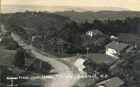 ohn and George Laing took up land between Little and Big Muddy Creeks in 1854 giving the area
the name Laingholm. The Mc Eldowneys had an orchard on the lower western reaches
of South Titirangi Rd.
ohn and George Laing took up land between Little and Big Muddy Creeks in 1854 giving the area
the name Laingholm. The Mc Eldowneys had an orchard on the lower western reaches
of South Titirangi Rd.
Early village life was primitive an old puriri tree served as the post office and meeting place, where letters were hung from the branches and settlers and pit sawyers would rendezvous. The source of much of the entertainment was an open dance floor -no walls or roof- where there was not so much dancing with the stars, as under them.
A NEW CENTURY:
At the turn of the 1900's New Zealand was pitched to the outside world as "The Holiday Resort for the brain weary and jaded man of business. The Ideal Home for the man of leisure." It was only seventeen days from San Francisco and just twenty six days from London.
Judging by a growing number of guesthouses in and around Waiatarua at that time it seems the natural attractions of the Waitakere Ranges were just as attractive to Aucklanders as the rest of the country was desirable to overseas tourists.
By 1884 Titirangi
had its first pub the Waikumiti Hotel. Set just south of the present day shops,
the hotel served beer but had no beds. It burned to the ground in 1884.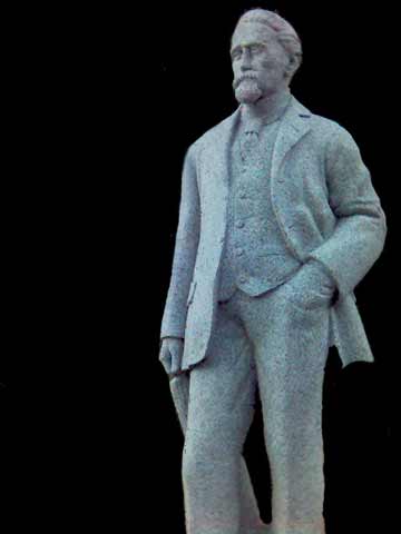
The Bishops had a tea kiosk not far from present day Lopdell House servicing day visitors to Mr Peat's Treasure House (now laying vacant behind Lopdell House.)
The Treasure House held an enormous collection of Kauri gum, carved heads, the sternpost from the largest waka and various other taonga; a veritable aviary of stuffed birds plus a suit of armour given to Hingi Ika by King George on Ika's visit to London in 1820.
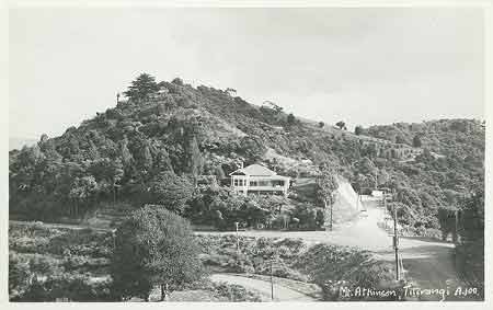
Henry Atkinson (1838-1921) built a holiday home on Rangiwai Rd. in the 1870's that he continued to use until 1921. His wife and daughter lived there until 1937 when the Geddes family bought it and have lived there ever since.
Atkinson encouraged the Auckland City council
to use the Nihotapu stream as water supply and donated large chunks of land for
the catchment area. He also donated much of his estate to the city for
parklands. The hill just off Kohu Rd is Mt. Atkinson and his statue that once
stood at the top now stands beside Lopdell House.
Although the area's first post office opened at Little Muddy Creek in 1861 before closing temporarily in 1862 when postmaster John Porter drowned, the first Titirangi post office didn't open until 1873.
The one lane bush track that is Exhibition Drive from the Scenic Drive to Mackays Rest was built 1913 -14 to commemorate the Auckland Exhibition. By all counts the elite of motoring Aucklanders received quite a thrill as they chugged along the steep sided gravel track with its expansive harbour views. Today the 3.2 km road is closed to traffic but is one of the more popular walking tracks in the area.
A public works scheme in the 1936 led to the construction of the Scenic Drive which took a team of 200 men -using only picks and wheel barrows- three years to carve. At it's opening in June 1939 the Minister of Public Works, Bob Semple called it "… an inspiration and a tonic."
Atkinson Rd. was all but a dirt track up to the village in 1930's. Wheat fields and The Thomas' daffodil farm filled the valley all the way up to Mt. Atkinson.
The Daffodil Farm
subdivision opened in 1964 with sections listed between £640-£995. The Thomas'
farm acknowledged today as Daffodil Street running between Atkinson and Konini
Roads.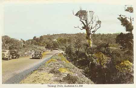
Ivan Yukich bought a sunny site on the northern slopes of the Scenic drive in 1934. He market gardened and took on all manner of work to survive slowly planting vines as he went. As Yukich and Sons Ivan was quietly selling wines to GI's stationed in Auckland during WWII.
His first official wines sold between 1952 by 1960 came from just ten hectares of vines.
In 1962 Ivan's sons Mate and Frank set up Montana (mountain) Wines introducing Cold Duck, Blenheimer and Bernadino to the lexicon of Antipodean sommeliers. In 1974 the winery and bottling plant was shut down and moved to Glen Innes.
 LOPDELL
HOUSE:
LOPDELL
HOUSE:
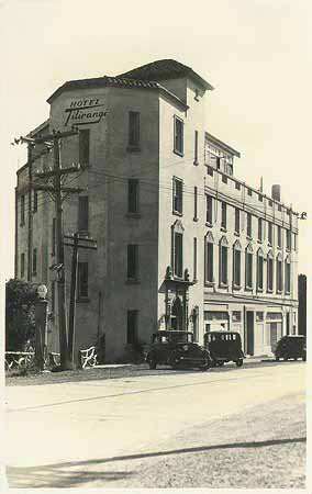
The landmark Titirangi Hotel was opened on the 2 November 1930. It was billed as the Ideal Mountain Guest House featuring 63 luxury rooms. The site was close to that of the Waikumiti the difference was that the new pub had plenty of beds but no liquor license. It was quickly dubbed the "Pub with no beer"
To compound its plight the effects of the depression were setting in and the road from New Lynn, rough though it was, carried up to eight bus loads of tourists to the hills per day in summer, was then closed for sealing during much of 1931.
There was however a brief hey day when the Woolworths heiress Barbara Hutton and her chaperone graced the corridors of the Spanish Mission accommodations and the Polish-American musician Ignacy Paderewski was heard playing the upright piano.
But the impending
liquor license in 'this dry area' was not forthcoming. The odds were against the
Hotel turning a profit and the last straw must surely have been when the
basement club which was busted for 'sly grogging' to the workers building the
Nihotupu dam.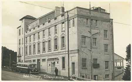
The building became a School for the Deaf from 1942 to 1960. Among it's many visitors was the American Deaf and Blind teacher Helen Keller. The building took the name Lopdell House for the Superintendent of Education Frank Lopdell. It remained a teacher's residence until 1982 and then re-opened refurbished -$100,000 over budget- as an arts centre in 1986.