Home 
 
BACKPACKERS GUIDE TO AUSTRALIA
NORTHERN TERRITORY
AUSTRALIA > NORTHERN TERRITORY
NORTHERN TERRITORY INDEX 
Description Northern Territory Map List of featured towns and districts Transport Other States
 
Northern Territory (population 200,000) 

The Northern Territory is remote and sparsely populated and is the region where Aboriginal culture and art is most prevalent. The only big towns are Darwin, its modern tropical capital and Alice Springs in the arid red centre. A single bitumen road, the Stuart Highway connects the two. From Alice Springs it continues on to South Australia

The world famous massive and brilliant red Ayres Rock lies in arid land 400 kilometres from Alice Springs. Not to be forgotten is nearby Olgas rock formation and Kings Canyon a further 300 kilometres. 

Alice Springs is situated at a gap through the dry MacDonnell Ranges. Along the ranges  are chasms, rockpools, gorges and fern filled valleys where intermitant streams have also cut gaps through. 

In the tropical north just outside Darwin is the Litchfield National Park on a plateau with waterfalls to the flat plains below. The wetlands of famous Kakadu World Heritage Area is a little further. Further south is Katherine Gorge near the town of Katherine

Tennant Creek is yet further south into the dry region. North of town is the road junction for the road to Queensland

Though the distances are long in the Northern Territory, it is blessed with magnificient sights and awesome geographic formations. It still has a frontier feel and the prices are high. 

Arkaroola, Flinders Ranges 
Picture: Ayres Rock.
Northern Territory Map
Map: Northern Territory
 
Road sign on the Nullabour Plain
Picture: Litchfield National Park, near Darwin.


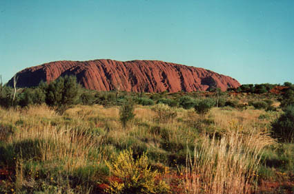
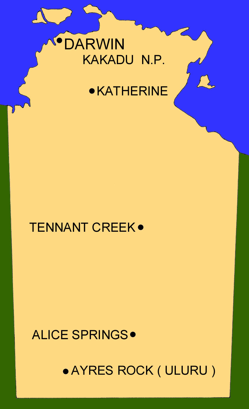
FEATURED TOWNS AND DISTRICTS 
 (See also descriptions above) 
 
Darwin City 

Near Darwin 

  • Litchfield National Park
  • Kakadu World Heritage Area

    Stuart Highway 
  • Katherine Gorge 
  • Katherine
  • Tennant Creek 
  • Devils Marbles
  • Mataranka Thermal Pool
  • and all roadhouses
  • Alice Springs 

    Near Alice Springs 

  • West MacDonnell Ranges

  •  
    Ayres Rock 
     
    Near Ayres Rock 
  • Yulara Township
  • The Olgas
  • Kings Canyon
  • and all roadhouses
  •  


     TRANSPORT 
     
    Refer to our separate Australia wide  transport page for detailed routes and timetables. This section is only a summary of services. 

    Buses run along the Stuart Higway from Darwin to Adelaide and beyond to South Australia. Some make the detour to Ayres Rock. Buses also run from Darwin to Threeways junction then across to Queensland. Buses do not neccessarily come every day and connections at Threeways junction are often extremely poor. 

    Darwin, Alice Springs and Ayres Rock have airports. 

    Distances are long. If driving or hiring a car remember petrol stations and supplies are infrequent. Roads off the bitumen are remote. Weather conditions are extreme. Before proceeding off the bitumen take proper precautions and notify police. 


    OTHER STATES AND TERRITORIES 

    Queensland - New South Wales - Victoria - South Australia - Western Australia - Tasmania 
     

    Australia Homepage
    .
    Copyright (c) 2001 Graham Warren.
    Backpackers Guide to Australia (TM) is a trademark.
     
    Hosted by www.Geocities.ws

    1