


|
|

History & Information |
Photographs | Map
and Access Details | Links
HISTORY
& INFORMATION
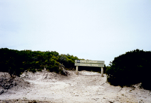
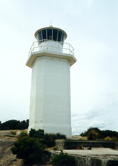
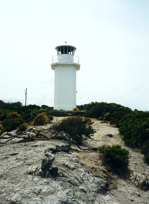
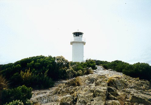
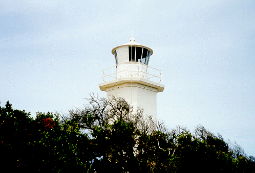
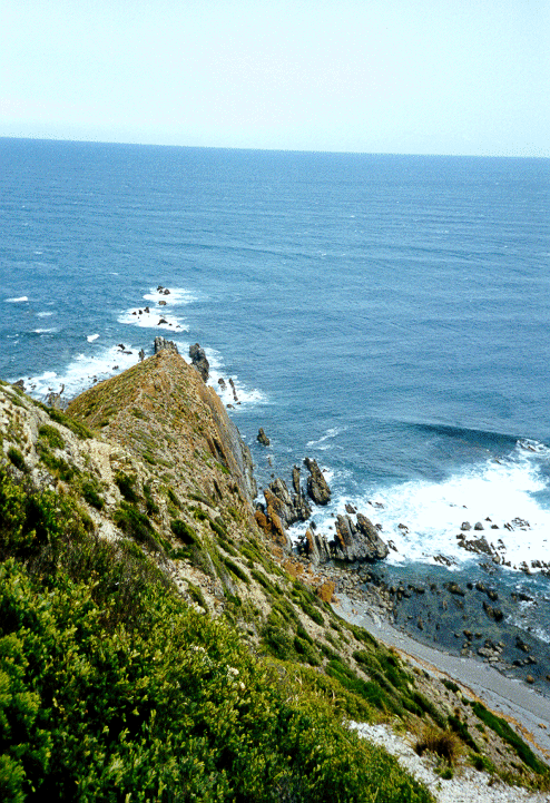
Cape Liptrap Lighthouse stands upon a
isolated rocky cliff top, on a solitary part of the South Gippsland coastline, in the Cape
Liptrap Coastal Park (4175 hectares), 160 km south east of Melbourne. The Cape itself is a
narrow peninsula formed by the spine of the Hoddle Range running out to sea. It consists
of steep cliffs of folded marine sediments flanked by rock pinnacles and wave cut
platforms.
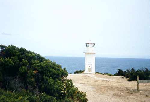
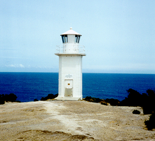
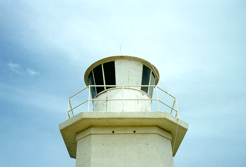
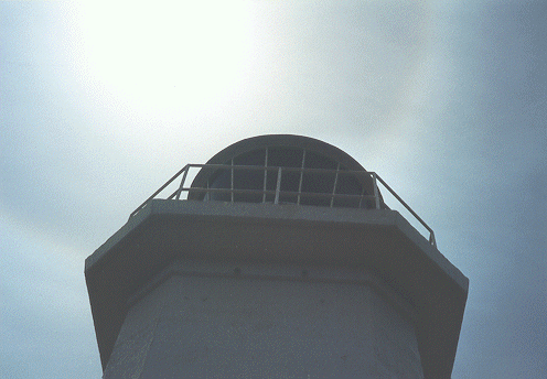
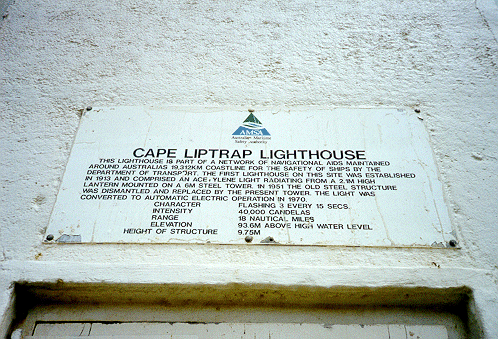
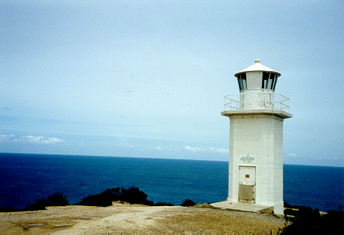
A lighthouse was established at Cape
Liptrap in 1913 to improve the safety of coastal shipping. The light consisted of 2.1
metre high acetylene light mounted on a 6 metre steel tower. Cape
Liptrap Lighthouse has the distinction of being the first automatic,
unattended lighthouse funded by the Commonwealth.
In 1951, the steel
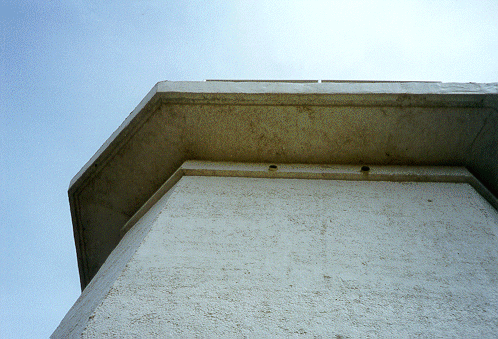
tower was dismantled and replaced with the current cast concrete structure, which was
converted to mains power in 1970. The light is still in operation and has a range of
18 nautical miles (over 34 kilometres). The Cape Liptrap Coastal Park was declared
in 1997, and there is no restriction of access to the lighthouse.
| Location: |
38�54'S 145�55'E |
| Nearest Town: |
Walkerville |
| Operator: |
Australian Maritime Safety Authority |
| Built: |
1951 |
| Structure: |
Octagonal
concrete tower |
| Open
to public: |
Yes |
| Access: |
Gravel
road |
| Accommodation: |
No |
|
|
| Character: |
Flashing 3 every 15 seconds |
Lens:
|
400
mm catadioptric drum |
| Power
source: |
Mains
power |
| Intensity: |
40,000
CD |
| Height: |
9.75 metres |
| Elevation: |
93.6 metres |
| Range: |
30
kilometres |
|
Sources:
* Parks
Victoria
* Lighthouses
of Australia Inc
* Lighthouses:
Australia
* Reid, G. (1988) "From Dusk to Dawn: A History of Australian Lighthouses",
AGPS
* Ibbotson, J. (2001) "Lighthouses of Australia: Images from the
End of an Era", Australian Lighthouse Traders
 PHOTOGRAPHS PHOTOGRAPHS
Photographed by K. Eggleston, 24 January 2000 � Kristie Eggleston
MAP & ACCESS DETAILS
Refer to regional map at Wilmap
for greater map detail. |
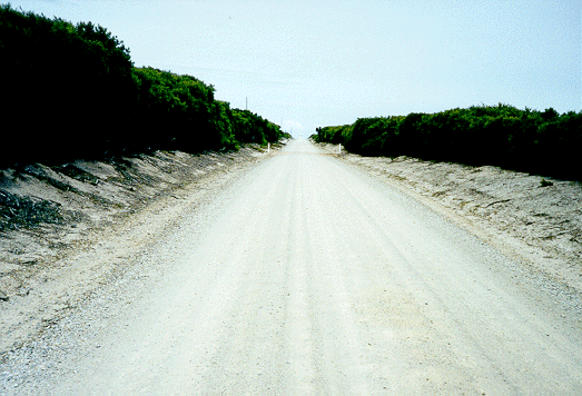
Access
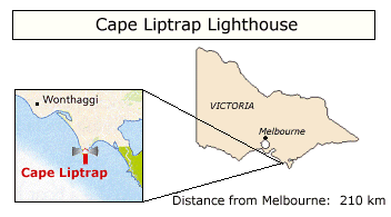
The Cape Liptrap Lighthouse is located
about 200 km south-east of Melbourne, via the South Gippsland Hwy, through
Korumburra, Leongatha and Fish Creek. The road leading to the
Lighthouse is unsealed and relatively rough, but can be traversed by 2WD.
There is parking available onsite, but no other facilities. Nearest
amenities are located at Walkerville.
|
| Since my visit there in Jan '00, a
lookout platform and fencing has been built around the lighthouse area.
The area is also popular with geologists, due to the folded marine
sediments below the lighthouse. |
LINKS
Page
last updated: 27 December 2003 Copyright � 1999-2003 Kristie Eggleston. All rights
reserved.
Email: [email protected]
|