(Map base on a USGS quadrangle.)
Langsford Pond (North Gloucester, Massachusetts.)
Langsford Pond is located in Annisquam just inland of Rte 127 (Washington
Street), between Revere and Bennett Streets and
opposite the Annisquam village church.
Langsford Pond properly also includes the area to the east which the topo
map shows as a marshy area, around the L and the P of "Langsford Pond",
but which has a lot of water year-round with alder bushes growing it.
It is a natural depresssion, dammed by a rock dam in the nineteenth century
to provide a source for ice. The outflow is to the Northwest, to the top of
Lobster Cove.
Beaver activity has raised the water level by about six feet over the last
three years. Maximum depth is now up to twelve feet in the west end.
The pond, and the area around the outflow, is
owned by Essex County Greenbelt Association. It is accessible to the
public from Washington Street. There is no parking. It can be used for
boating, and is used by the village youth for skating in winter. There
is no fish in the pond.
Wildlife includes a resident family of beavers, muskrat, and occasionally
otters. Nesting birds include wood duck and occasionally green heron.
There is a colony of grackles amd red-winged blackbirds in the alders in
the east section.
There are many painted turtles and snapping turtles, and twelve species
of dragonfly have been identified.
Conservation concerns.
The pond itself and its outflow is owned by Greenbelt, which also holds a
conservation restriction on private property just north of the pond (shown.)
The nearest protected property inland is the Norton Memorial Forest, which
connects to Dogtown.
There are a lot of new houses (not shown) along Bennett St and Tufts Lane, but
apart from that the area between Hutchins Court and Bennett St, though
unprotected, is untouched woodland, mostly difficult of access and difficult
to build on because of rocks, hills, and wetlands. The concern is a
proposed development that would make a road connection between the end of
Tufts Lane and the end of Bennett St, and cut Langsford Pond off from all
other protected areas.
See below the map for the picture gallery.
This topo map is 300K and may require some time to load.
Map details.
The red line in the top left is Washington Street (Rte 127.) One of the black
dots is the Annisquam Village Church.
The dark line across the top is
Revere Street, curving around until it ends just where it meets the right-hand
side of the map. The line curving down (South) in the middle from Revere St
is Hutchins Court.
The middle of the three side streets off Rte 127 is Dorset Drive, a private
road, with just two houses.
The southernmost of the three side streets is (North) Bennett St,
currently mostly a dirt road, which curves through the hills until it drops
down to Dennison Street as South Bennett St.
The water in the lower left is Goose Cove. The dark line along it, then
curving into the woods, is Dennison Street.
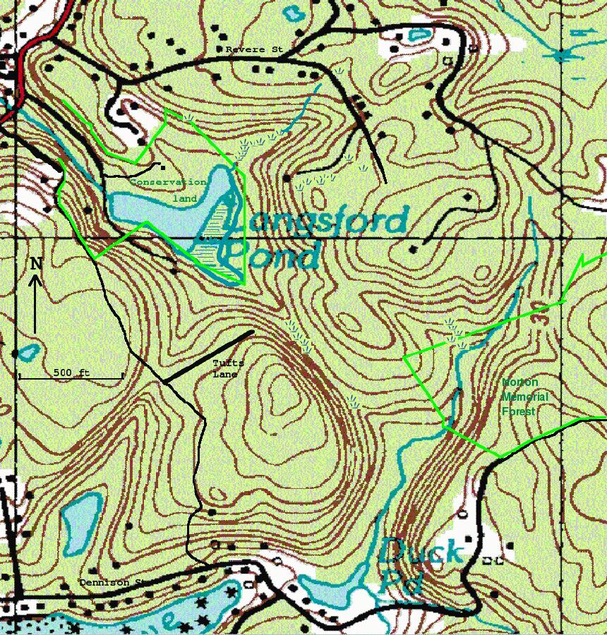
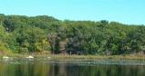
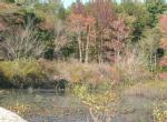
Picture gallery.
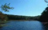
The first two pictures were taken on the same day, October 3, 2005. Note
the difference in color between a west exposure (first) and a south
exposure (second picture.)
The second pair was take some weeks apart in March 2004.
East view - October |
North view - October |
North view - March |
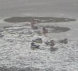
Wood ducks - March |
Two more views.
East view - October |
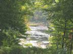
Southeast view - October |