Burrs Mill was water powered initially but it was later converted to steam.
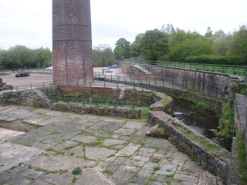
The photograph shows the site of Burrs Mill with the route of the canal feeder running across the upper right. The channel visible starting in the lower right was taken from the feeder to supply water to nearby Higher Woodhill Mill.
|
|
|
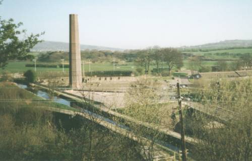
Continue along the footpath on the left-hand side of the canal feeder, which now crosses the Irwell on an aqueduct (at map ref SD 799 125), running diagonally from upper left to lower right in this photograph, which also shows Burrs Mill in the centre of the picture.
|
|
|
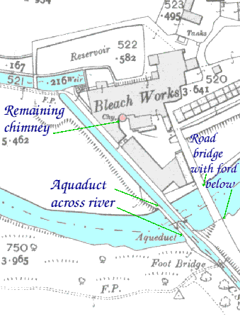
This is taken from a map made in 1908 and shows the area of Burrs Mill bleach works, roughly corresponding to the photograph above.
|
|
|
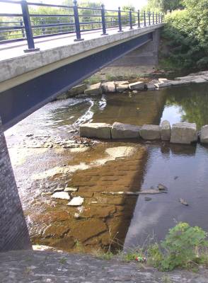
Stand on the aqueduct beside the canal feeder and look into the river underneath the modern roadbridge alongside.
If the water level is low it is possible to see the flagstones of the old ford across the river, which was the crossing for horse traffic from Burrs Mill until the bridge was built, sometime after 1850.
This photograph is taken from beside the road bridge, looking along the ford. The flags along the riverbed can be clearly seen.
|
|
|