18. Isles of Shoals
north of Wallis Sands Beach in Rye, NH
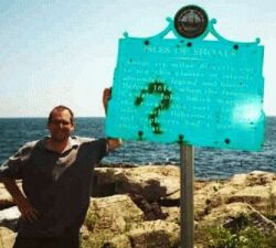
erected 1963
The New Hampshire portion of the Isles of Shoals was listed on the National Register in 1980.
Isles of Shoals from Rye Beach
Stalking New Hampshire's Historical Markers
Related Links: |
||
| Isles of Shoals | ||
| White Island Light | ||
| Star Island | ||
| Smuttynose Island | ||
| Isles of Shoals Steamship Company | ||
All text and images on this website (c)2002 Mary Lizie/Robert Marville |
||
Revised 2/13/2002 |
||