8. Site of Piscataqua Bridge
near its junction witb Back River Road in Durham, NH
erected 1962
Stalking New Hampshire's Historical Markers
All text and images on this website (c)2001 Mary Lizie/Robert Marville
Revised 7/4/2001
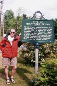
8. Site of Piscataqua Bridge | ||
|---|---|---|
| located on the south side of US4, east of its junction with
NH108 and near its junction witb Back River Road in Durham, NH |
||
|
"At end of next road southeast, this engineering feat was used
from 1794 to 1855. It joined Fox Point, Newington, and Meader's Neck, Durham via Goat Island. Also site,
in same period, of proposed state capital, Franklin City, and beginning of First New Hampshire Turnpike -
vital route for instate traffic." erected 1962 |
|
Stalking New Hampshire's Historical Markers |
||
| Historical Markers of the Seacoast Region | ||
All text and images on this website (c)2001 Mary Lizie/Robert Marville |
||
Revised 7/4/2001 |
||