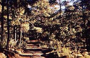
To be this close to the capital and breathe clean
fresh air amidst
beautiful long-needle pines and catch glimpses of stalwart peaks
looming above you is an unexpected treat. This hike takes you through
all that and
as a bonus
shows you a cascade and a waterfall.
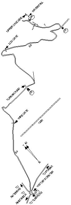
The road to Paso de Cortés starts from the highway at the south end
of Amecameca
100 m south of Pemex #0222. There might be a sign for
Tlamacás. Follow the road up to the high point of a saddle between
Popocatépetl and Iztaccíhuatl Mountains. There you'll find a circle
with a square block column
which marks where Cortés crossed on his way
to Tenochtitlan-México. Next to it is a ranger station where you can
stay if you bring a sleeping bag and a back-pad and you're prepared to
cook meals; you'd need a stove and there aren't any showers. There are
four other roads leaving this circle: one toward Tlamacás
one toward
Puebla
one toward the microwave antennas uphill
and another between
the last two that leads to the trailhead. You have to open (and close)
a gate near the circle to proceed
and there's a wire gate at 1.5 km.
The trailhead is at 2.4 km
where the road widens enough that you can
park and there's a turnaround for anything as big as a van. After that
the road gets worse.
|