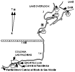
Arroyo las Palomas |
|
Length = 2.8 km. Exertion index = 140 going (+ 60 for the overlook) 30 returning. Maximum elevation = 2250 m.
|
|
If you're in Guanajuato and you've had enough of crowded sidewalks and narrow streets this will help. It follows a ravine up to the city's reservoir which is a man-made but pretty lake.
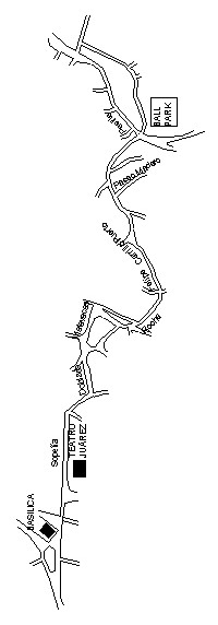
You can reach the trailhead from downtown on foot. Actually that's better because parking opportunities are poor. Use your map from the Tourist Information Office and the one shown above to get you to the baseball stadium (AKA Parque Deportivo) at the east end of town. From the street intersection northwest of the stadium go northeast on Pastita Street all the way up to the Carretera Panorámica about 1 km and uphill enough to warm up your leg muscles. There go right (east) .3 km to a narrow fairly steep concrete street on the left with a 12-inch steel pipe running along its left side and a concrete guard rail along its right side. To your left is a small fenced-in colonia and to the right is a private recreation club surrounded by a stone wall. The concrete street is the first part of the trail.
Bikers like to go around to a viewpoint above the lake to get a better workout.