Lagunillas |
|
|
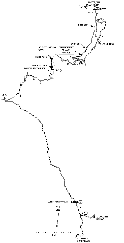
For the first 4.4 km there could be enough road traffic to be annoying although between trucks it's good walking. The rest of the way you should encounter only people and livestock. The road branches off the Guanajuato-Dolores Hidalgo highway between Los Mexicanos and Santa Rosa. At Km 91.8 on the outside of a curve go north on a dirt road. To the right is Rancho Milagro. In .3 mi (.5 km) reach the Restaurant Lolita. The owner is gracious about letting hikers use his parking lot ("Hago una caminata. ¿Me permite estacionar?"). Eating a meal is not a requirement for parking but it is the gracious way to say thanks. Anyway the food's good. If this doesn't work for some reason there are a couple of parking spaces across the road. |
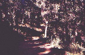 Most
of the way is on jeep tracks
but the first part is on an all-purpose
dirt road and some is on foot or donkey trails. Going through Llanos de
la Fragua
the trail is a narrow lane between farms. The vegetation is
oak forest with other dryland plants. There are some glimpses of the
surrounding hills. At the end you'll reach a pretty
shady ravine with
a little brook just babbling its heart out. It even tumbles over a rock
face to make a dainty waterfall. You can make your way above the
waterfall and follow the ravine as far as you like.
Most
of the way is on jeep tracks
but the first part is on an all-purpose
dirt road and some is on foot or donkey trails. Going through Llanos de
la Fragua
the trail is a narrow lane between farms. The vegetation is
oak forest with other dryland plants. There are some glimpses of the
surrounding hills. At the end you'll reach a pretty
shady ravine with
a little brook just babbling its heart out. It even tumbles over a rock
face to make a dainty waterfall. You can make your way above the
waterfall and follow the ravine as far as you like.