
CSOB* Cockpit Wx
&
Garmin GPSMAP Mounting On Cygnet Dual Yoke
(Because Flying Safely with Weather Avoidance Doesn't Have to be Expensive!)
By: Michael Caban ATP-MEL
More Aviation Related Links, Beechcraft Manuals in PDF & Beechcraft Operating & Maintenance Tips
Download the January 2008 ABS Article: "Nexrad on a Budget"
Dallas, TX
214-295-6507
"The flight is the reason, the destination is just an excuse."
= "CSOB" (Cheap $on
of a Beech) High Praise Recommendation. Because Owning and Flying your
Beechcraft can be done safely AND for less money!
Back when I was living in Tampa, FL, the thunderstorm capital of North America (perhaps even the world), my goal was to get XM Nexrad Wx into my cockpit at the lowest possible cost. I started out with the concept of using one of the Garmin Auto/Marine GPSMAP units that were equipped with the GXM30 low profile XM radio receiver. I chose the GPSMAP 376C since it was readily available and already superseded by newer models, which made the purchase cost quite low for the 376C. The 376C can be purchased for about 1/3 the cost (via Ebay in new or open box/display model condition) of an Aviation Garmin GPSMAP396! Add the "Auto Kit" for about $200 (with detailed street mapping CD, storage card and extra power plugs) for the Garmin units and you have a powerful land based airport database, hotels, restaurants, shopping and street by street directions to anywhere.
One of many Auto
Kit Sources: Click
Here or Click
Here
Of course the 376C has none of the highly touted aviation navigation and database of airports, intersections, airspace, etc., however, for my purposes this was not an issue. I already had a panel mounted IFR certified GPS with aviation moving map display and a small battery powered aviation handheld GPS with an aviation database.
See a complete customer review of 376C Features: Click Here
I simply wanted to get the important Nexrad capability in my plane for strategic in-flight decision making. It does not hurt that the 376C is a WAAS capable GPS unit for an emergency navigation backup in the event of a complete electrical failure or panel mounted GPS equipment failure.
I found that
XM's
Sailor Weather package
at $29/month (side note, when you subscribe
to a Weather product you get XM Radio for $7/month - a no brainer for me since I
can run the audio out to the Garmin 340 audio panel in the plane and set my cars
up) gave me the
all important, High Resolution Nexrad and many other helpful weather products to
work with:
Surface Analysis Weather Maps
Precipitation Type at Surface
Surface Wind Speed & Direction
Surface Analysis Forecast Chart for 12, 24, 36 and 48 Hours
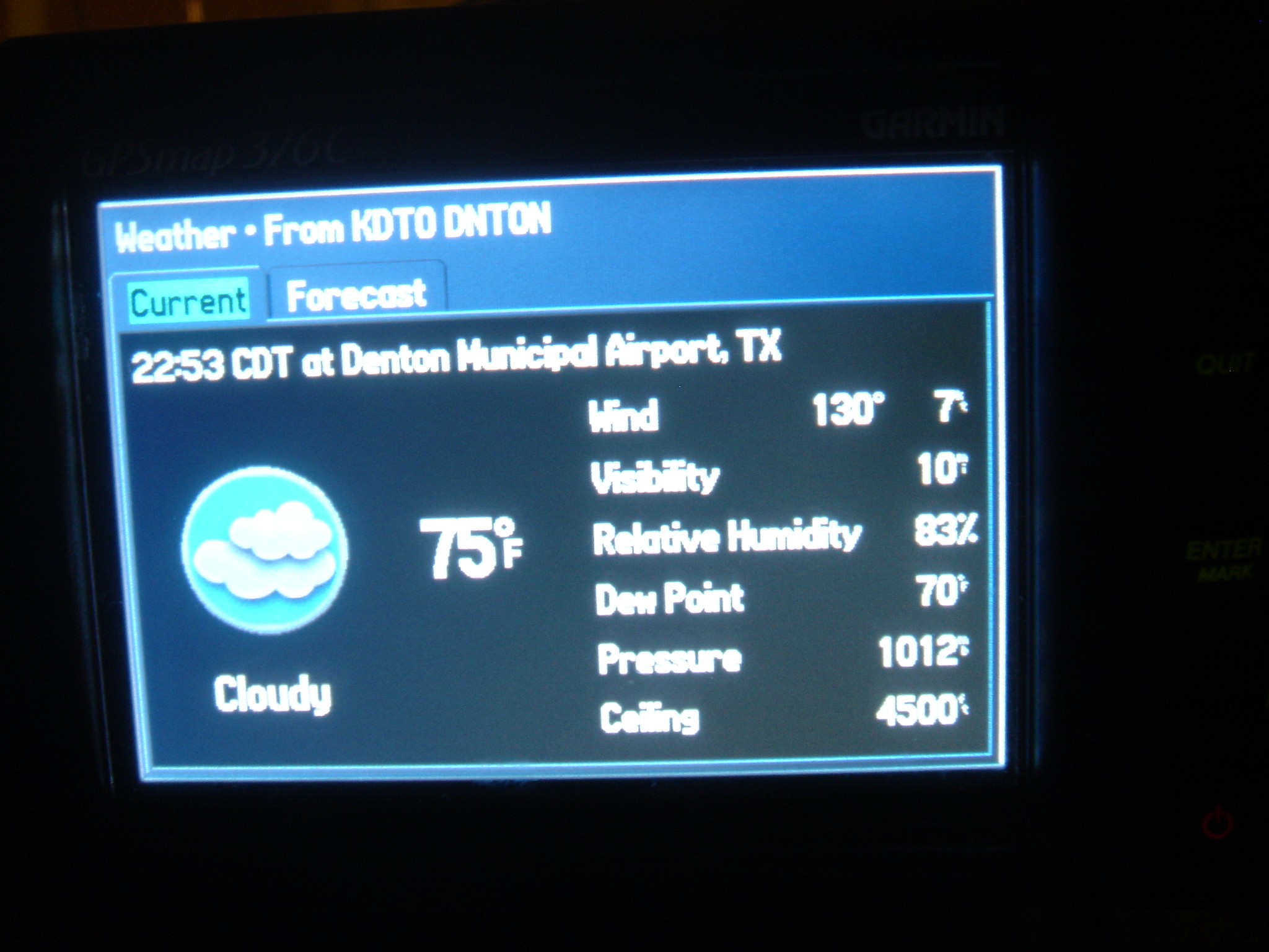
Airport Observations (You look them up on the 376C as "Transportation" facilities and then click "Find" then "Weather Data") that include winds speed and direction, visibility, barometric pressure and sometimes ceiling when reported.
So, if you can't swing the price of the GPSMAP 396 or the GPSMAP 496, a system like this can give you an affordable way to have some in-flight situational Wx awareness.
Search
Ebay Right Now for a 376C - New in Box units can be found for around $600,
from what I have seen.
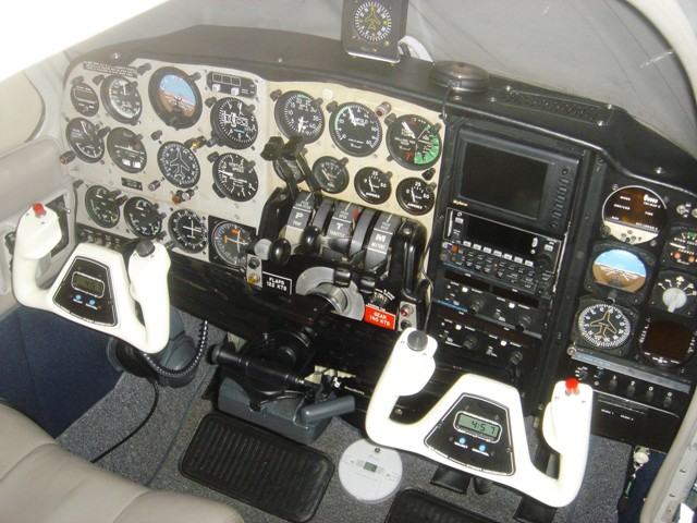
Mounting my GPSMAP 376C (as well as other Garmin GPSMAP clones):
We start with the base of the stock Garmin Marine Mount. This base is mounted to the center of the yoke by removing the 12 o'clock position screw in the center circular plate. I replaced the short screw from the Cygnet yoke with a #8-32 x1/2" stainless steel screw and screwed the base of the Garmin Marine Mount in it's 12 o'clock position to the yoke. Confirm that this screw does not interfere with the movement of your control arm and yoke.
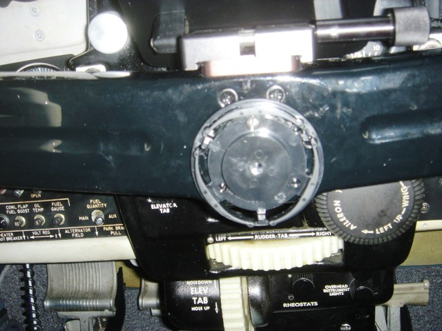
Place the marine mount with your GPSMAP onto the base disc that you just attached to the yoke. You can see the clearance available under the stock Cygnet Flight Desk.
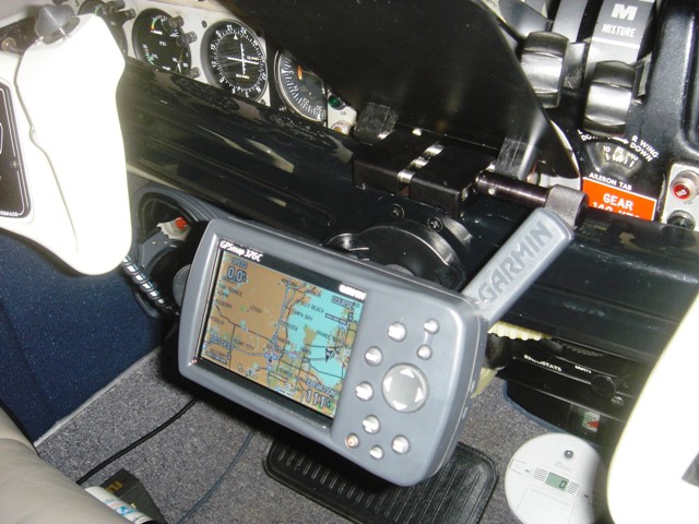
Here the unit is shown with the flight desk removed from it's mounting pedestal. In this position I received plenty of satellites and had WAAS position accuracy of 9 feet within about ten minutes.
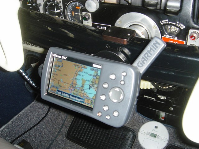
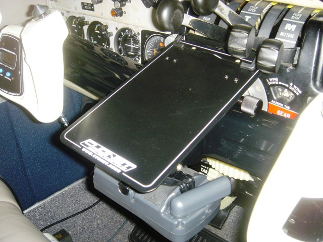
Here you see the GPSMAP in a somewhat stowed position without the Flight Desk.
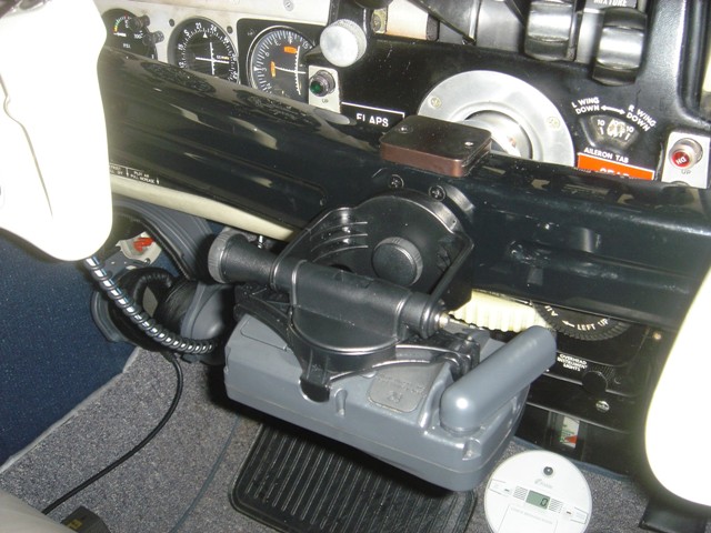
Here is the GPSMAP when stowed with the Flight Desk in place for use.
This is the "Plain Language" METAR interpretation that you get. Wind (speed and direction), visibility and ceiling. This works for me! By the way, this is exactly what is being broadcast at the time by ATIS/AWOS at the field.
These clips from True Value Hardware keep the wires in place, eliminating dangling wire "hell" in your cockpit.
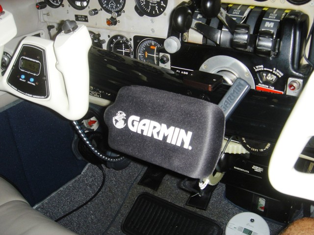
With the Garmin GPSMAP screen cover.
Full panel with GPSMAP in stowed position and GXM30 antenna in place on glare shield. No compass issues since
magnets were removed, via the
procedure outlined by NUMA Aviation at:
http://www.numa.aero/GXM30.html
If this write up has helped you in any way, pay it forward and take a young person flying with you on your next hamburger or pancake run!
