These are all the maps that show the steady expansion of the empire, the one map not on here is the one showing the inner divisions of the empire (i.e.- provinces, diocese etc.). That map is available only in the Tabula. Each of these maps has the same synopsis that is available on its individual page when you click it on the timeline.

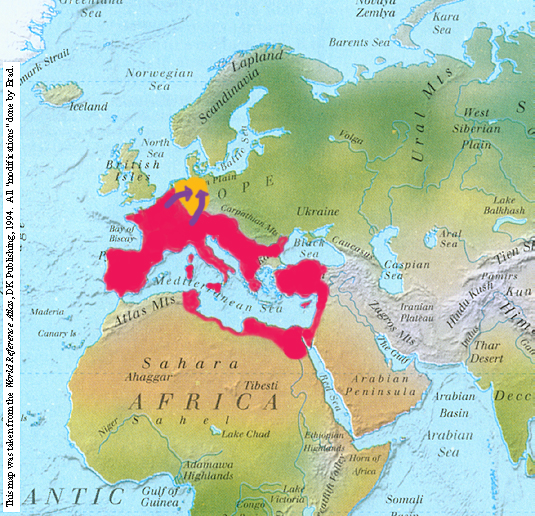
Here we see Augustus Caesar's successful invasion of the lands between the Rhine and Elbe rivers.
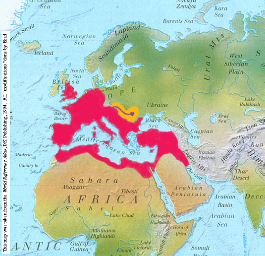
Here, Trajans forces storm south and then into Dacia, to complete his conquests in Europe. Note also that lands have been aquired in the East.

The empire gains further eastern territories.
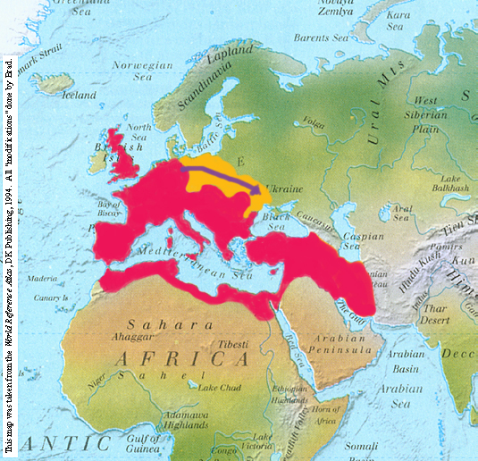
The traitorous German kingdoms are absorbed into the Empire. I have a map of these kingdoms and their locations before they are conquered by Rome, but until it scans better, I cannot put it up. Please keep visiting to see when I post it (when I do, it will be on this page and it's individual map page).
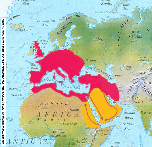
The absorbtion of the Arabian Peninsula and sub-Egyptian kingdoms.
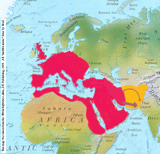
The final conquests in the east, eradication of the traitorous partisans.
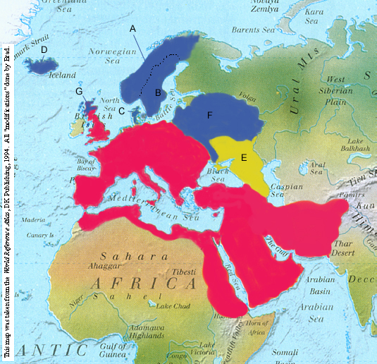
Here is the empire at current status. The "Normannii" tribes are all in blue, though they have separate states (see below). And the Khanate of Khazaria is in yellow (E).
Normannii States:
- A: Normannia
- B: Suedia
- C: Dania
- D: Magna Normannia
- F: Russia/Slavia
- G: Monapia (Jarldom of Monapia)
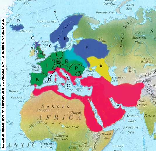
Here is the empire after the council. The only real power in the former Roman held european east is now the Equites Templii (represented by the light blue). The "Normannii" tribes are all in dark blue, though they have separate states (see below). And the Khanate of Khazaria is in yellow (E). In green we see the new independent former provinces.
- A: Normannia
- B: Suedia
- C: Dania
- D: Magna Normannia
- F: Russia/Slavia
- G: Monapia (Jarldom of Monapia)
- H: Albion
- I: Imperium Galliarum
- K: Hispania
- L: Germania
- M: Regnum Hermundurum
- N: Helvetia
- O: Pannonia
- P: Dacia et Gothica
- Q: Thracia Nova
- R: unorganized at end of council, strongest group in the region is the Equites Templii...
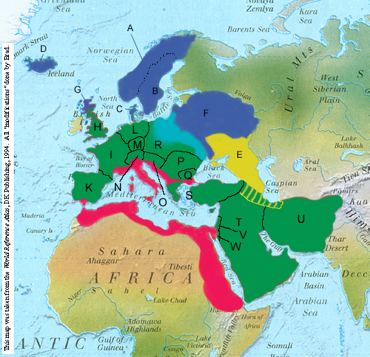 Here is the empire after the second council. The only real power in the former Roman held european east is now the Equites Templii (represented by the light blue). The "Normannii" tribes are all in dark blue, though they have separate states (see below). And the Khanate of Khazaria is in yellow (E), with its newly acquired territory striped. In green we see the new independent former provinces.
- A: Normannia
- B: Suedia
- C: Dania
- D: Magna Normannia
- F: Russia/Slavia
- G: Monapia (Jarldom of Monapia)
- H: Albion
- I: Imperium Galliarum
- K: Hispania
- L: Germania
- M: Regnum Hermundurum
- N: Helvetia
- O: Pannonia
- P: Dacia et Gothica
- Q: Thracia Nova
- R: unorganized at end of council, strongest group in the region is the Equites Templii...
- S: Graecia et Asia
- T: Syria Magna
- U: Persia
- V: Palaestina
- W: Petra
Back to Main Menu