 |
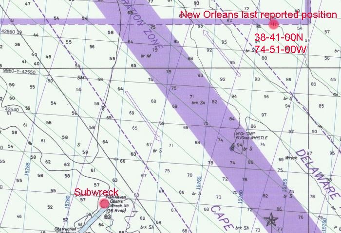
| The reported position of the New Orleans sinking, 38-41-00N 74-51-00W, is clearly marked on this chart. |
|
| The reported position of the New Orleans sinking, 38-41-00N 74-51-00W, is clearly marked on this chart. |
Barge 877 barge sunk before the war off Indian River Inlet, Delaware
38-35-00N 74-56-18W / LORAN-C 27077.83 / 42518.56
*loran numbers are from the WreckChart lat/long interpolation
Source: US Navy Wreck Chart, (1947), Item #877
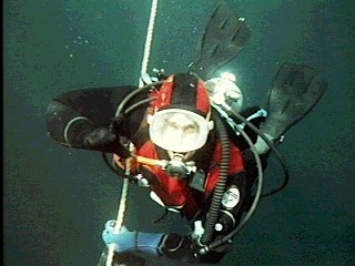
From a diver's viewpoint, what can I look for on the wrecksite that may help identify the ship's name? A nameplate or bell with a name on it is always nice, but are rarely ever found on older wrecks. Maybe they were already removed or maybe they were never there. The cargo is sometimes useful, but can be misleading as many ships carried the same cargo in the same waters. The Builders plate would be nice, but also may not be there. Boiler size, prop size, and engine size may be all that is left to identify some wrecks. That's where data from Lloyd's of London Records of Shipping, American Bureau of Shipping Records, and builders records becomes very useful.
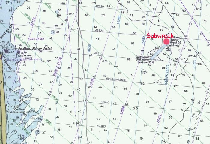
The Subwreck is an iron hulled vessel. It is obviously a steamship because boilers are present. The Subwreck about the correct age,the level of deteriorization to the wreck matchs other wrecks which are known to have sunk in the late 1890's and early 1900's. Subwreck appears to have been carrying sulphur (the right cargo), and sank "near" the reported area of the New Orleans sinking (plus or minus 5 miles).
I am still looking for more accurate accounts of where the New Orleans sank. The Subwreck has some of the worst of conditions for good wrecksite investigation. The visisbility on the wrecksite is most times very dark (similiar to diving at night) regardless of what time of day it is or what the sun/cloud cover is doing at the surface. The distance visibility is very limited, most times 1-2 ft at best and often as low as 1-6" during the worst conditions. Current is not usually a problem, however the depth, 65-70ft limits the time for safe, no-decompression diving to 40 minutes or less per dive.
I have dove the Subwreck only 13 times since 1980. The first dive I made to the Subwreck, I had been pulled off the Chinawreck, where I planned to be to do a second dive, and moved on the Subwreck, a deeper dive. That day, the visibility was 20+ ft. but I really didn't see much of the wreck because we were anchored "off the wreck" in the sand to the westside of the wreck and I already had too much residual nitrogen from the previous dive to do an extended second dive at a deeper depth (70 foot tables).
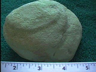
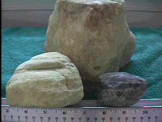
In 1983, I did one dive on the Subwreck from the Bill Brown's dive boat, the Sun-Up. At that time, I noticed an abundance of pale yellow "rocks" littered the wrecksite.
In 1984 after a very successful season diving some of the "inshore wrecks", Tim Cassady, one of my diving buddies, started working with me on researching the "forgotten wrecks" which we all knew about but didn't dive due to bad visibility. During his search of data availiable from the Maryland Steamship Society and interview with Jean Haviland in Baltimore, MD, Tim found that sulphur was the listed cargo for the New Orleans. Armed with that information and my remembering seeing "the yellow rocks" on the Subwreck, we returned to the Subwreck to recover some of those "rocks". We recovered a half dozen or so and they were infact sulphur, just as we had thought. Now what? We tried to get out to the Subwreck every chance we got after that. Unfortunately, due to the bad visibility and depth, nobody ever wanted to go there.
From 1985-2002, I only got to dive the Subwreck about 10 times. The last dive trip I made on my own dive boat, the Congo Clipper was to the Subwreck for two dives. The Subwreck has always considered to be "unfinished business" for me since my last dive there 1986. I have repeatedly tried to talk dive boats to take me there, but there is no interest to dive that wreck. It is well known that visibility is always bad and that bottom time is usually very limited. At this point I have not been able to advance my theory very far from a diving standpoint.
In 1989-90, when Gary Gentile returned some materials he had borrowed from me wrecks for his 1990 book, SHIPWRECKS OF DELAWARE and MARYLAND, I mentioned my Subwreck/New Orleans theory to him.
In 2002, Gary Gentile published his Revised SHIPWRECKS of DELAWARE and MARYLAND with my Subwreck/New Orleans theory
mentioned in his chapter about the New Orleans. Gary openly raised questions to my theory. Gary stated that the "Subwreck"
he dove was in 80-85 feet of water and that there was no sign of any sulphur anywhere on the wrecksite that he visited.
That was just what I needed to get me back out to the Subwreck for more investigation. My first goal would be to prove
the Subwreck was still in 60-65 feet of water. Had it maybe washed out since I was last there back in 1986? My second
goal was to retrieve some of the sulphur that had been laying all over the wrecksite back in th 1980's. Could all that
sulphur somehow be gone now? It would be an added bonus if we could find the boilers on the Subwreck and measure them.
That was my goal for the 2002 diving season. Could it be done? Thanks to Mike Bullard and Bill Brown my shot on the
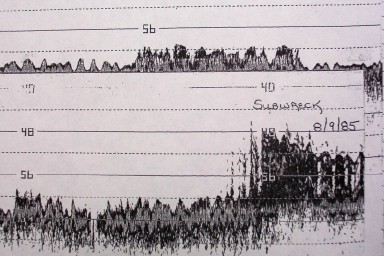
Subwreck on the second dive of the day on September 8th, 2002.