The Log of Quiet Passage
Lat: 41 17.386N
Long: 72 21.615W
Monday, September 18, 2000
After living through a day of light gale force winds in Newport, as well as a promise by the weatherman that they would slacken in the night (they did), we were happy to depart Newport with the rising sun.
Jo and I were up before the dawn making ready for the next leg. We felt we could make the passage to Noank, on the Connecticut shore where we would connect with the owners of our former boat, also named Quiet Passage.
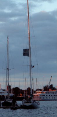
We slipped the mooring at 0700 and headed out into a dead calm morning. We kept our side curtains up to protect us from the early morning chill.
We came southwest down Narragansett Bay and turned at Pt. Judith. This is the Harbor of Refuge of which I wrote a couple of logs back. There was a nasty chop at the confluence of the bay and the waters off Pt. Judith. We could see Block Island sparkling like a diamond out in Block Island Sound. After Pt. Judith there was no opening along the pristine beaches of Rhode Island. Mile after mile of sand, sand, sand.
The lighthouse at Watch Hill was our beacon today. It ushered us into Fishers Island Sound, a body of protected water, scattered with jewels of islands and nasty little reefs just waiting to grab your keel.
When we approached Latimer Reef, I called on the radio: �Quiet Passage, Quiet Passage in Noank. This is Quiet Passage in Fishers Island Sound. Do you read me?� Back came a crackly voice: �Quiet Passage. This is Quiet Passage in Noank.� We chatted with Glenna Kuhlman, one of the new owners, and told her we had the benefits of a current which was providing a boost in speed and we felt we needed to make more westing. We decided we could push ahead another 20 miles and head for Saybrook at the mouth of the Connecticut River.
The engine droned on, pushing us along at 6 knots, sometimes 6.4 knots. When we passed The Race, where all the water of Long Island Sound is squeezed as it tries to leave or enter, the current still was fair and we moved smartly along the Connecticut coast. But, as with all things, there comes a time in the affairs
of men when the tide turns. With 10 miles to go, we faced a counter current that subtracted a knot from our headway. Now we slowed to 4.8, sometimes 4.4 knots.
But the end was in sight. The sea buoy, marking the shoals at the mouth of the great Connecticut River is a mile out in the Sound. We made it around and then bucked the current up the river. We stopped at Saybrook to fill our diesel tank and Ming, a prisoner aboard since a week ago Friday, sprang to the dock and
announced in no uncertain terms that she had enough of being held prisoner. She strutted and meowed her way into the dockmaster�s office. He, of course, immediately offered to make her the dock cat.
We retrieved her and paid for our fuel, locking her in the head so she couldn�t make a flying leap to escape once more.
Choices:
Our Info:
Name:
Bob & Jo Mellis
Our next door neighbor in Newport was the 12-meter racer Columbia..
Email:
Email:
When you use Pocketmail, please note that. Pocketmail cannot transmit attachments.