DAY 13
DAY 15
FINISH:
miles
Davenport, IA
9283.9
longest day of my trip. With me
logging over one thousand miles that
day, it would be the most miles I had
ever driven in one day. I left
Wheatland very early in the morning
and drove almost all of the rest of my
time in Wyoming in darkness, taking I-
25 to Exit 126, and then onto Route
18, which brought me into S. Dakota.
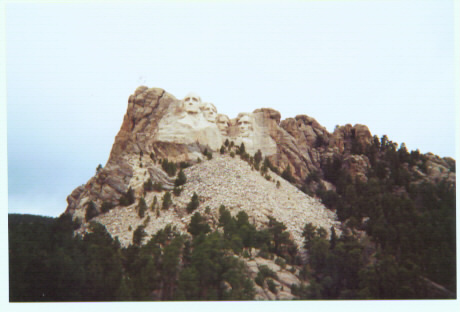
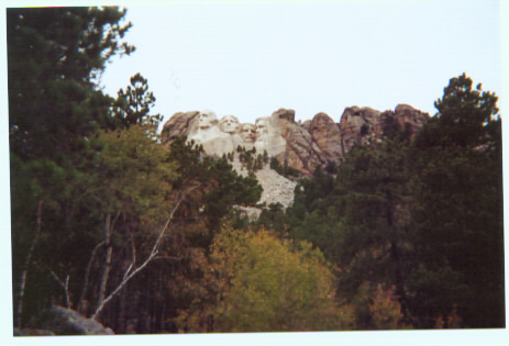
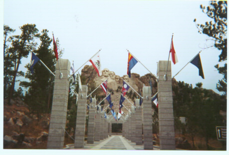
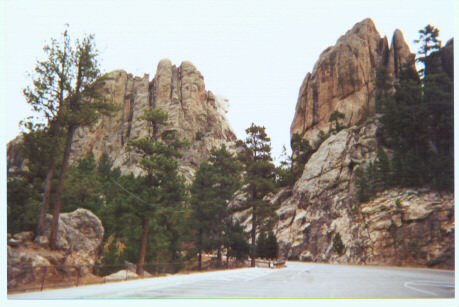
Between Custer and Rapid City, in the
Black Hills of South Dakota, is where
Mount Rushmore is located. At Mt.
Rushmore, I had the option of parking
in the main lot (for $8.00), or parking
in the remote lot at no charge. I chose
the remote lot, which I understand fills
up quickly during the peak tourist
season. From the remote lot, I had to
walk two tenths of a mile uphill (up a
series of stairs) to get to Mt.
Rushmore. There is no actual
admission fee to get to Mt. Rushmore,
just the parking fee if you choose to
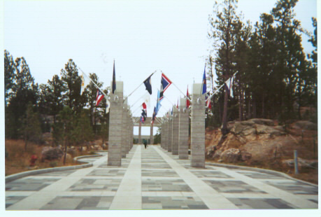
park in the main lot. The walkway
connecting the main parking lot and the
primary viewing area is lined with flags
- one for each of the 50 states. I
stopped inside the gift shop, which had
quite a variety of gifts and souvenirs to
offer. The cashier struck up a
conversation with me. He was an
older gentleman originally from
Arizona, mentioning that a lot of
regular visitors to Mt. Rushmore are
disappointed with some of the changes
that have happened there over the past
years. He specifically mentioned the
paving of the main lot and the
expansion of the gift shop, implying
that some people thought that this
national monument now had too much
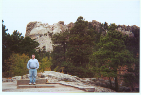
of a commercial appeal. After
spending about 45 minutes at Mt.
Rushmore (and over 50 dollars at its
gift shop), I walked back down to my
car and headed on my way. I drove
through the small town of Keystone
and through Rapid City to get to I-90.
Unfortunately, in order for me to get
back home in time to avoid late fees on
the rental car, I would have to drive on
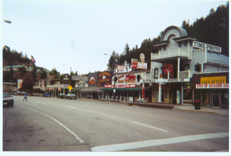
This town is located just a few miles from Mt. Rushmore
noticed billboards for "Wall Drug" placed very frequently on the highway. Each sign
was unique, many with cute catch-phrases trying to lure you to this drugstore located in
Wall, South Dakota. (If you've ever driven on I-95 through the Carolinas and have seen
the multitude of signs for "South Of The Border," it was a similar experience, only that
the signs for Wall Drug were typically much smaller and less flashy.) One billboard read
that Wall Drug has been mentioned in "Reader's Digest," and another that it has been
mentioned on "Good Morning America." If I had some more time, I would have
stopped by to check it out. I continued on my way across South Dakota on I-90,
eventually passing through Oacoma, a town which is mentioned on a road sign on I-90 in
Massachusetts. (As you drive across the Berkshire Mountains on I-90 in Massachusetts,
there is a sign which reads "Highest Elevation on I-90 in Massachusetts. Next highest
elevation - Oacoma, South Dakota") I was hoping there would be some mention of this
as I passed through Oacoma, but there was not. Oacoma lies on the Missouri River,
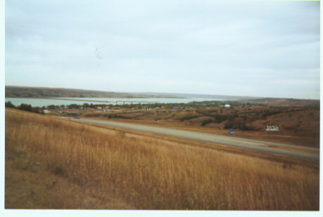
located a rest area which gives some
nice views of this river (the second-
longest river in the country). I-90
brought me into Sioux Falls, where I
headed south on I-29 into Sioux City,
Iowa. I was in Iowa for only about 3
miles, since I wanted to head south and
log some more miles in Nebraska (I
had driven only 8 miles in Nebraska
thus far.) I was happy to make it to
Nebraska before sunset, because I
would have been disappointed to have
of Nebraska in daylight, but shortly after crossing back over the Missouri River (near
Blair, Nebraska) into Iowa, the sun sank below the horizon, and I would spend the rest
of the evening driving across the entire state of Iowa on Interstate 80 in darkness. I
reached Davenport around midnight, bringing an end to the third-to-last day of my trip.