DAY 2
DAY 4
FINISH:
miles
Fargo, ND
2185.6
over the city. I exited I-35 at Forest Lake (Exit 132) and headed east on Route 8 back
towards Wisconsin. In this 20-mile stretch of Route 8 between Forest Lake and the
Wisconsin border live many people of Swedish ancestry, as can be seen by the
Swedish flags which fly alongside US flags as you pass through the small towns -
among them, Lindstrom. Most signs in Lindstrom, even road signs, show a diagonal
slash through the "o" of the town's name, the way the Swedes would spell it.
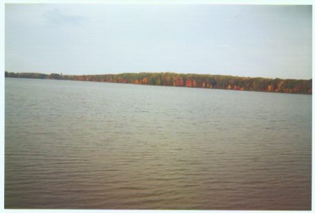
Once back in Wisconsin, I headed up Route 35 north toward Superior. To the eagle-
eye map watcher, it appears as if I'm backtracking by doing this driving in Wisconsin.
I did this for two reasons: 1) I wanted to do some non-Interstate driving in Wisconsin.
2) I wanted to get a picture of each "State Welcome" sign on my road trip, and Day 2
for finding a sign for Wisconsin. The
sign you see on the "State Welcome
Signs" page is located on Route 48
near Douglas. Route 35 brought me to
Superior and back into Minnesota at
the westernmost end of Lake Superior,
and the city of Duluth. I took
Falls on the Canadian border. There was a toll of $6.00 to cross the "bridge" from Intl
Falls, Minnesota to Fort Frances, Ontario. You had to pay very close attention to
notice that you were actually going across a bridge as you crossed the border, and the
$6.00 toll is in my opinion very steep. The Canadian customs official asked where I
was headed, and when I replied "Winnipeg," his response was "You do realize it is 4
hours to Winnipeg, right?," as if he were surprised by my answer.
The 100+ mile stretch of highway from Fort Frances to Kenora is very lonely, but gets
more and more scenic the closer you get to Kenora. Once in Kenora, a small tourist
town, you are only about 30 miles away from Manitoba. I had an interesting
experience as I crossed the border from Ontario into Manitoba. The police were
stopping each car heading into Manitoba and asking them questions, almost as if you
were going into another country. I was asked for my license and registration, and
what plans I had in Manitoba. I simply explained that I was on a road trip cross-
country and had never been to Manitoba before. His response was something to the
effect of "You drove all the way from New York to Manitoba in a rental car - well, I'll
be damned!" My best guess is that they normally do not have police at the border,
and it was just an instance of them either trying to catch a lawbreaker, or a spot check
of the people passing through.
Not too far into Manitoba begin the Great Plains of Canada, a region which extends
hundreds of miles west into Saskatchewan and Alberta. I stayed on Route 1 into
Winnipeg, and then headed south on Route 75 back towards the United States. Right
before the border, you have 2 options - stay on the highway and head into North
Dakota (onto Interstate 29), or exit the highway and head right into Minnesota. I
chose the less-traveled road and went back to Minnesota for another 3 miles, heading
right over to North Dakota.
I entered North Dakota in the town of Pembina, nestled in the northeasternmost
corner of the state. I proceeded onto I-29 south, where I saw a phenomenon which I
had never seen before. A sign on the Interstate simply read: "Exit 200 1 Mile" No
city or town name was listed on the sign, nor even a route number. I thought to
myself "What is at Exit 200, and why is the exit even there? Boy, I must be in the
middle of nowhere." (Note: I don't remember what the number of the exit was; I just
used 200 as an example). I saw more signs like these as I continued down I-29 until I
reached Fargo, where I would end Day 3.