![]()
![]()
![]()
![]()
![]()


|
|
|
|
1959 - 2001 analysis and long-term climate trends.
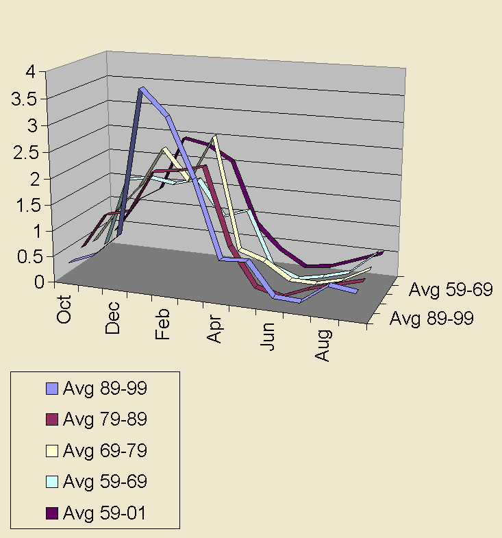
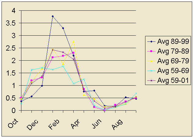
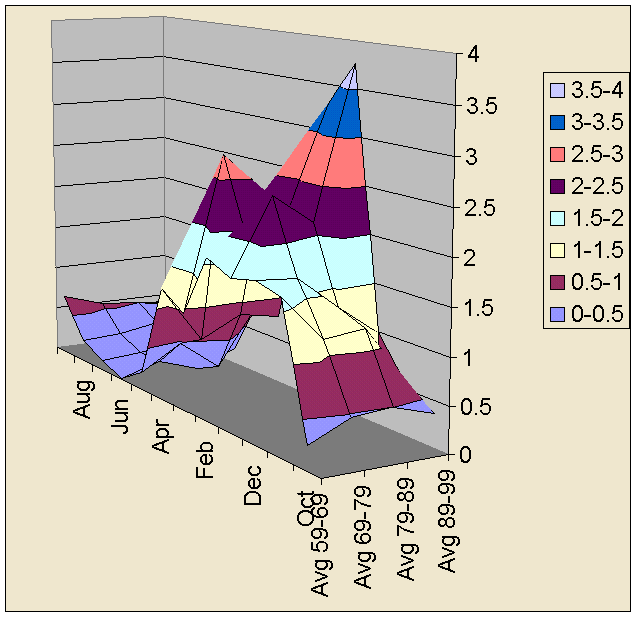
The first 4 graph lines represent 4 decades of monthly rainfall averages starting with the 1990's, the 80's, the 70's and the 60's followed by the average of all monthly rainfall data from 1959 to 2001. To assist in observing the annual rainfall cycle, October 1 to September 31 is used as the standard annual rainfall year, and all measurements here are in inches. The following graph illustrates 4 separate decade long rainfall averages, which show an overall increase in precipitation, which we have been noticing since 1982 as a basic shift in temperature patterns tending toward more subtropical conditions for the region, driving both warmer ocean currents and tropical weather conditions further north, perhaps accounting for the droughts and massive fires in the tropical rainforests. There was notably more rain in the 1990's than in the 1980's or 1970's, and notably less rain in the 1960's than in the 1970's or 1980's. However these conditions are not sufficiently obvious for most residents busy with their work or indoor tasks to take any notice or suspect that the climate changes they see represents a pattern, or if there is a pattern that it could have a meaning, and if it had a meaning that anyone could ever change what they did or consumed, and if some change could be helpful it would be extremely difficult to consider entertaining any change in one's personal habits.
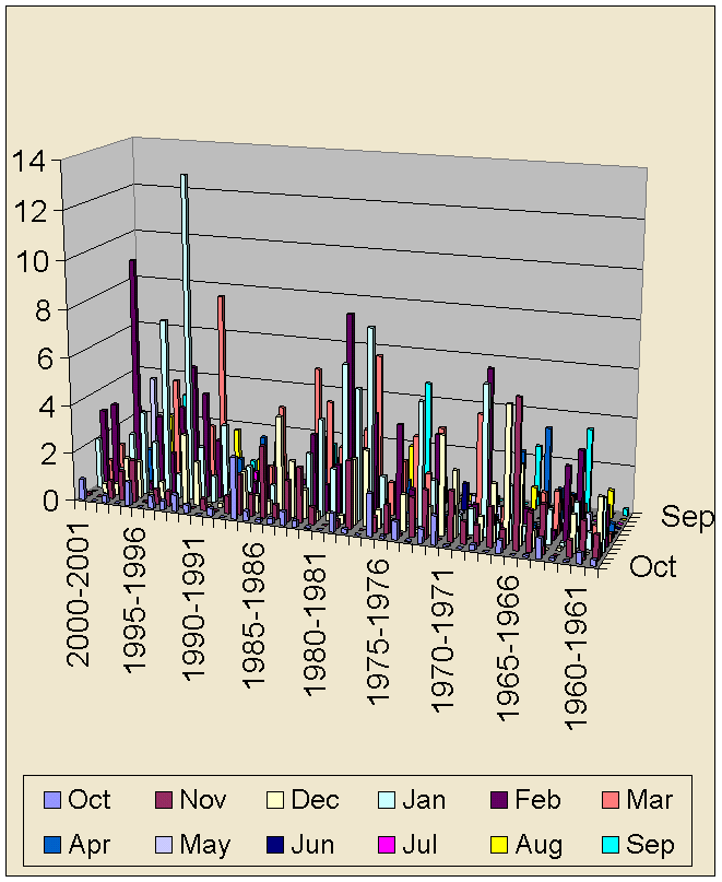
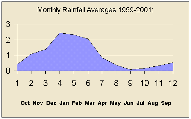
Rainfall trends in the San Jacinto valley Short-term or numeric observations may only show semi-random year to year fluctuations. Long-term, multiple decade graphic representations reveal several trends. 1) A long term increase in rainfall, 2) A cyclic wave pattern of increasing levels of rainfall over the years, 3) More erratic semi-random fluctuations and 4) A progressive decline in rainfall during the months of November and December over the 4 decades of the 1960's, 70's, 80's and 90's, along with a more significant increase in rainfall after December through June. Monthly totals are based on rainfall data recorded in inches at 8 AM daily, and beginning the year on October 1.
42 Year Monthly Rainfall Graph 1959-2001
Decade Rainfall Trends of the 60's, 70's, 80's and 90's. The first 4 graphs represents decade rainfall averages for each month starting with the 1990's, the 80's, the 70's and the 60's followed by the average of all monthly rainfall data from 1959 to 2001. The decade data averages demonstrate an overall increase in precipitation, which we have been noticing as a shift in the weather pattern since 1982, tending toward more subtropical conditions for the region, driving both warmer ocean currents and tropical weather conditions further north, perhaps accounting for droughts and massive fires in the tropical rainforests. However these conditions are not sufficiently pronounced for most residents busy with indoor or business tasks to take any notice of related global warming trends nor consider alternatives.
Decade Rainfall Averages for the 60's, 70's, 80's & 90's
Rainfall data recorded at: 2480 E Florida Ave (at the corner of Columbia Street and East Florida Avenue), in the city of Hemet California, by the Lake Hemet Municipal Water District, at 8:00 AM as daily precipitation data, measured in inches, consolidated here as monthly totals, using October 1 to September 31 as the standard annual rainfall year. |
Send mail to [email protected] with
questions or comments about this web site.
|