| SATELLITE METEOROLOGY Meteorologia por sat�lites |
| Raul Fritz B. Teixeira (Brasil) |
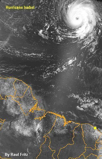
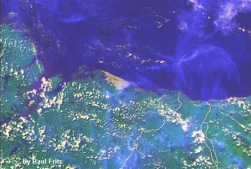
| NOAA channel 1 (visible) image of the Hurricane Isabel in the tropical North Atlantic Ocean. It is visible the north region of Brazil. The small yellow square corresponds to the receiving site that acquired the image. Sept 2003. |
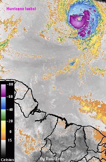
| NOAA channel 4 (infrared) image of the Hurricane Isabel in the North Alantic Ocean (same as above). Enhanced image using a customised color palette representing cloud top temperatures. September 2003. |
| These images can be used only with reference to the author |
| Estas imagens podem ser usadas somente com refer�ncia ao autor |
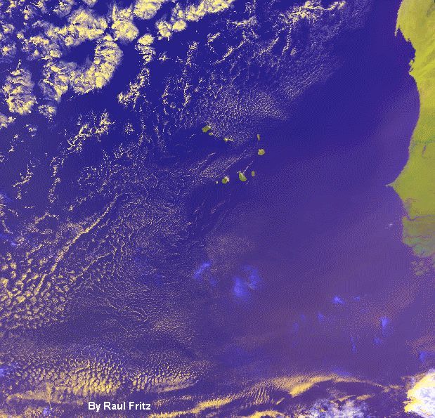
| NOAA-16 channel-1, 2, 4 color composite (true-color) image of Cape Verde near the western African coast. March 2004. |
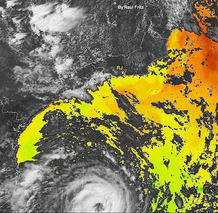
| Hurricane/cyclone Catarina (at the end of the NOAA-16 pass) on March 26, 2004, 17:02 UT, Brazil. Channel 1 (visible) image overlayed with sea surface temperatures. The letters RJ show the position of Rio de janeiro City, Brazil. |
 |
 |
 |
 |
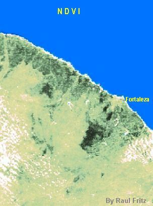
| Vegetation index (NDVI) NOAA-17 image of Fortaleza City (where is located the receiving site) and surroundings. The darkest green areas are mountains covered with dense tropical vegetation. Some clouds appear in white. August 19, 2003. |
 |
 |
| NOAA-16 true-color image of Len��is Maranhenses (the yellowish area at the centre), Brazil, formed by several dunes of white sand and scattered fresh water ponds between them. May 17, 2004. |
| NOAA-16 true color image of a cyclonic system near the southern coast of Brazil. May 9, 2004, 17 UT. The letters RJ indicate Rio de Janeiro City. |
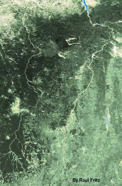
| Vegetation index (NDVI) NOAA-17 image of the rivers Xingu (on the left) and Araguaia (on the right) at the centre-north of Brazil. May 24, 2004. Dark green areas are fully vegetated. |
 |
 |
| Vegetation index (NDVI) image showing the cities of S�o Paulo and Rio de Janeiro, Brazil. NOAA-17 image from August 5, 2003 at 12:50 UT. |
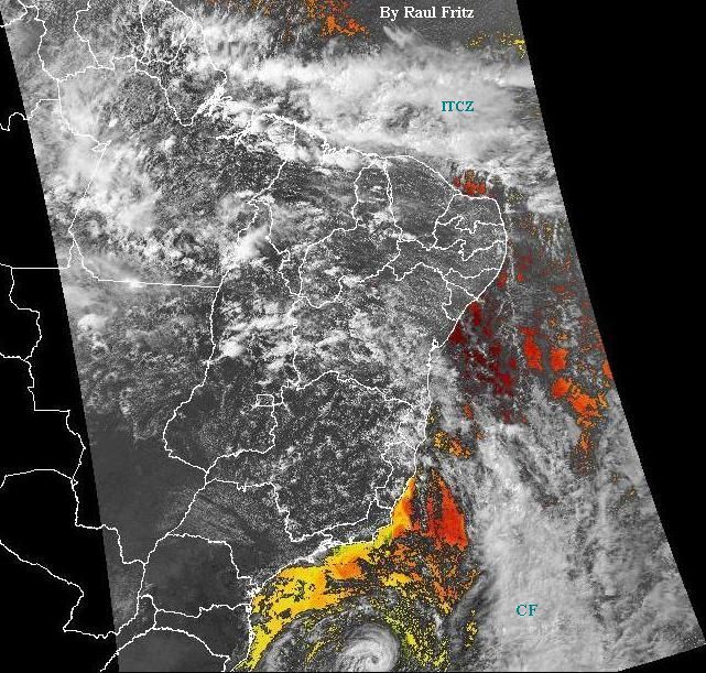
| Hurricane/cyclone Catarina (at the end of the NOAA-16 pass) on March 25, 2004, 17:14 UT, Brazil. Ch1 (vis) image overlayed with sea surface temperatures. CF - Cold Front. ITCZ - Intertropical Convergence Zone. |
 |
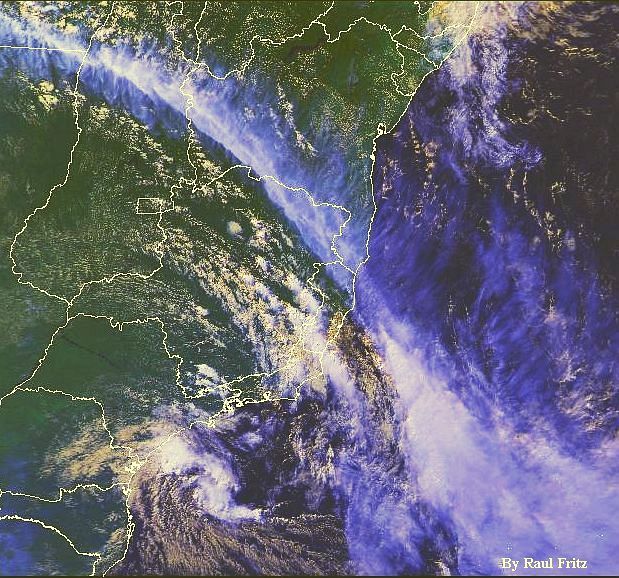
| NOAA-16 true-color image of a cold front and a cyclonic circulation over Brazil. June 4, 2004, 17:09 UT. |
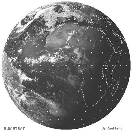 |
| Meteosat-7 (EUMETSAT) visible image acquired at 16:30 UT on June 1, 2004. Note the sunglint on the waters of the tropical North Atlantic Ocean and great convective complexes of clouds near central Africa. |
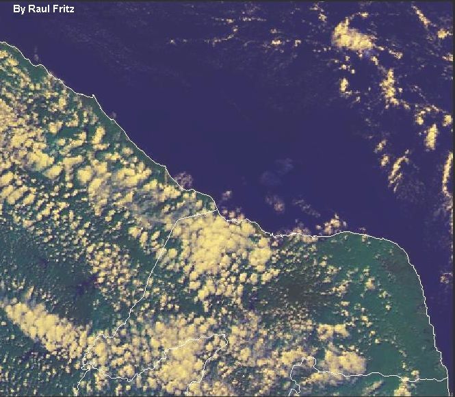
| NOAA-16 true-color image of cumulus clouds over the States of Rio Grande do Norte and Cear� at the northeast of Brazil. June 23, 2004, 16:55 UT. |
 |
| NOAA-12 ch1 image of a tropical storm over the Atlantic and near Salvador City, Bahia (S). Jan 19, 2004, 18:46 UT. |
 |