| SATELLITE METEOROLOGY Meteorologia por sat�lites |
| Raul Fritz B. Teixeira (Brasil) |
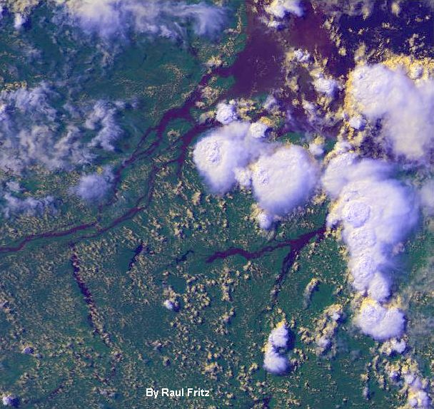
| NOAA-16 true-colour (24-bits) image of Maraj� Island (north of Brazil) at the mouth of Amazonas River. Image acquired on July 8, 2004 (17:24 UT). |
| NOAA-16 channel 1 (visible) image overlayed with sea surface temperatures of the Hurricane Danielle in the tropical North Alantic Ocean. Image acquired on August 15, 2004 (16:53 UT). |
| These images can be used only with reference to the author |
| Estas imagens podem ser usadas somente com refer�ncia ao autor |
 |
| NOAA-16 channel 1 (visible) image overlayed with sea surface temperatures of the Hurricane Danielle (close-up of the image above). Image acquired on August 15, 2004 (16:53 UT). |
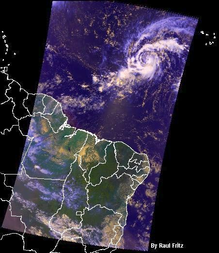
| NOAA-16 true-color image of the hurricane Ivan in its infancy acquired at 16:37 UT on Sep 03, 2004. Its center was at 7.5 N and 34 W. Meteosat -7 visible image, 16:30 UT, (lower right) . |
| NOAA-16 true-color image of a cold front near the coast of southern Brazil acquired at 17:29 UT on September 16, 2004. The more developed clouds are in blue/white colour. |
| NOAA-17 true-color image of the hurricane Karl in its infancy captured at 13:13 UT on September 17, 2004. The center of the storm was around 12 N and 35 W . |
 |
| NOAA-16 true-color image of the hurricane Karl acquired at 16:56 UT on September 19, 2004. The center of the storm was at 16.7 N and 43.3 W. Note the smaller system of clouds in a format of an inverted comma. |
| NOAA-16 true-color image of the hurricane Karl and a secondary smaller cyclonic system (tropical storm) dubbed Lisa, acquired at 16:44 UT on September 20, 2004. |
 |
| Livro (book): Aplica��es Ambientais Brasileiras dos Sat�lites NOAA e TIROS-N. Raul Fritz como co-autor. Pode ser adquirido pela Internet na Oficina de Textos. |
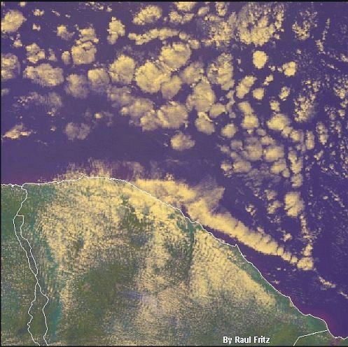
| NOAA-17 true-color image of the north of Cear� located in the semi-arid Northeast Brazil and acquired at 13:03 UT on October 5, 2004. |
 |
| NOAA-17 true-color close-up of the hurricane Karl in its infancy acquired at 13:13 UT on September 17, 2004. |
| Meteosat-7 (EUMETSAT) visible image acquired at 12:00 UT on October 27, 2004, showing a deep depression (top center) near the UK and France . |
| NOAA-16 close-up image of the hurricane Ivan in its infancy acquired at 16:37 UT on September 3, 2004. |
| NDVI NOAA-17 image of Mato Grosso, Brazil . This region suffers a process of deforestation. Top right: a protected area. 06/15/2005 - 13:30 UT. |